Gmina Krynki
Located in Sokółka County, Podlasie Voivodship Coordinates: 53°15′49″ N 23°46′22″ E
- Population
- 3,127
- 3.1K
- Elevation
- 150 m
- above sea level
- Local time
- UTC+01:00
- Europe/Warsaw · UTC+01:00
- Places inside
- 2
- listed under Gmina Krynki
- Airports
- BQT Brest International Airport129 km
- VNO Vilnius International Airport182 km
About Gmina Krynki
Gmina Krynki is a municipality. Location: Sokółka County, Podlasie Voivodship. Population: 3,127. Elevation: 150 m. The best months to visit are June–August. The nearest airport is Brest International Airport (129 km).
Photos of Gmina Krynki
-
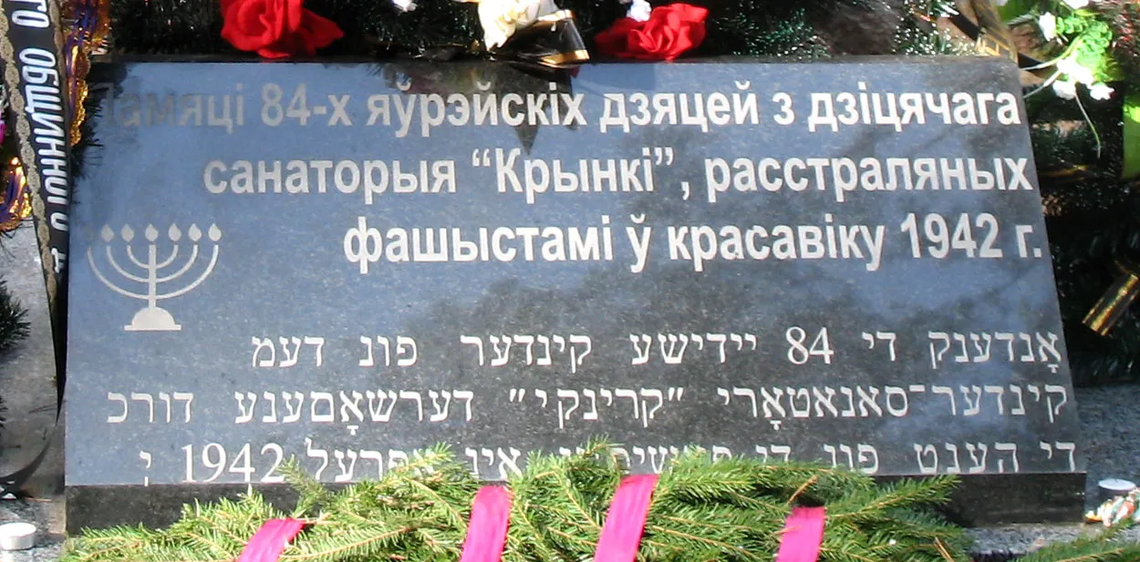
Krynki Ghetto Vadim Akopyan · CC0

Climate of Gmina Krynki
Best months for sightseeingBest months for sightseeing: June–August.
This month · November
A cold month
Day 4° · Night -1° · Rain 44 mm
- Hottest month
- July (day 22°)
- Coldest month
- January (night -7°)
- Wettest month
- July (83 mm)
- Driest month
- February (27 mm)
Bars: average monthly low and high temperature. Below: precipitation. Monthly averages for 1970–2000 at about 18 km resolution, adjusted for elevation. Highlighted months are mild and relatively dry. Source: WorldClim 2.1 (CC BY 4.0).
Show values as a table
| Month | Jan | Feb | Mar | Apr | May | Jun | Jul | Aug | Sep | Oct | Nov | Dec |
|---|---|---|---|---|---|---|---|---|---|---|---|---|
| Average high (°C) | -1° | 0° | 4° | 11° | 18° | 21° | 22° | 22° | 17° | 11° | 4° | 0° |
| Average low (°C) | -7° | -6° | -3° | 1° | 7° | 10° | 11° | 10° | 7° | 3° | -1° | -5° |
| Precipitation (mm) | 34 | 27 | 32 | 40 | 54 | 70 | 83 | 63 | 54 | 45 | 44 | 42 |
How to get to Gmina Krynki
The nearest airport is Brest International Airport (BQT), 129 km to the south as the crow flies. The nearest large city is Kaunas, 183 km to the north.
Airports
- Brest International Airport (BQT) Brest 129 kmsouth
- Vilnius International Airport (VNO) Vilnius 182 kmnortheast
- Olsztyn-Mazury Airport (SZY) Szymany 190 kmwest
Nearby large cities
- Kaunas Population: 289.4K 183 kmnorth
- Vilnius Population: 542.4K 187 kmnortheast
- Klaipėda Population: 172.3K 321 kmnorthwest
Straight-line distances; road distances are longer. Airport data: OurAirports.
Day trips from Gmina Krynki
Within 100 km: 25 historic and cultural sites, 3 natural sites, 1 lake, river or coast.
0–25 km2 places
- Sokółka Ghetto Historic site 25 kmNW
- Krynki Ghetto Historic site 1 kmNE
25–60 km12 places
- Dąbrowa Ghetto Historic site 53 kmNW
- Janów Ghetto Historic site 42 kmNW
- Jasionówka Ghetto Historic site 51 kmW
- Kuźnica Ghetto Historic site 29 kmN
60–100 km15 places
- Augustów Ghetto Historic site 83 kmNW
- Grajewo Ghetto Historic site 98 kmNW
- Rajgród Ghetto Historic site 88 kmNW
- Ežeras Veisiejis Lake 88 kmN
Straight-line distances.
Places in Gmina Krynki
2 placesKrynki
Population: 2.7K
-
Sources & licences
Data last updated: