- Elevation
- 84 m
- above sea level
- Local time
- UTC+01:00
- Europe/Warsaw · UTC+01:00
- Airports
- GDN Gdańsk Lech Wałęsa Airport14 km
- KGD Khrabrovo Airport139 km
About Redłowo
Redłowo is a village. Location: Gdynia, Gdynia. Elevation: 84 m.
Redłowo is a coastal district of the Polish city of Gdynia. It is 2.96 km2 and has a population of 7,986 (as of 2022). The Pomeranian Science and Technology Park Gdynia is located in Redłowo.
Source: Wikipedia · CC BY-SA 4.0
At a glance
- Area
- 2.8 km²
Source: Wikidata
Photos of Redłowo
-
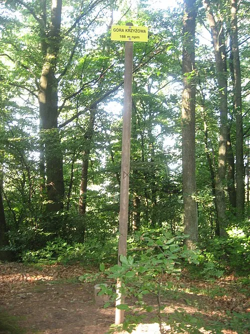
Krzyzowa Gora Leinad · CC BY 3.0

Climate of Redłowo
Best months for sightseeingBest months for sightseeing: June–August.
This month · November
A cold month
Day 6° · Night 2° · Rain 56 mm
- Hottest month
- July (day 22°)
- Coldest month
- January (night -4°)
- Wettest month
- July (77 mm)
- Driest month
- February (31 mm)
Bars: average monthly low and high temperature. Below: precipitation. Monthly averages for 1970–2000 at about 18 km resolution, adjusted for elevation. Highlighted months are mild and relatively dry. Source: WorldClim 2.1 (CC BY 4.0).
Show values as a table
| Month | Jan | Feb | Mar | Apr | May | Jun | Jul | Aug | Sep | Oct | Nov | Dec |
|---|---|---|---|---|---|---|---|---|---|---|---|---|
| Average high (°C) | 1° | 2° | 6° | 11° | 16° | 19° | 22° | 22° | 17° | 12° | 6° | 3° |
| Average low (°C) | -4° | -3° | -1° | 2° | 7° | 10° | 13° | 13° | 9° | 6° | 2° | -2° |
| Precipitation (mm) | 40 | 31 | 33 | 36 | 50 | 68 | 77 | 70 | 70 | 62 | 56 | 52 |
How to get to Redłowo
The nearest airport is Gdańsk Lech Wałęsa Airport (GDN), 14 km to the southwest as the crow flies. The nearest large city is Klaipėda, 213 km to the northeast.
Airports
- Gdańsk Lech Wałęsa Airport (GDN) Gdańsk 14 kmsouthwest
- Khrabrovo Airport (KGD) Kaliningrad 139 kmeast
- Ignacy Jan Paderewski Bydgoszcz Airport (BZG) Bydgoszcz 160 kmsouth
Nearby large cities
- Klaipėda Population: 172.3K 213 kmnortheast
- Kaunas Population: 289.4K 348 kmeast
- Malmö Population: 362.1K 376 kmwest
Straight-line distances; road distances are longer. Airport data: OurAirports.
Day trips from Redłowo
Within 100 km: 41 historic and cultural sites, 31 natural sites, 1 lake, river or coast.
0–25 km14 places
- Jastarnia Lighthouse Landmark 25 kmN
- Holm Island Island 15 kmSE
- Danzig Concentration Camp (Westerplatte) Historic site 17 kmS
- Danzig-Holm Concentration Camp Historic site 15 kmSE
25–60 km46 places
- Preußisch Stargard Concentration Camp Historic site 59 kmS
- Wlk. Klincz 178 Mountain 56 kmSW
- Wzgorza nad Szczodrowem S Mountain 43 kmS
- Jastrzębia Góra Mountain 40 kmN
60–100 km13 places
- Kamienna Góra Mountain 75 kmSE
- Pelplin Concentration Camp Historic site 64 kmS
- Bruss-Sophienwalde Concentration Camp Historic site 87 kmSW
- Stilo Lighthouse Landmark 62 kmNW
Straight-line distances.
Nearby attractions & nature
Everything nearby-
Gotenhafen Concentration Camp (Deutsche Werke Kiel) Historic site, Gdynia3.2 km NW
-
Krzyzowa Gora Mountain, Gdynia6.2 km W
-
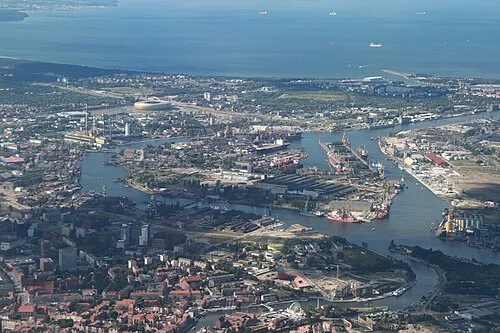 Holm Island Island, Gdańsk15 km SE
-
Danzig-Zigankenberg Concentration Camp Historic site, Gdańsk16 km S
-
Danzig Concentration Camp (Schulemann-Klinik) Historic site, Gdańsk17 km S
-
Danzig Concentration Camp (SS-Oberabschnitt Weichsel) Historic site, Gdańsk17 km S
Sources & licences
Data last updated: · 2 independent sources