- Population
- 359
- 359
- Elevation
- 8 m
- above sea level
- Local time
- UTC+01:00
- Europe/Warsaw · UTC+01:00
- Airports
- GDN Gdańsk Lech Wałęsa Airport59 km
- KGD Khrabrovo Airport170 km
About Białogóra
Białogóra is a village. Location: Gmina Krokowa, Puck County. Population: 359. Elevation: 8 m. The best months to visit are June–August. The nearest airport is Gdańsk Lech Wałęsa Airport (59 km). Nearby sights include Stilo Lighthouse and Kolkau Concentration Camp.
Climate of Białogóra
Best months for sightseeingBest months for sightseeing: June–August.
This month · November
A cold month
Day 7° · Night 2° · Rain 61 mm
- Hottest month
- August (day 21°)
- Coldest month
- January (night -3°)
- Wettest month
- July (73 mm)
- Driest month
- February (32 mm)
Bars: average monthly low and high temperature. Below: precipitation. Monthly averages for 1970–2000 at about 18 km resolution, adjusted for elevation. Highlighted months are mild and relatively dry. Source: WorldClim 2.1 (CC BY 4.0).
Show values as a table
| Month | Jan | Feb | Mar | Apr | May | Jun | Jul | Aug | Sep | Oct | Nov | Dec |
|---|---|---|---|---|---|---|---|---|---|---|---|---|
| Average high (°C) | 2° | 2° | 5° | 10° | 15° | 19° | 21° | 21° | 17° | 12° | 7° | 3° |
| Average low (°C) | -3° | -3° | -1° | 2° | 6° | 10° | 13° | 13° | 10° | 6° | 2° | -1° |
| Precipitation (mm) | 42 | 32 | 34 | 34 | 45 | 58 | 73 | 67 | 72 | 65 | 61 | 55 |
How to get to Białogóra
The nearest airport is Gdańsk Lech Wałęsa Airport (GDN), 59 km to the southeast as the crow flies. The nearest large city is Klaipėda, 225 km to the northeast.
Airports
- Gdańsk Lech Wałęsa Airport (GDN) Gdańsk 59 kmsoutheast
- Khrabrovo Airport (KGD) Kaliningrad 170 kmeast
- Ignacy Jan Paderewski Bydgoszcz Airport (BZG) Bydgoszcz 191 kmsouth
Nearby large cities
- Klaipėda Population: 172.3K 225 kmnortheast
- Malmö Population: 362.1K 328 kmwest
- Copenhagen Population: 1.2M 356 kmwest
- Helsingborg Population: 104.2K 360 kmnorthwest
- Kaunas Population: 289.4K 382 kmeast
Straight-line distances; road distances are longer. Airport data: OurAirports.
Day trips from Białogóra
Within 100 km: 30 historic and cultural sites, 28 natural sites, 1 lake, river or coast.
0–25 km4 places
- Kolkau Concentration Camp Historic site 13 kmSE
- Rieben-Althammer Concentration Camp Historic site 17 kmSE
- Stilo Lighthouse Landmark 15 kmW
- Gora Wysoka Mountain 22 kmS
25–60 km22 places
- Jastrzębia Góra Mountain 26 kmE
- Putzig Concentration Camp Historic site 31 kmE
- Jastarnia Lighthouse Landmark 48 kmE
- Pucka Góra Mountain 36 kmSE
60–100 km33 places
- Wlk. Klincz 178 Mountain 82 kmS
- Wzgorza nad Szczodrowem S Mountain 82 kmS
- Stolp Concentration Camp Historic site 72 kmSW
- Jarosławiec Lighthouse Landmark 96 kmW
Straight-line distances.
Nearby attractions & nature
Everything nearby-
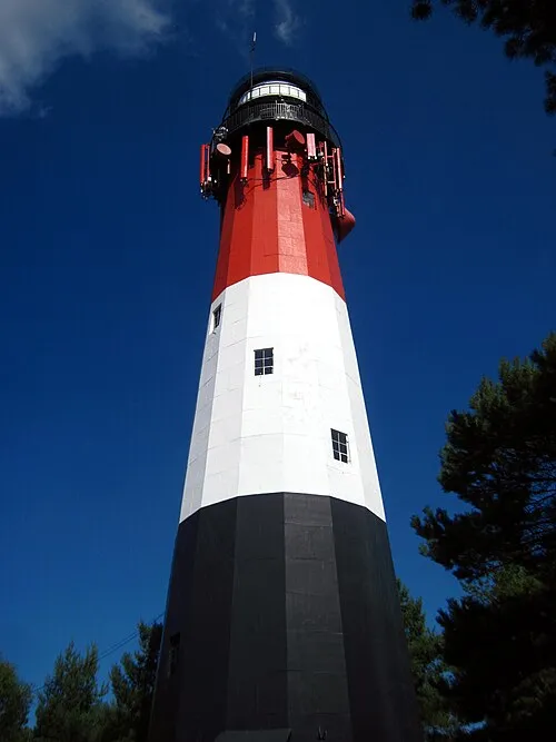 Stilo Lighthouse Landmark, Gmina Choczewo15 km W
-
Kolkau Concentration Camp Historic site, Gmina Gniewino13 km SE
-
Gora Wysoka Mountain, Łęczyce22 km S
-
Rieben-Althammer Concentration Camp Historic site, Gmina Gniewino17 km SE
Sources & licences
Data last updated: