Wyżyna Elbląska
Located in Warmian-Masurian Voivodeship, Poland Coordinates: 54°15′00″ N 19°30′00″ E
- Elevation
- 182 m
- above sea level
- Local time
- UTC+01:00
- Europe/Warsaw · UTC+01:00
- Airports
- GDN Gdańsk Lech Wałęsa Airport69 km
- KGD Khrabrovo Airport101 km
About Wyżyna Elbląska
Wyżyna Elbląska is a natural site. Location: Warmian-Masurian Voivodeship, Poland. The best months to visit are June–August. The nearest airport is Gdańsk Lech Wałęsa Airport (69 km). Nearby sights include Dörbeck Concentration Camp and Hopehill-Reimannsfelde Concentration Camp.
Climate of Wyżyna Elbląska
Best months for sightseeingBest months for sightseeing: June–August.
This month · November
A cold month
Day 5° · Night 0° · Rain 58 mm
- Hottest month
- July (day 21°)
- Coldest month
- January (night -5°)
- Wettest month
- June (81 mm)
- Driest month
- February (34 mm)
Bars: average monthly low and high temperature. Below: precipitation. Monthly averages for 1970–2000 at about 18 km resolution, adjusted for elevation. Highlighted months are mild and relatively dry. Source: WorldClim 2.1 (CC BY 4.0).
Show values as a table
| Month | Jan | Feb | Mar | Apr | May | Jun | Jul | Aug | Sep | Oct | Nov | Dec |
|---|---|---|---|---|---|---|---|---|---|---|---|---|
| Average high (°C) | -1° | 0° | 5° | 10° | 16° | 19° | 21° | 21° | 16° | 11° | 5° | 1° |
| Average low (°C) | -5° | -5° | -2° | 2° | 7° | 10° | 12° | 12° | 9° | 5° | 0° | -3° |
| Precipitation (mm) | 45 | 34 | 38 | 40 | 51 | 81 | 81 | 78 | 75 | 67 | 58 | 58 |
How to get to Wyżyna Elbląska
The nearest airport is Gdańsk Lech Wałęsa Airport (GDN), 69 km to the west as the crow flies. The nearest large city is Klaipėda, 193 km to the northeast.
Airports
- Gdańsk Lech Wałęsa Airport (GDN) Gdańsk 69 kmwest
- Khrabrovo Airport (KGD) Kaliningrad 101 kmnortheast
- Olsztyn-Mazury Airport (SZY) Szymany 127 kmsoutheast
Nearby large cities
- Klaipėda Population: 172.3K 193 kmnortheast
- Kaunas Population: 289.4K 294 kmeast
- Vilnius Population: 542.4K 378 kmeast
Straight-line distances; road distances are longer. Airport data: OurAirports.
Day trips from Wyżyna Elbląska
Within 100 km: 35 historic and cultural sites, 26 natural sites, 1 lake, river or coast.
0–25 km9 places
- Dörbeck Concentration Camp Historic site 3 kmW
- Pröbbernau Concentration Camp Historic site 15 kmNW
- Stoboi Concentration Camp Historic site 8 kmS
- Zeyersniederkampen Concentration Camp Historic site 12 kmW
25–60 km19 places
- Steegen Concentration Camp (Oberforstamt) Historic site 27 kmW
- Wzgorze nad Rumunkami Mountain 51 kmSW
- Holm Island Island 57 kmW
- Danzig Concentration Camp (Westerplatte) Historic site 57 kmW
60–100 km34 places
- Wlk. Klincz 178 Mountain 96 kmW
- Wzgorza nad Szczodrowem S Mountain 74 kmW
- Jastrzębia Góra Mountain 98 kmNW
- Putzig Concentration Camp Historic site 88 kmNW
Straight-line distances.
Nearest towns and villages
Nearby attractions & nature
Everything nearby-
Dörbeck Concentration Camp Historic site, Elbląg3.2 km W
-
Hopehill-Reimannsfelde Concentration Camp Historic site, Tolkmicko5.3 km NW
-
Stoboi Concentration Camp Historic site, Gmina Milejewo7.9 km S
-
Elbing Concentration Camp (Tannenbergallee/Boelkestraße) Historic site, Elbląg12 km SW
-
Zeyersniederkampen Concentration Camp Historic site, Elbląg12 km W
-
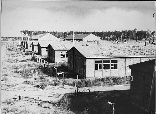 Stutthof Concentration Camp Historic site, Gmina Sztutowo24 km W
-
Elbląg Concentration Camp (Schichau-Werft) Historic site, Elbląg12 km SW
-
Zeyersvorderkampen Concentration Camp Historic site, Gmina Nowy Dwór Gdański15 km W
Sources & licences
Data last updated: · 2 independent sources