- Population
- 120
- 120
- Elevation
- 5 m
- above sea level
- Local time
- UTC+01:00
- Europe/Warsaw · UTC+01:00
- Airports
- SZZ Solidarity Szczecin–Goleniów Airport92 km
- HDF Heringsdorf Airport115 km
About Łopienica
Łopienica is a village. Location: Gmina Będzino, Koszalin County. Population: 120. Elevation: 5 m. The best months to visit are June–August. The nearest airport is Solidarity Szczecin–Goleniów Airport (92 km).
Photos of Łopienica
-
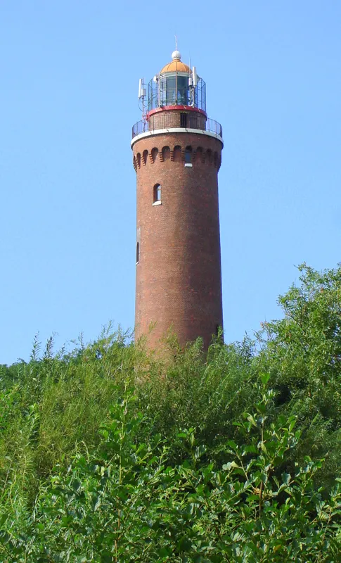
Gąski Lighthouse Aw58 · CC BY-SA 3.0 pl

Climate of Łopienica
Best months for sightseeingBest months for sightseeing: June–August.
This month · November
A cold month
Day 7° · Night 2° · Rain 59 mm
- Hottest month
- August (day 22°)
- Coldest month
- January (night -3°)
- Wettest month
- August (80 mm)
- Driest month
- February (39 mm)
Bars: average monthly low and high temperature. Below: precipitation. Monthly averages for 1970–2000 at about 18 km resolution, adjusted for elevation. Highlighted months are mild and relatively dry. Source: WorldClim 2.1 (CC BY 4.0).
Show values as a table
| Month | Jan | Feb | Mar | Apr | May | Jun | Jul | Aug | Sep | Oct | Nov | Dec |
|---|---|---|---|---|---|---|---|---|---|---|---|---|
| Average high (°C) | 2° | 3° | 7° | 12° | 17° | 20° | 22° | 22° | 18° | 13° | 7° | 3° |
| Average low (°C) | -3° | -2° | 1° | 4° | 8° | 12° | 14° | 14° | 11° | 7° | 2° | -1° |
| Precipitation (mm) | 47 | 39 | 39 | 47 | 50 | 70 | 79 | 80 | 78 | 55 | 59 | 52 |
How to get to Łopienica
The nearest airport is Solidarity Szczecin–Goleniów Airport (SZZ), 92 km to the southwest as the crow flies. The nearest large city is Malmö, 238 km to the northwest.
Airports
- Solidarity Szczecin–Goleniów Airport (SZZ) Szczecin(Glewice) 92 kmsouthwest
- Heringsdorf Airport (HDF) Zirchow 115 kmwest
- Bornholm Airport (RNN) Rønne 117 kmnorthwest
Nearby large cities
- Malmö Population: 362.1K 238 kmnorthwest
- Rostock Population: 198.3K 241 kmwest
- Berlin Population: 3.4M 247 kmsouthwest
- Copenhagen Population: 1.2M 265 kmnorthwest
- Potsdam Population: 184.8K 273 kmsouthwest
Straight-line distances; road distances are longer. Airport data: OurAirports.
Day trips from Łopienica
Within 100 km: 5 historic and cultural sites, 2 natural sites, 2 lakes, rivers and coasts.
0–25 km1 place
- Gąski Lighthouse Landmark 5 kmNE
25–60 km1 place
- Jarosławiec Lighthouse Landmark 59 kmNE
60–100 km7 places
- Wolin Island 93 kmW
- Bull-Graben River 77 kmW
- Spyczyna Góry Mountain 71 kmSE
- Skotna Góra Mountain 94 kmSE
Straight-line distances.
Sources & licences
Data last updated: