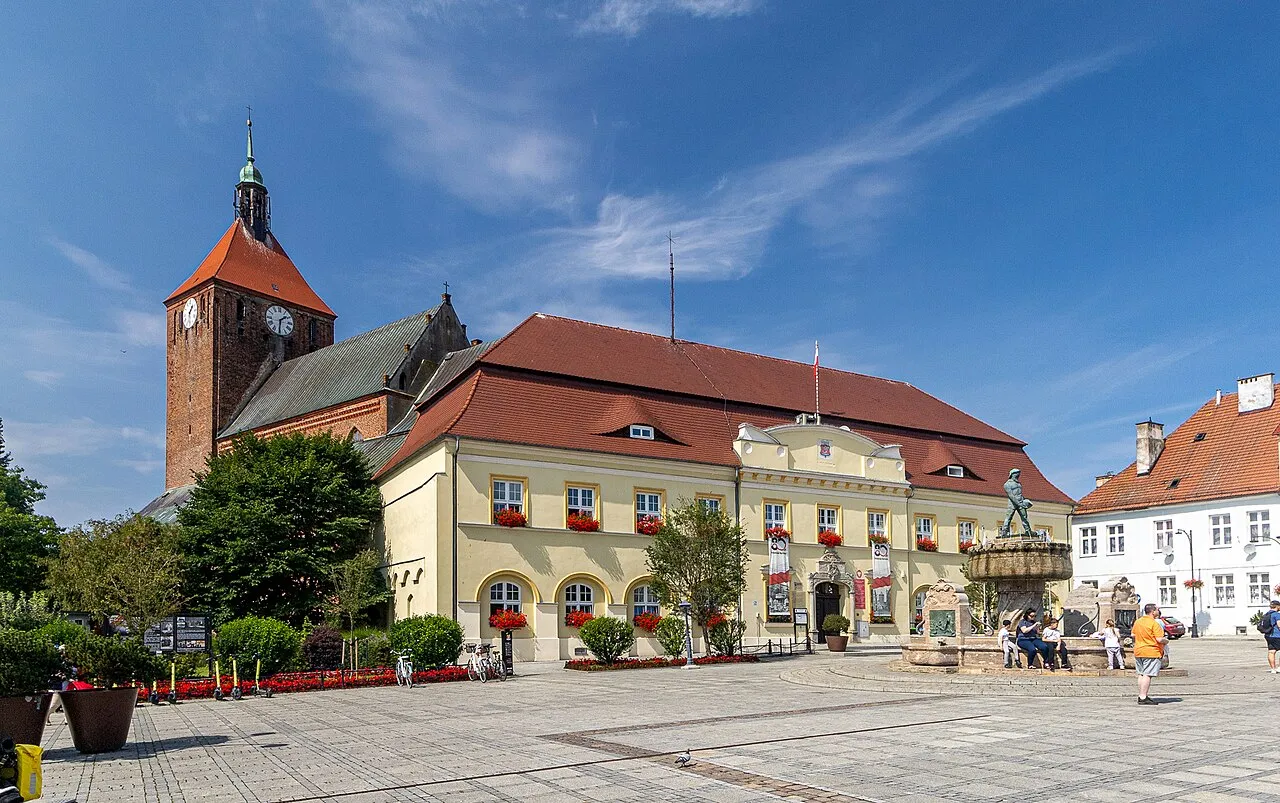
- Population
- 13,324
- 13.3K
- Elevation
- 7 m
- above sea level
- Local time
- UTC+01:00
- Europe/Warsaw · UTC+01:00
- Airports
- RNN Bornholm Airport128 km
- GDN Gdańsk Lech Wałęsa Airport134 km
About Darłowo
Darłowo is a town. Location: Darłowo, Sławno County. Population: 13,324. Elevation: 7 m.
Darłowo (Polish: [darˈwɔvɔ] ; Kashubian: Dërłowò; German: Rügenwalde) is a seaside town on the Slovincian Coast of north-western Poland, south of the Baltic Sea, with 13,324 inhabitants as of December 2021. Administratively, it is located in Sławno County in West Pomeranian Voivodeship. The earliest archaeological signs of a settlement in the area occurred when Roman merchants travelled along the Amber Road in the hope of trading precious metals like bronze and silver for amber.
Source: Wikipedia · CC BY-SA 4.0
Photos of Darłowo
-

Piekneslowa · CC BY-SA 4.0 -

Mariochom · CC BY-SA 4.0 -

Mariochom · CC BY-SA 4.0 -

Ewkaa · CC BY-SA 3.0 pl -

Michal Gorski · CC BY-SA 3.0


Travel notes for Darłowo
From Wikivoyage
Darlowo is a resort town in the Zachodniopomorskie voivodeship in northwestern Poland. It is situated at the coast of Pomerania at a wide sandy beach. The town is located at the Baltic Sea.
Get in+
By plane:
There is no airport really near to Darłowo. These two are the closest ones:
Solidarity Szczecin–Goleniów Airport (SZZ IATA). 155km southwest of Darłowo.
1 Gdańsk Lech Wałęsa Airport (Polish: Port Lotniczy Gdańsk im. Lecha Wałęsy GDN IATA). 175km east of Darłowo.
By public transport:
The train station of Darłowo no longer receives any passenger service. The best connection is via Koszalin, from where there is a regular bus service.
Buses are operated by PKS [1]. Approximately hourly service to Koszalin, less frequent service to Sławno, Słupsk, Ustka and other nearby villages, and some long-distance service (Kolobrzeg, Warsaw, ...). The bus terminal is located in front of the train station, ten minutes walk west of the town centre.
By car:
From Gdańsk or Szczecin by the route E28 to Slawno and then just north west by the 205 to the coast.
Source: Wikivoyage · CC BY-SA 4.0 · abridged
Twin towns and sister cities of Darłowo
- Rønne· Denmark
Source: Wikidata. Only places with a page on this site are shown.
Climate of Darłowo
Best months for sightseeingBest months for sightseeing: June–August.
This month · November
A cold month
Day 6° · Night 2° · Rain 59 mm
- Hottest month
- August (day 21°)
- Coldest month
- January (night -3°)
- Wettest month
- July (76 mm)
- Driest month
- February (31 mm)
Bars: average monthly low and high temperature. Below: precipitation. Monthly averages for 1970–2000 at about 18 km resolution, adjusted for elevation. Highlighted months are mild and relatively dry. Source: WorldClim 2.1 (CC BY 4.0).
Show values as a table
| Month | Jan | Feb | Mar | Apr | May | Jun | Jul | Aug | Sep | Oct | Nov | Dec |
|---|---|---|---|---|---|---|---|---|---|---|---|---|
| Average high (°C) | 2° | 2° | 6° | 10° | 16° | 19° | 21° | 21° | 17° | 12° | 6° | 3° |
| Average low (°C) | -3° | -3° | 0° | 3° | 7° | 11° | 13° | 13° | 10° | 6° | 2° | -1° |
| Precipitation (mm) | 43 | 31 | 38 | 35 | 45 | 68 | 76 | 64 | 69 | 60 | 59 | 53 |
How to get to Darłowo
The nearest airport is Bornholm Airport (RNN), 128 km to the northwest as the crow flies. For international flights: Gdańsk Lech Wałęsa Airport (GDN) (134 km). The nearest large city is Malmö, 255 km to the northwest.
Airports
- Bornholm Airport (RNN) Rønne 128 kmnorthwest
- Gdańsk Lech Wałęsa Airport (GDN) Gdańsk 134 kmeast
- Solidarity Szczecin–Goleniów Airport (SZZ) Szczecin(Glewice) 136 kmsouthwest
Nearby large cities
- Malmö Population: 362.1K 255 kmnorthwest
- Rostock Population: 198.3K 281 kmwest
- Copenhagen Population: 1.2M 283 kmnorthwest
- Berlin Population: 3.4M 290 kmsouthwest
- Helsingborg Population: 104.2K 298 kmnorthwest
Straight-line distances; road distances are longer. Airport data: OurAirports.
Day trips from Darłowo
Within 100 km: 7 historic and cultural sites, 3 natural sites.
0–25 km1 place
- Jarosławiec Lighthouse Landmark 16 kmNE
25–60 km2 places
- Gąski Lighthouse Landmark 40 kmSW
- Stolp Concentration Camp Historic site 40 kmE
60–100 km7 places
- Stilo Lighthouse Landmark 95 kmNE
- Dąbrowa Góra Mountain 100 kmE
- Goddentow Concentration Camp Historic site 96 kmE
- Lauenburg Concentration Camp Historic site 88 kmE
Straight-line distances.
Sources & licences
Data last updated: · 2 independent sources