Vila de Frades
Located in Vidigueira Municipality, Beja District Coordinates: 38°13′41″ N 7°49′59″ W
- Population
- 799
- 799
- Elevation
- 278 m
- above sea level
- Local time
- UTC+00:00
- Europe/Lisbon · UTC+00:00
- Airports
- BJZ Badajoz Airport115 km
- LIS Lisbon Humberto Delgado Airport129 km
About Vila de Frades
Vila de Frades is a municipality. Location: Vidigueira Municipality, Beja District. Population: 799. Elevation: 278 m. The best months to visit are May, October. The nearest airport is Badajoz Airport (115 km). Nearby sights include Castle of Viana do Alentejo and Monte de Santa Luzia.
Climate of Vila de Frades
Best months for sightseeingBest months for sightseeing: May, October.
This month · November
Outside the best season
Day 17° · Night 9° · Rain 75 mm
- Hottest month
- July (day 32°)
- Coldest month
- January (night 5°)
- Wettest month
- December (98 mm)
- Driest month
- July (3 mm)
Bars: average monthly low and high temperature. Below: precipitation. Monthly averages for 1970–2000 at about 18 km resolution, adjusted for elevation. Highlighted months are mild and relatively dry. Source: WorldClim 2.1 (CC BY 4.0).
Show values as a table
| Month | Jan | Feb | Mar | Apr | May | Jun | Jul | Aug | Sep | Oct | Nov | Dec |
|---|---|---|---|---|---|---|---|---|---|---|---|---|
| Average high (°C) | 14° | 15° | 18° | 19° | 23° | 28° | 32° | 32° | 28° | 22° | 17° | 14° |
| Average low (°C) | 5° | 6° | 7° | 8° | 10° | 13° | 15° | 15° | 15° | 12° | 9° | 6° |
| Precipitation (mm) | 81 | 63 | 45 | 61 | 48 | 20 | 3 | 4 | 25 | 63 | 75 | 98 |
How to get to Vila de Frades
The nearest airport is Badajoz Airport (BJZ), 115 km to the northeast as the crow flies. For international flights: Lisbon Humberto Delgado Airport (LIS) (129 km). The nearest large city is Setúbal, 98 km to the west.
Airports
- Badajoz Airport (BJZ) Badajoz 115 kmnortheast
- Lisbon Humberto Delgado Airport (LIS) Lisbon 129 kmnorthwest
- Faro - Gago Coutinho International Airport (FAO) Faro 135 kmsouth
Nearby large cities
- Setúbal Population: 118.2K 98 kmwest
- Badajoz Population: 150.5K 104 kmnortheast
- Lisbon Population: 517.8K 127 kmnorthwest
- Huelva Population: 144.3K 133 kmsoutheast
- Seville Population: 686.7K 189 kmsoutheast
Straight-line distances; road distances are longer. Airport data: OurAirports.
Day trips from Vila de Frades
Within 100 km: 24 historic and cultural sites, 99 natural sites, 70 lakes, rivers and coasts.
0–25 km5 places
- Serra de Vila Nova Mountain 16 kmW
- Outeiro do Salto Mountain 20 kmN
- Castle of Viana do Alentejo Historic site 19 kmNW
- Castelo de Beja Historic site 24 kmS
25–60 km27 places
- Cerro do Vale Mountain 37 kmS
- Serra de Alcaria Ruiva Mountain 59 kmS
- Castelo de Aljustrel Historic site 48 kmSW
- Serra de Serpa Mountain 49 kmSE
60–100 km161 places
- Castelo de Estremoz Historic site 71 kmN
- Vale do Corvo Natural site 72 kmNW
- Vale da Venda Natural site 75 kmNW
- Vale do Simarro Natural site 78 kmNW
Straight-line distances.
Nearby attractions & nature
Everything nearby-
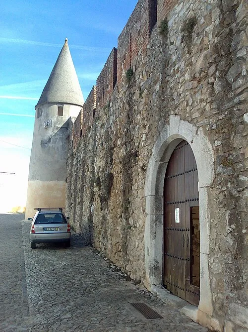 Castle of Viana do Alentejo Historic site, Viana do Alentejo19 km NW
-
Monte de Santa Luzia Mountain, Alvito13 km W
-
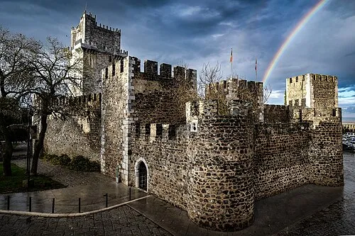 Castelo de Beja Historic site, União das freguesias de Beja (Santiago Maior e São João Baptista)24 km S
-
Serra de Vila Nova Mountain, Vila Nova da Baronia16 km W
-
Outeiro do Salto Mountain, Torre de Coelheiros20 km N
Sources & licences
Data last updated: