Serra da Estrela - Torre
Located in Alvoco da Serra, Seia Municipality Coordinates: 40°19′19″ N 7°36′47″ W
- Elevation
- 1,993 m
- above sea level
- Local time
- UTC+00:00
- Europe/Lisbon · UTC+00:00
- Airports
- VSE Aerodromo Goncalves Lobato (Viseu Airport)51 km
- VRL Vila Real Airport106 km
About Serra da Estrela - Torre
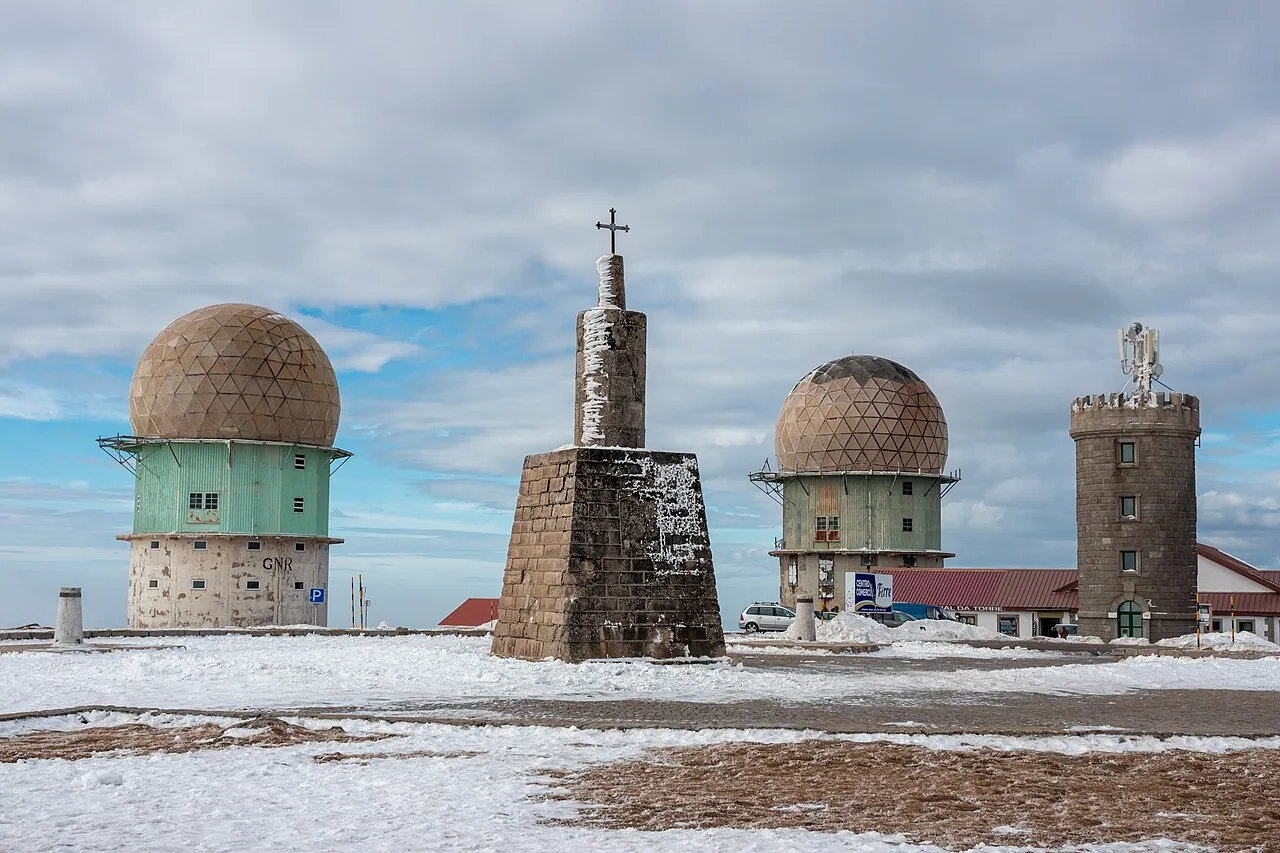
Serra da Estrela - Torre is a mountain. Location: Alvoco da Serra, Seia Municipality. Elevation: 1,993 m.
Torre (English: Tower) is the highest point of mainland Portugal, and the second-highest of the country overall (after Mount Pico, in the Azores). This point is not a distinctive mountain summit, but rather the highest point in the Torre Plateau, in the central massif of the Estrela Mountains. Torre has an unusual feature of being a summit that is accessible by paved road, the Regional Road 339 (R 339), formerly National Road 339 (N 339).
Source: Wikipedia · CC BY-SA 4.0
At a glance
- Topographic prominence
- 1,204 m
Source: Wikidata
Photos of Serra da Estrela - Torre
-

DCSaavedra · CC BY-SA 4.0 -

JC Ferreira - Fotografia · CC BY-SA 4.0 -

JC Ferreira - Fotografia · CC BY-SA 4.0 -

Vitor Oliveira from Torres Vedras, PORTUGAL · CC BY 2.0 -

MIMICA2018 · CC BY-SA 4.0


Climate of Serra da Estrela - Torre
Best months for sightseeingBest months for sightseeing: July–August.
This month · November
A wet month
Day 5° · Night -2° · Rain 164 mm
- Hottest month
- August (day 19°)
- Coldest month
- January (night -5°)
- Wettest month
- December (199 mm)
- Driest month
- August (15 mm)
Bars: average monthly low and high temperature. Below: precipitation. Monthly averages for 1970–2000 at about 18 km resolution, adjusted for elevation. Highlighted months are mild and relatively dry. Source: WorldClim 2.1 (CC BY 4.0).
Show values as a table
| Month | Jan | Feb | Mar | Apr | May | Jun | Jul | Aug | Sep | Oct | Nov | Dec |
|---|---|---|---|---|---|---|---|---|---|---|---|---|
| Average high (°C) | 2° | 3° | 5° | 7° | 10° | 16° | 19° | 19° | 16° | 10° | 5° | 2° |
| Average low (°C) | -5° | -4° | -3° | -2° | 1° | 5° | 7° | 7° | 5° | 2° | -2° | -4° |
| Precipitation (mm) | 190 | 156 | 113 | 112 | 102 | 52 | 17 | 15 | 55 | 140 | 164 | 199 |
How to get to Serra da Estrela - Torre
The nearest airport is Aerodromo Goncalves Lobato (Viseu Airport) (VSE), 51 km to the northwest as the crow flies. For international flights: Francisco de Sá Carneiro Airport (OPO) (137 km). The nearest large city is Porto, 125 km to the northwest.
Airports
- Aerodromo Goncalves Lobato (Viseu Airport) (VSE) Viseu 51 kmnorthwest
- Vila Real Airport (VRL) Vila Real 106 kmnorth
- Francisco de Sá Carneiro Airport (OPO) Porto 137 kmnorthwest
Nearby large cities
- Porto Population: 252.7K 125 kmnorthwest
- Braga Population: 193.3K 153 kmnorthwest
- Badajoz Population: 150.5K 170 kmsouth
- Salamanca Population: 144.8K 180 kmnortheast
- Lisbon Population: 517.8K 221 kmsouthwest
Straight-line distances; road distances are longer. Airport data: OurAirports.
Day trips from Serra da Estrela - Torre
Within 100 km: 41 historic and cultural sites, 145 natural sites, 57 lakes, rivers and coasts.
0–25 km16 places
- Castelo de Avô Historic site 25 kmW
- Serra do Gato Mountain 21 kmNE
- Serra da Galega Mountain 12 kmNE
- Cabeço do Espinho Mountain 13 kmSW
25–60 km67 places
- Cabeço das Lamas Mountain 30 kmSW
- Serra do Homem de Pedra Mountain 59 kmE
- Serra da Guardunha Mountain 27 kmS
- Cabeço do Gato Mountain 37 kmSW
60–100 km160 places
- Sapateira Grande Mountain 98 kmS
- Pantano de Águeda Lake 99 kmE
- Sierra de Gata Mountain 72 kmE
- Pico Jálama Mountain 74 kmE
Straight-line distances.
Nearest towns and villages
-
Loriga Municipality, Seia Municipality4.5 km W
-
Unhais da Serra Municipality, Covilhã Municipality4.8 km S
-
Loriga Village, Loriga6.5 km W
-
Manteigas (São Pedro) Municipality, Manteigas Municipality6.6 km NE
-
Cortes do Meio Municipality, Covilhã Municipality6.3 km SE
-
Sabugueiro Municipality, Seia Municipality7 km N
Nearby attractions & nature
Everything nearby-
Serra da Alvoaça Mountain, Guarda District7.5 km SW
-
Cerro do Covão da Costa Mountain, Sabugueiro8.7 km N
-
Cabeço da Malhada Velha Mountain, São Romão11 km NW
-
Serra da Galega Mountain, Verdelhos12 km NE
-
Alto da Malhoeira Mountain, Orjais16 km E
-
Cabeço do Espinho Mountain, Erada13 km SW
-
Serra da Cabeça Alta Mountain, Valhelhas21 km NE
-
Cabeço do Valongo Mountain, Caria21 km E
Sources & licences
Data last updated: · 2 independent sources