Santo Aleixo
Located in Monforte Municipality, Portalegre District Coordinates: 38°55′04″ N 7°24′38″ W
- Population
- 497
- 497
- Elevation
- 293 m
- above sea level
- Local time
- UTC+00:00
- Europe/Lisbon · UTC+00:00
- Airports
- BJZ Badajoz Airport51 km
- LIS Lisbon Humberto Delgado Airport151 km
About Santo Aleixo
Santo Aleixo is a municipality. Location: Monforte Municipality, Portalegre District. Population: 497. Elevation: 293 m. The best months to visit are May–June, October. The nearest airport is Badajoz Airport (51 km). Nearby sights include Forte de Santa Luzia and Alto dos Ripados.
Climate of Santo Aleixo
Best months for sightseeingBest months for sightseeing: May–June, October.
This month · November
Outside the best season
Day 17° · Night 8° · Rain 83 mm
- Hottest month
- August (day 31°)
- Coldest month
- January (night 5°)
- Wettest month
- December (89 mm)
- Driest month
- July (5 mm)
Bars: average monthly low and high temperature. Below: precipitation. Monthly averages for 1970–2000 at about 18 km resolution, adjusted for elevation. Highlighted months are mild and relatively dry. Source: WorldClim 2.1 (CC BY 4.0).
Show values as a table
| Month | Jan | Feb | Mar | Apr | May | Jun | Jul | Aug | Sep | Oct | Nov | Dec |
|---|---|---|---|---|---|---|---|---|---|---|---|---|
| Average high (°C) | 13° | 15° | 17° | 19° | 22° | 27° | 31° | 31° | 28° | 22° | 17° | 14° |
| Average low (°C) | 5° | 6° | 7° | 8° | 10° | 14° | 16° | 16° | 15° | 12° | 8° | 6° |
| Precipitation (mm) | 78 | 69 | 55 | 58 | 50 | 24 | 5 | 6 | 31 | 67 | 83 | 89 |
How to get to Santo Aleixo
The nearest airport is Badajoz Airport (BJZ), 51 km to the east as the crow flies. For international flights: Lisbon Humberto Delgado Airport (LIS) (151 km). The nearest large city is Badajoz, 38 km to the east.
Airports
- Badajoz Airport (BJZ) Badajoz 51 kmeast
- Lisbon Humberto Delgado Airport (LIS) Lisbon 151 kmwest
- Cascais Airport (CAT) Cascais 170 kmwest
Nearby large cities
- Badajoz Population: 150.5K 38 kmeast
- Setúbal Population: 118.2K 136 kmwest
- Lisbon Population: 517.8K 153 kmwest
- Huelva Population: 144.3K 188 kmsouth
- Seville Population: 686.7K 212 kmsoutheast
Straight-line distances; road distances are longer. Airport data: OurAirports.
Day trips from Santo Aleixo
Within 100 km: 81 historic and cultural sites, 91 natural sites, 103 lakes, rivers and coasts.
0–25 km4 places
- Castelo de Estremoz Historic site 18 kmSW
- Alto dos Ripados Mountain 11 kmNE
- Alto da Esparregueira Mountain 14 kmNE
- Forte de Santa Luzia Historic site 22 kmE
25–60 km99 places
- Pantano de la Peña del Águila Lake 55 kmNE
- Sierra Morena Mountain 59 kmSE
- Parque de Castelar Natural site 38 kmE
- Parque de La Legión Natural site 39 kmE
60–100 km172 places
- Sapateira Grande Mountain 61 kmN
- Vale do Corvo Natural site 78 kmW
- Vale Costado Natural site 78 kmW
- Pantano de Proserpina Lake 91 kmE
Straight-line distances.
Nearby attractions & nature
Everything nearby-
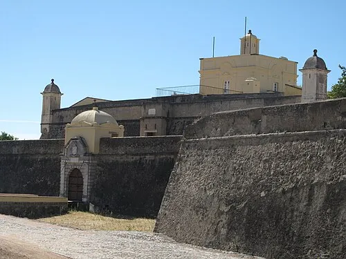 Forte de Santa Luzia Historic site, Assunção, Ajuda, Salvador e Santo Ildefonso22 km E
-
Alto dos Ripados Mountain, Monforte11 km NE
-
Alto da Esparregueira Mountain, Santa Eulália14 km NE
-
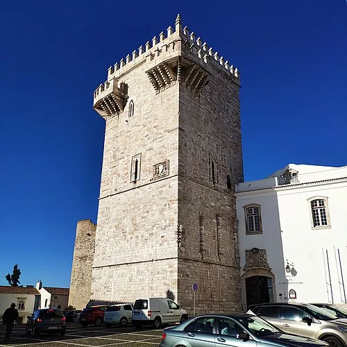 Castelo de Estremoz Historic site, União das freguesias de Estremoz (Santa Maria e Santo André)18 km SW
Sources & licences
Data last updated: