Serra Amarela
Located in Lindoso, Ponte da Barca Municipality Coordinates: 41°48′49″ N 8°11′44″ W
- Elevation
- 1,362 m
- above sea level
- Local time
- UTC+00:00
- Europe/Lisbon · UTC+00:00
- Airports
- VGO Vigo Airport59 km
- VRL Vila Real Airport72 km
About Serra Amarela
Serra Amarela is a mountain. Location: Lindoso, Ponte da Barca Municipality. Elevation: 1,362 m. The best months to visit are July–August. The nearest airport is Vigo Airport (59 km). Nearby sights include Sierra de la Cruz de Piñeiro and Serra de Santa Eufemia.
Climate of Serra Amarela
Best months for sightseeingBest months for sightseeing: July–August.
This month · November
A wet month
Day 8° · Night 1° · Rain 173 mm
- Hottest month
- July (day 20°)
- Coldest month
- January (night -2°)
- Wettest month
- December (201 mm)
- Driest month
- July (23 mm)
Bars: average monthly low and high temperature. Below: precipitation. Monthly averages for 1970–2000 at about 18 km resolution, adjusted for elevation. Highlighted months are mild and relatively dry. Source: WorldClim 2.1 (CC BY 4.0).
Show values as a table
| Month | Jan | Feb | Mar | Apr | May | Jun | Jul | Aug | Sep | Oct | Nov | Dec |
|---|---|---|---|---|---|---|---|---|---|---|---|---|
| Average high (°C) | 5° | 6° | 8° | 10° | 13° | 17° | 20° | 20° | 17° | 13° | 8° | 5° |
| Average low (°C) | -2° | -2° | 0° | 1° | 4° | 7° | 9° | 9° | 7° | 4° | 1° | -1° |
| Precipitation (mm) | 183 | 172 | 140 | 117 | 105 | 63 | 23 | 31 | 75 | 145 | 173 | 201 |
How to get to Serra Amarela
The nearest airport is Vigo Airport (VGO), 59 km to the northwest as the crow flies. For international flights: Francisco de Sá Carneiro Airport (OPO) (75 km). The nearest large city is Braga, 35 km to the southwest.
Airports
- Vigo Airport (VGO) Vigo 59 kmnorthwest
- Vila Real Airport (VRL) Vila Real 72 kmsoutheast
- Francisco de Sá Carneiro Airport (OPO) Porto 75 kmsouthwest
Nearby large cities
- Braga Population: 193.3K 35 kmsouthwest
- Vigo Population: 293.6K 64 kmnorthwest
- Ourense Population: 105.2K 64 kmnortheast
- Porto Population: 252.7K 82 kmsouthwest
- A Coruña Population: 250.4K 174 kmnorth
Straight-line distances; road distances are longer. Airport data: OurAirports.
Day trips from Serra Amarela
Within 100 km: 164 historic and cultural sites, 241 natural sites, 315 lakes, rivers and coasts.
0–25 km28 places
- Serra de Santa Eufemia Mountain 6 kmNE
- Río Fragoso River 21 kmNE
- Río de Casal River 13 kmNE
- Río Caldo River 12 kmNE
25–60 km198 places
- Praia de Areeiros Beach 44 kmNW
- Illa Ariño da Pasaxe Island 55 kmW
- Monte de Santa Trega Mountain 56 kmW
- Sierra de Larouca Mountain 45 kmE
60–100 km494 places
- Illa de Arousa Island 99 kmNW
- Illa de Ons Island 88 kmNW
- A Illa da Toxa Island 92 kmNW
- Islas Cíes Island 73 kmNW
Straight-line distances.
Nearest towns and villages
-
União das freguesias de Entre Ambos-os-Rios, Ermida e Germil Municipality, Ponte da Barca Municipality6.3 km W
-
Campo do Gerês Municipality, Terras de Bouro Municipality6.5 km SE
-
União das freguesias de Cibões e Brufe Municipality, Terras de Bouro Municipality7.4 km SW
-
Britelo Municipality, Ponte da Barca Municipality7.6 km NW
-
Carvalheira Municipality, Terras de Bouro Municipality8 km SW
-
 Lobios Municipality, Ourense13 km NE
Nearby attractions & nature
Everything nearby-
Sierra de la Cruz de Piñeiro Mountain, Braga District6.8 km SE
-
Serra de Santa Eufemia Mountain, Spain6.2 km NE
-
Monte del Quinxo Mountain, Entrimo14 km N
-
Serra da Cabreira Mountain, Braga District22 km SE
-
Serra do Gêrez Mountain, Vila Real District16 km E
-
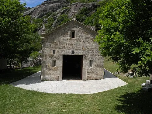 Anamão Mountain, União das freguesias de Castro Laboreiro e Lamas de Mouro23 km N
-
Fraga da Espinheira Mountain, Pitões das Junias20 km E
-
Monte Vermelho Mountain, São João de Rei21 km S
Sources & licences
Data last updated: · 2 independent sources