Emirdağ
Located in Emirdağ İlçesi, Afyonkarahisar Province Coordinates: 39°01′11″ N 31°09′00″ E
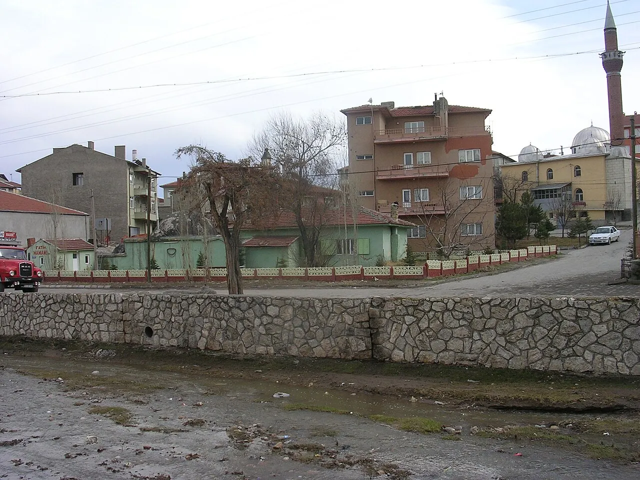
- Population
- 20,063
- 20.1K
- Elevation
- 964 m
- above sea level
- Local time
- UTC+03:00
- Europe/Istanbul · UTC+03:00
- Airports
- KZR Zafer Airport89 km
- AOE Hasan Polatkan Airport103 km
About Emirdağ
Emirdağ is a city. Location: Emirdağ İlçesi, Afyonkarahisar Province. Population: 20,063. Elevation: 964 m.
Emirdağ is a town of Afyonkarahisar Province in Turkey, between the cities of Afyon and Eskişehir. It is the seat of Emirdağ District.Emirdağ district has a total population of 43,484 according to the 2024 census. The mayor is Serkan Koyuncu (AKP). The Emir Mountains rise steeply behind the town. The region is vulnerable to earthquakes. The weather is very cold in winter.
Source: Wikipedia · CC BY-SA 4.0
Photos of Emirdağ
-

FoPen · CC BY-SA 4.0 -

FoPen · CC BY-SA 4.0 -

Volker Höhfeld · CC BY-SA 4.0 -

Ragkara at Turkish Wikipedia · Public domain


Climate of Emirdağ
Best months for sightseeingBest months for sightseeing: May–June, September–October.
This month · November
A cold month
Day 12° · Night 2° · Rain 32 mm
Better nearby cities in November
- Alanya · 285 km south21°
- Aydin · 317 km southwest19°
- Silifke · 382 km southeast21°
- Hottest month
- July (day 29°)
- Coldest month
- January (night -3°)
- Wettest month
- May (56 mm)
- Driest month
- August (12 mm)
Bars: average monthly low and high temperature. Below: precipitation. Monthly averages for 1970–2000 at about 18 km resolution, adjusted for elevation. Highlighted months are mild and relatively dry. Source: WorldClim 2.1 (CC BY 4.0).
Show values as a table
| Month | Jan | Feb | Mar | Apr | May | Jun | Jul | Aug | Sep | Oct | Nov | Dec |
|---|---|---|---|---|---|---|---|---|---|---|---|---|
| Average high (°C) | 4° | 6° | 11° | 16° | 21° | 25° | 29° | 29° | 25° | 19° | 12° | 6° |
| Average low (°C) | -3° | -2° | 1° | 5° | 9° | 12° | 15° | 14° | 11° | 7° | 2° | -1° |
| Precipitation (mm) | 41 | 39 | 43 | 48 | 56 | 41 | 16 | 12 | 15 | 35 | 32 | 50 |
Other places to visit in this season: May June September October
How to get to Emirdağ
The nearest airport is Zafer Airport (KZR), 89 km to the west as the crow flies. For international flights: Hasan Polatkan Airport (AOE) (103 km). The nearest large city is Afyonkarahisar, 60 km to the southwest.
Airports
- Zafer Airport (KZR) Altıntaş 89 kmwest
- Hasan Polatkan Airport (AOE) Eskişehir 103 kmnorthwest
- Süleyman Demirel International Airport (ISE) Isparta 146 kmsouthwest
Nearby large cities
- Afyonkarahisar Population: 251.8K 60 kmsouthwest
- Eskişehir Population: 921.6K 100 kmnorthwest
- Kütahya Population: 185K 110 kmnorthwest
- Isparta Population: 172.3K 149 kmsouth
- Uşak Population: 369.4K 156 kmwest
Straight-line distances; road distances are longer. Airport data: OurAirports.
Day trips from Emirdağ
Within 100 km: 18 historic and cultural sites, 296 natural sites, 145 lakes, rivers and coasts.
0–25 km30 places
- Koca Göl Lake 17 kmNE
- Dedeli Tepe Mountain 12 kmSW
- Eğerlidağı Tepesi Mountain 24 kmW
- Emirdede Tepe Mountain 15 kmSE
25–60 km112 places
- Lake Eber Lake 41 kmS
- Prymnessos Lake 46 kmSW
- Karkız Gölü Lake 38 kmN
- Yediler Tepesi Mountain 57 kmNE
60–100 km317 places
- Sarısunger Göleti Lake 91 kmNW
- Lake Çavuşçu Lake 98 kmSE
- Beylikahır Gölü Lake 75 kmN
- Lake Akşehir Lake 61 kmSE
Straight-line distances.
Nearby attractions & nature
Everything nearby-
Adaçal Tepesi Mountain, Emirdağ İlçesi2.1 km NW
-
Karaağaç Köprüsü Landmark, Emirdağ İlçesi4.4 km N
-
Çayırlar Deresi River, Afyonkarahisar Province4.9 km SW
-
Sivrikale Tepesi Mountain, Emirdağ İlçesi9.5 km W
-
Dedeli Tepe Mountain, Emirdağ İlçesi12 km SW
-
Boz Tepe Mountain, Emirdağ İlçesi12 km N
-
Kızdoğdu Tepesi Mountain, Emirdağ İlçesi19 km SE
-
Sokullu Tepe Mountain, Emirdağ İlçesi17 km NW
Sources & licences
Data last updated: · 2 independent sources