- Population
- 4,835
- 4.8K
- Elevation
- 613 m
- above sea level
- Local time
- UTC+03:00
- Europe/Istanbul · UTC+03:00
- Places inside
- 85
- listed under Beypazari
- Airports
- ESB Esenboğa International Airport92 km
- AOE Hasan Polatkan Airport125 km
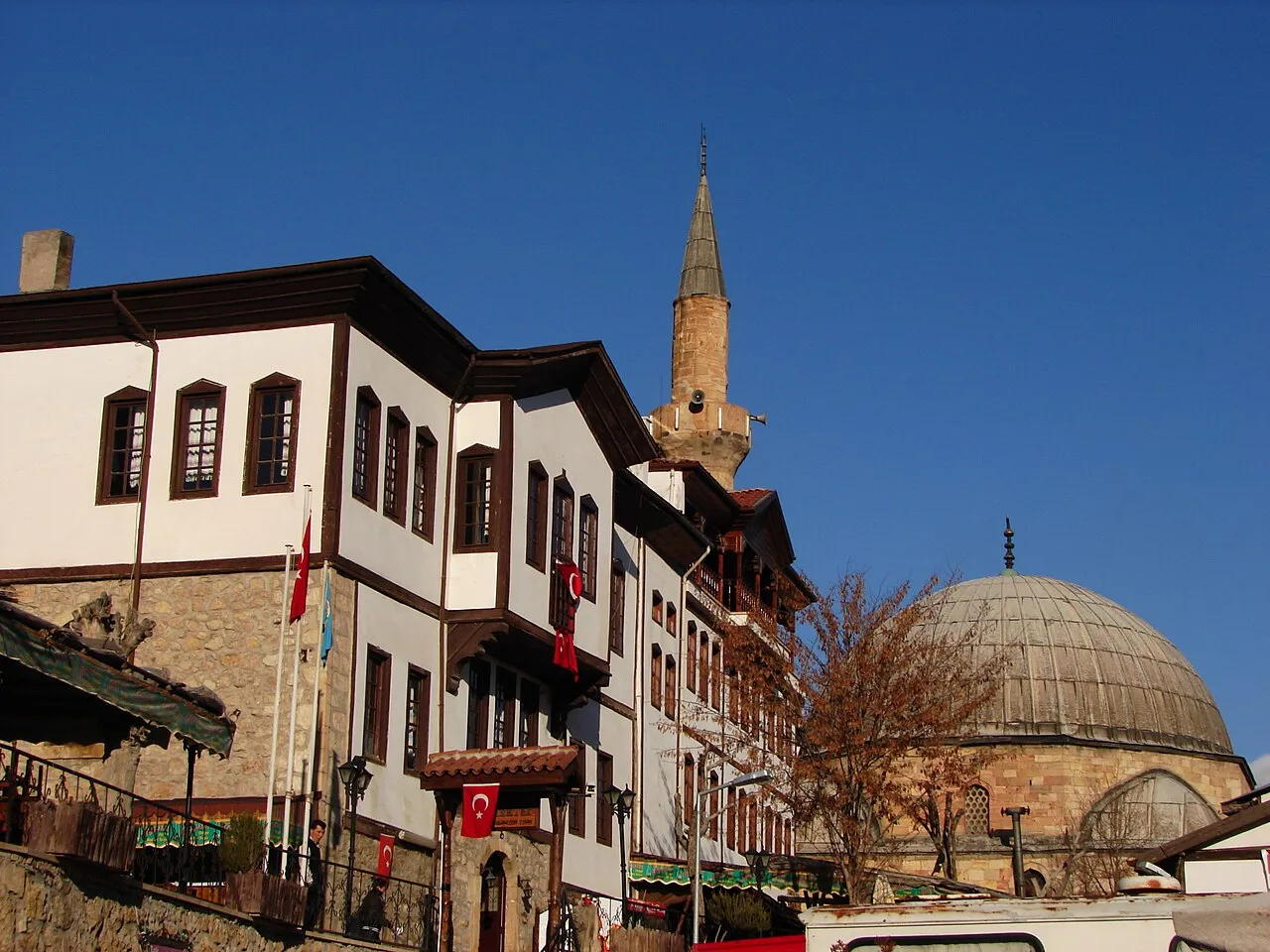
About Beypazari
Beypazari is a district. Location: Ankara Province, Turkey. Population: 4,835. The best months to visit are April–May, September–October. The nearest airport is Esenboğa International Airport (92 km). Nearby sights include Kirmir Çayı and Karaboğaz Çayı.
Climate of Beypazari
Best months for sightseeingBest months for sightseeing: April–May, September–October.
This month · November
Outside the best season
Day 14° · Night 4° · Rain 28 mm
- Hottest month
- July (day 32°)
- Coldest month
- January (night -1°)
- Wettest month
- December (58 mm)
- Driest month
- August (10 mm)
Bars: average monthly low and high temperature. Below: precipitation. Monthly averages for 1970–2000 at about 18 km resolution, adjusted for elevation. Highlighted months are mild and relatively dry. Source: WorldClim 2.1 (CC BY 4.0).
Show values as a table
| Month | Jan | Feb | Mar | Apr | May | Jun | Jul | Aug | Sep | Oct | Nov | Dec |
|---|---|---|---|---|---|---|---|---|---|---|---|---|
| Average high (°C) | 6° | 9° | 14° | 19° | 24° | 29° | 32° | 32° | 28° | 21° | 14° | 8° |
| Average low (°C) | -1° | 0° | 3° | 7° | 11° | 15° | 17° | 17° | 13° | 9° | 4° | 1° |
| Precipitation (mm) | 53 | 43 | 43 | 37 | 46 | 34 | 17 | 10 | 15 | 23 | 28 | 58 |
Other places to visit in this season: April May September October
How to get to Beypazari
The nearest airport is Esenboğa International Airport (ESB), 92 km to the east as the crow flies. The nearest large city is Bolu, 71 km to the north.
Airports
- Esenboğa International Airport (ESB) Ankara 92 kmeast
- Hasan Polatkan Airport (AOE) Eskişehir 125 kmwest
- Zonguldak Çaycuma Airport (ONQ) Zonguldak 152 kmnorth
Nearby large cities
- Bolu Population: 184.7K 71 kmnorth
- Ankara Population: 3.5M 84 kmeast
- Çankaya Population: 792.2K 84 kmeast
- Gölbaşı Population: 165.2K 86 kmsoutheast
- Düzce Population: 194.1K 100 kmnorthwest
Straight-line distances; road distances are longer. Airport data: OurAirports.
Day trips from Beypazari
Within 100 km: 71 historic and cultural sites, 753 natural sites, 252 lakes, rivers and coasts.
0–25 km24 places
- Arıdoruğu Tepesi Mountain 23 kmSE
- Uyku Dağı Mountain 14 kmW
- Keltepe Mountain 15 kmNW
- Halakayası Mountain 25 kmNW
25–60 km443 places
- Sazak Göleti Lake 47 kmSW
- Sarıyar Barajı Lake 28 kmSW
- Aladağ Göleti Lake 55 kmNW
- Asartepe Barajı Lake 41 kmE
60–100 km609 places
- Lake Mogan Lake 86 kmSE
- Yunus Emre Göleti Lake 61 kmE
- Lake Eymir Lake 85 kmSE
- Beylikahır Gölü Lake 80 kmSW
Straight-line distances.
Places in Beypazari
85 places- 1 Beypazarı 38.8K
- 2 Kırbaşı 946
- 3 Karaşar 429
- 4 Üreğil 348
- 5 Tacettin 318
- 6 Uruş 276
- 7 Gursogut 276
- 8 Macun 265
- 9 Adaören 264
- 10 Oymaağaç 255
- 11 Kızılcasöğüt 255
- 12 Kırşeyhler 246
- 13 Sekli 243
- 14 Boyalı 243
- 15 Yoğunpelit 235
- 16 Tahir 226
- 17 Dikmen 201
- 18 Mahmutlar 188
- 19 Kapullu 163
- 20 Kuyumcutekke 163
- 21 Kayabükü 162
- 22 Kabaca 157
- 23 Yukarıulucak 149
- 24 Dibecik 146
- 25 Kuyucak 145
- 26 Kozalan 142
- 27 Çantırlı 137
- 28 Yiğerler 133
- 29 Çakıloba 124
- 30 İncepelit 114
- 31 Hırkatepe 114
- 32 Köstköy 112
- 33 Dereli 109
- 34 Dudaş 102
- 35 Fasıl 101
- 36 Akçakavak 92
- 37 Karacaören 90
- 38 Sopçaalan 86
- 39 Yalnızçam 85
- 40 Uşakgöl 85
- 41 Bağözü 77
- 42 Kozağaç 67
- 43 Kerbanlar 65
- 44 Mikail 62
- 45 Acısu 61
- 46 Yıldız 61
- 47 Kargı 56
- 48 Doğanyurt 55
- 49 Dağşeyhler 50
- 50 Kabalar 48
- 51 Başören 48
- 52 Kaplan 46
- 53 Mençeler 46
- 54 Dıbekören 44
- 55 Karaören 43
- 56 Nuhhoca 36
- 57 Köseler 36
- 58 Doğançalı 36
- 59 Sarıağıl 35
- 60 Batça 35
Bar: population relative to the most populous place in this list.
Nearby attractions & nature
Everything nearby-
Kirmir Çayı River, Ankara Province11 km SW
-
Karaboğaz Çayı River, Ankara Province12 km SE
-
Kara Pınar Natural site, Ankara Province21 km S
-
Karlık Dağı Mountain, Bolu Province19 km N
-
Kakma Tepeleri Mountain, Ayaş İlçesi23 km SE
-
Yeniağıl Tepesi Mountain, Ayaş İlçesi23 km SE
Sources & licences
Data last updated: