Nallıhan Bucağı
Located in Ankara Province, Turkey Coordinates: 40°10′44″ N 31°20′38″ E
- Elevation
- 609 m
- above sea level
- Local time
- UTC+03:00
- Europe/Istanbul · UTC+03:00
- Airports
- AOE Hasan Polatkan Airport81 km
- ESB Esenboğa International Airport141 km
About Nallıhan Bucağı
Nallıhan Bucağı is a municipality. Location: Ankara Province, Turkey. Elevation: 609 m. The best months to visit are May–June, September–October. The nearest airport is Hasan Polatkan Airport (81 km). Nearby sights include Oyuk Tepe and Bozkaya Çayı.
Climate of Nallıhan Bucağı
Best months for sightseeingBest months for sightseeing: May–June, September–October.
This month · November
Outside the best season
Day 13° · Night 4° · Rain 36 mm
Better nearby cities in November
- Aydin · 399 km southwest19°
- Hottest month
- July (day 30°)
- Coldest month
- January (night -1°)
- Wettest month
- December (61 mm)
- Driest month
- August (16 mm)
Bars: average monthly low and high temperature. Below: precipitation. Monthly averages for 1970–2000 at about 18 km resolution, adjusted for elevation. Highlighted months are mild and relatively dry. Source: WorldClim 2.1 (CC BY 4.0).
Show values as a table
| Month | Jan | Feb | Mar | Apr | May | Jun | Jul | Aug | Sep | Oct | Nov | Dec |
|---|---|---|---|---|---|---|---|---|---|---|---|---|
| Average high (°C) | 6° | 8° | 12° | 18° | 22° | 27° | 30° | 29° | 26° | 20° | 13° | 7° |
| Average low (°C) | -1° | 0° | 3° | 7° | 11° | 14° | 16° | 16° | 13° | 9° | 4° | 1° |
| Precipitation (mm) | 55 | 43 | 48 | 45 | 55 | 45 | 23 | 16 | 19 | 29 | 36 | 61 |
Other places to visit in this season: May June September October
How to get to Nallıhan Bucağı
The nearest airport is Hasan Polatkan Airport (AOE), 81 km to the southwest as the crow flies. The nearest large city is Bolu, 66 km to the north.
Airports
- Hasan Polatkan Airport (AOE) Eskişehir 81 kmsouthwest
- Esenboğa International Airport (ESB) Ankara 141 kmeast
- Bursa Yenişehir Airport (YEI) Yenişehir 152 kmwest
Nearby large cities
- Bolu Population: 184.7K 66 kmnorth
- Düzce Population: 194.1K 75 kmnorth
- Eskişehir Population: 921.6K 83 kmsouthwest
- Adapazarı Population: 286.8K 104 kmnorthwest
- Ankara Population: 3.5M 132 kmeast
Straight-line distances; road distances are longer. Airport data: OurAirports.
Day trips from Nallıhan Bucağı
Within 100 km: 10 historic and cultural sites, 503 natural sites, 187 lakes, rivers and coasts.
0–25 km23 places
- Tokmakça Tepe Mountain 16 kmSW
- Oyuk Tepe Mountain 4 kmSE
- Kurtdumanı Tepe Mountain 18 kmNE
- Kıztepe Mountain 21 kmE
25–60 km139 places
- Beylikahır Gölü Lake 55 kmS
- Sazak Göleti Lake 50 kmSE
- Sarıyar Barajı Lake 30 kmSE
- Aladağ Göleti Lake 55 kmNE
60–100 km538 places
- Sarısunger Göleti Lake 84 kmSW
- Yeniçağa Gölü Lake 89 kmNE
- Melen Gölü Lake 69 kmN
- Asartepe Barajı Lake 90 kmE
Straight-line distances.
Nearby attractions & nature
Everything nearby-
Oyuk Tepe Mountain, Nallıhan İlçesi3.7 km SE
-
Bozkaya Çayı River, Ankara Province8.4 km N
-
Karakuz Tepe Mountain, Nallıhan İlçesi10 km NW
-
Nallı Çayı River, Ankara Province11 km S
-
Hoca Dağı Mountain, Bolu Province19 km N
-
Köstebek Çayı River, Ankara Province16 km NW
-
Atça Deresi River, Ankara Province18 km E
-
Kepez Tepesi Mountain, Nallıhan İlçesi22 km SE
Other cities and towns in Ankara Province
-
Çayırhan Town, Nallıhan İlçesi29 km E
-
Beydili Bucağı Municipality, Ankara Province28 km W
-
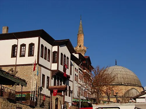 Beypazarı City, Beypazari49 km E
-
Çayırhan Bucağı Municipality, Ankara Province30 km E
-
Yıldız Municipality, Ankara Province37 km E
-
Kırbaşı Bucağı Municipality, Ankara Province46 km E
Sources & licences
Data last updated: