Teke Yarımadası
Located in Antalya Province, Turkey Coordinates: 36°10′15″ N 29°43′37″ E
- Elevation
- 171 m
- above sea level
- Local time
- UTC+03:00
- Europe/Istanbul · UTC+03:00
- Airports
- DLM Dalaman International Airport103 km
- AYT Antalya International Airport126 km
About Teke Yarımadası
Teke Yarımadası is a natural site. Location: Antalya Province, Turkey. The best months to visit are April–May, October–November. The nearest airport is Dalaman International Airport (103 km). Nearby sights include Çam Dağı and Körmen Adası.
Photos of Teke Yarımadası
-
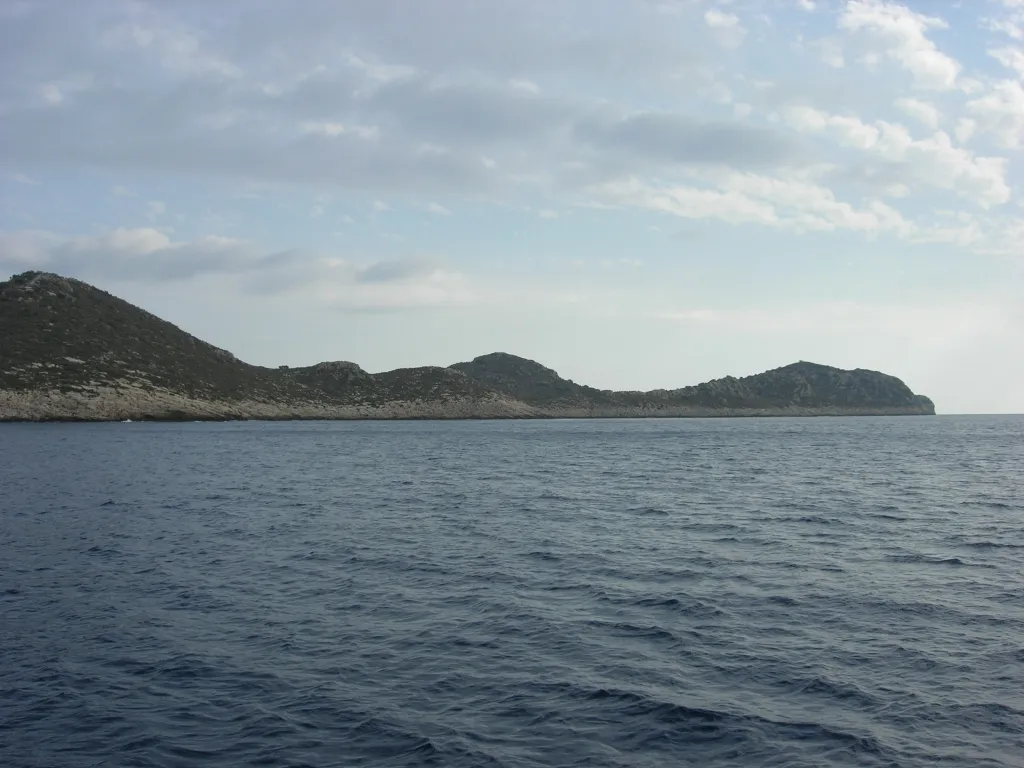
İçada A. Fabbretti · CC BY-SA 4.0

Climate of Teke Yarımadası
Best months for sightseeingBest months for sightseeing: April–May, October–November.
This month · November
A good month to visit
Day 20° · Night 10° · Rain 85 mm
- Hottest month
- August (day 35°)
- Coldest month
- January (night 6°)
- Wettest month
- January (161 mm)
- Driest month
- August (5 mm)
Bars: average monthly low and high temperature. Below: precipitation. Monthly averages for 1970–2000 at about 18 km resolution, adjusted for elevation. Highlighted months are mild and relatively dry. Source: WorldClim 2.1 (CC BY 4.0).
Show values as a table
| Month | Jan | Feb | Mar | Apr | May | Jun | Jul | Aug | Sep | Oct | Nov | Dec |
|---|---|---|---|---|---|---|---|---|---|---|---|---|
| Average high (°C) | 15° | 15° | 18° | 22° | 26° | 31° | 34° | 35° | 31° | 26° | 20° | 16° |
| Average low (°C) | 6° | 6° | 8° | 11° | 14° | 18° | 21° | 21° | 18° | 14° | 10° | 7° |
| Precipitation (mm) | 161 | 117 | 73 | 38 | 24 | 13 | 7 | 5 | 12 | 53 | 85 | 156 |
Other places to visit in this season: April May October November
How to get to Teke Yarımadası
The nearest airport is Dalaman International Airport (DLM), 103 km to the northwest as the crow flies. The nearest large city is Antalya, 119 km to the northeast.
Airports
- Dalaman International Airport (DLM) Dalaman 103 kmnorthwest
- Antalya International Airport (AYT) Antalya 126 kmnortheast
- Rhodes International Airport "Diagoras" (RHO) Rhodes 150 kmwest
Nearby large cities
- Antalya Population: 1.3M 119 kmnortheast
- Muratpaşa Population: 450K 123 kmnortheast
- Denizli Population: 313.2K 187 kmnorth
- Merkezefendi Population: 280.3K 191 kmnorth
- Isparta Population: 172.3K 192 kmnorth
Straight-line distances; road distances are longer. Airport data: OurAirports.
Day trips from Teke Yarımadası
Within 100 km: 18 historic and cultural sites, 190 natural sites, 133 lakes, rivers and coasts.
0–25 km52 places
- Sarıada Island 7 kmSW
- Gürmenli Adası Island 16 kmW
- Kekova Adası Island 13 kmE
- Besmi Adası Island 10 kmW
25–60 km97 places
- Öksüz Adası Island 25 kmW
- Heybeli Ada Island 27 kmW
- Güvercin Adası Island 39 kmE
- Boğazcık Adası Island 25 kmW
60–100 km192 places
- Çalış Beach Beach 78 kmNW
- Ölüdeniz Plajı Beach 68 kmNW
- Kidrak Beach Beach 67 kmNW
- Kabak Beach Beach 63 kmNW
Straight-line distances.
Nearest towns and villages
Nearby attractions & nature
Everything nearby-
Çam Dağı Mountain, Kaş İlçesi1.4 km N
-
Körmen Adası Island, Antalya Province1.8 km SW
-
Çılpacık Adası Island, Antalya Province2.9 km SW
-
İçada Island, Antalya Province4.5 km SE
-
Siğtaş Adası Island, Antalya Province5.8 km SW
-
Sıcak Yarımadası Natural site, Antalya Province6.4 km E
-
Sarıada Island, Antalya Province7.4 km SW
-
Güvercinli Adası Island, Antalya Province7.2 km SW
Sources & licences
Data last updated: