- Elevation
- 12 m
- above sea level
- Local time
- UTC+03:00
- Europe/Istanbul · UTC+03:00
- Airports
- SMI Samos Airport52 km
- BJV Milas Bodrum International Airport56 km
About Kalcık
Kalcık is a village. Location: Söke İlçesi, Aydın Province. Elevation: 12 m. The best months to visit are April–May, October. The nearest airport is Samos Airport (52 km). Nearby sights include Sarı Çay and Durmuş Dağı.
Climate of Kalcık
Best months for sightseeingBest months for sightseeing: April–May, October.
This month · November
Outside the best season
Day 19° · Night 9° · Rain 85 mm
Better nearby cities in November
- Aydin · 32 km northeast19°
- Hottest month
- July (day 35°)
- Coldest month
- January (night 5°)
- Wettest month
- December (145 mm)
- Driest month
- July (5 mm)
Bars: average monthly low and high temperature. Below: precipitation. Monthly averages for 1970–2000 at about 18 km resolution, adjusted for elevation. Highlighted months are mild and relatively dry. Source: WorldClim 2.1 (CC BY 4.0).
Show values as a table
| Month | Jan | Feb | Mar | Apr | May | Jun | Jul | Aug | Sep | Oct | Nov | Dec |
|---|---|---|---|---|---|---|---|---|---|---|---|---|
| Average high (°C) | 13° | 15° | 18° | 22° | 28° | 33° | 35° | 34° | 31° | 25° | 19° | 15° |
| Average low (°C) | 5° | 6° | 7° | 10° | 14° | 18° | 21° | 20° | 17° | 13° | 9° | 6° |
| Precipitation (mm) | 138 | 107 | 77 | 48 | 27 | 13 | 5 | 5 | 18 | 42 | 85 | 145 |
How to get to Kalcık
The nearest airport is Samos Airport (SMI), 52 km to the west as the crow flies. For international flights: Milas Bodrum International Airport (BJV) (56 km). The nearest large city is Aydin, 32 km to the northeast.
Airports
- Samos Airport (SMI) Samos Island 52 kmwest
- Milas Bodrum International Airport (BJV) Bodrum 56 kmsouth
- Adnan Menderes International Airport (ADB) Gaziemir 69 kmnorthwest
Nearby large cities
- Aydin Population: 163K 32 kmnortheast
- Nazilli Population: 119.4K 75 kmeast
- Karabağlar Population: 479.3K 79 kmnorthwest
- Izmir Population: 2.9M 82 kmnorthwest
- Konak Population: 332.3K 82 kmnorthwest
Straight-line distances; road distances are longer. Airport data: OurAirports.
Day trips from Kalcık
Within 100 km: 100 historic and cultural sites, 191 natural sites, 200 lakes, rivers and coasts.
0–25 km30 places
- Subice Dağı Mountain 18 kmSE
- Maden Dağı Mountain 22 kmNW
- Köstepe Mountain 20 kmE
- Kızmezar Tepe Mountain 14 kmS
25–60 km151 places
- Moní Megális Panagías Attraction 58 kmW
- Iasos Historic site 51 kmS
- Kadınlar Plajı Beach 26 kmNW
- Didem Plajı Beach 46 kmSW
60–100 km310 places
- Nisída Krevvatió Island 95 kmS
- Karabel relief Historic site 71 kmN
- Gümbet Plajı Beach 78 kmS
- Bardakçı Plajı Beach 78 kmS
Straight-line distances.
Nearby attractions & nature
Everything nearby-
Sarı Çay River, Aydın Province2.4 km SW
-
Durmuş Dağı Mountain, Söke İlçesi12 km NW
-
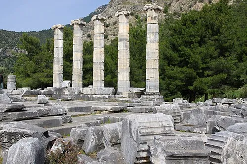 Priene Historic site, Söke İlçesi20 km SW
-
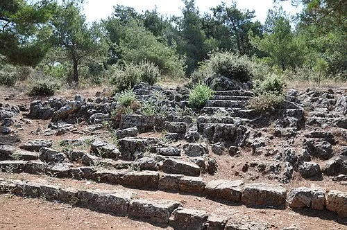 Panionium Historic site, Söke İlçesi15 km W
-
Moralı Çay River, Aydın Province7.5 km N
-
Karyağdı Tepe Mountain, Söke İlçesi12 km NW
Sources & licences
Data last updated: