- Population
- 68,230
- 68.2K
- Elevation
- 38 m
- above sea level
- Local time
- UTC+03:00
- Europe/Istanbul · UTC+03:00
- Airports
- SMI Samos Airport44 km
- BJV Milas Bodrum International Airport60 km
About Söke
Söke is a city. Location: Söke İlçesi, Aydın Province. Population: 68,230. Elevation: 38 m. The best months to visit are April–May, October. The nearest airport is Samos Airport (44 km). Nearby sights include Panionium and Durmuş Dağı.
Photos of Söke
-
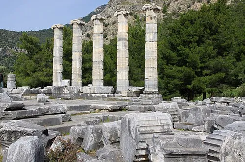
Priene Ken and Nyetta · CC BY 2.0 -
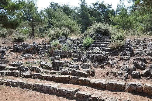
Panionium Isabeau · CC BY-SA 4.0


Climate of Söke
Best months for sightseeingBest months for sightseeing: April–May, October.
This month · November
Outside the best season
Day 19° · Night 9° · Rain 88 mm
Better nearby cities in November
- Aydin · 40 km east19°
- Hottest month
- July (day 34°)
- Coldest month
- January (night 5°)
- Wettest month
- December (148 mm)
- Driest month
- July (5 mm)
Bars: average monthly low and high temperature. Below: precipitation. Monthly averages for 1970–2000 at about 18 km resolution, adjusted for elevation. Highlighted months are mild and relatively dry. Source: WorldClim 2.1 (CC BY 4.0).
Show values as a table
| Month | Jan | Feb | Mar | Apr | May | Jun | Jul | Aug | Sep | Oct | Nov | Dec |
|---|---|---|---|---|---|---|---|---|---|---|---|---|
| Average high (°C) | 13° | 14° | 17° | 22° | 27° | 32° | 34° | 33° | 30° | 25° | 19° | 15° |
| Average low (°C) | 5° | 6° | 7° | 10° | 14° | 18° | 21° | 20° | 17° | 13° | 9° | 7° |
| Precipitation (mm) | 140 | 108 | 80 | 47 | 26 | 11 | 5 | 5 | 18 | 42 | 88 | 148 |
How to get to Söke
The nearest airport is Samos Airport (SMI), 44 km to the west as the crow flies. For international flights: Milas Bodrum International Airport (BJV) (60 km). The nearest large city is Aydin, 40 km to the east.
Airports
- Samos Airport (SMI) Samos Island 44 kmwest
- Milas Bodrum International Airport (BJV) Bodrum 60 kmsouth
- Adnan Menderes International Airport (ADB) Gaziemir 64 kmnorth
Nearby large cities
- Aydin Population: 163K 40 kmeast
- Karabağlar Population: 479.3K 74 kmnorth
- Konak Population: 332.3K 77 kmnorth
- Izmir Population: 2.9M 77 kmnorth
- Bornova Population: 452.5K 82 kmnorth
Straight-line distances; road distances are longer. Airport data: OurAirports.
Day trips from Söke
Within 100 km: 100 historic and cultural sites, 188 natural sites, 198 lakes, rivers and coasts.
0–25 km51 places
- Kadınlar Plajı Beach 18 kmNW
- Karga Adası Island 17 kmNW
- Maden Dağı Mountain 16 kmNW
- Kızmezar Tepe Mountain 15 kmS
25–60 km124 places
- Moní Megális Panagías Attraction 50 kmW
- Iasos Historic site 55 kmS
- Didem Plajı Beach 45 kmS
- Kapota Island Island 52 kmS
60–100 km311 places
- Nisída Krevvatió Island 95 kmS
- Karabel relief Historic site 69 kmN
- Gümbet Plajı Beach 79 kmS
- Bardakçı Plajı Beach 80 kmS
Straight-line distances.
Söke and similar cities
Side by side with cities of similar size in the same country: population, elevation and climate.
| Measure | Söke | Ardeşen | Şırnak | Ödemiş |
|---|---|---|---|---|
| Population | 68.2K | 68K | 67.7K | 67.2K |
| Elevation | 38 m | 8 m | 1,269 m | 129 m |
| Summer day (hottest month) | 34° | 27° | 35° | 35° |
| Winter night (coldest month) | 5° | 4° | -2° | 3° |
| Annual rainfall | 718 mm | 1,880 mm | 800 mm | 689 mm |
| Best months | Apr–May, Oct | May–Jul, Sep–Oct | May, Oct | Apr–May, Oct |
| Distance | — | 1,227 km | 1,327 km | 73 km |
Climate values are 1970–2000 monthly averages; straight-line distance.
Nearby attractions & nature
Everything nearby-
Panionium Historic site, Söke İlçesi8.3 km SW
-
Durmuş Dağı Mountain, Söke İlçesi8.2 km N
-
Karyağdı Tepe Mountain, Söke İlçesi7.7 km N
-
Priene Historic site, Söke İlçesi14 km SW
-
Sarı Çay River, Aydın Province7.7 km SE
-
Theatre of Priene Historic site, Söke İlçesi14 km SW
-
Temple of Athena, Priene Historic site, Söke İlçesi14 km SW
-
Kese Dağı Mountain, Kuşadası İlçesi18 km NW
Sources & licences
Data last updated: