Kayapa Bucağı
Located in Balıkesir Province, Turkey Coordinates: 39°30′12″ N 27°27′54″ E
- Elevation
- 346 m
- above sea level
- Local time
- UTC+03:00
- Europe/Istanbul · UTC+03:00
- Airports
- EDO Balıkesir Koca Seyit Airport39 km
- BZI Balıkesir Airport42 km
About Kayapa Bucağı
Kayapa Bucağı is a municipality. Location: Balıkesir Province, Turkey. Elevation: 346 m. The best months to visit are May–June, September–October. The nearest airport is Balıkesir Koca Seyit Airport (39 km). Nearby sights include Türkelidağları and Madra Deresi.
Climate of Kayapa Bucağı
Best months for sightseeingBest months for sightseeing: May–June, September–October.
This month · November
Outside the best season
Day 15° · Night 5° · Rain 94 mm
Better nearby cities in November
- Aydin · 187 km south19°
- Hottest month
- July (day 30°)
- Coldest month
- January (night 1°)
- Wettest month
- December (133 mm)
- Driest month
- July (11 mm)
Bars: average monthly low and high temperature. Below: precipitation. Monthly averages for 1970–2000 at about 18 km resolution, adjusted for elevation. Highlighted months are mild and relatively dry. Source: WorldClim 2.1 (CC BY 4.0).
Show values as a table
| Month | Jan | Feb | Mar | Apr | May | Jun | Jul | Aug | Sep | Oct | Nov | Dec |
|---|---|---|---|---|---|---|---|---|---|---|---|---|
| Average high (°C) | 8° | 9° | 13° | 18° | 23° | 28° | 30° | 30° | 27° | 20° | 15° | 10° |
| Average low (°C) | 1° | 1° | 3° | 7° | 11° | 14° | 17° | 17° | 13° | 10° | 5° | 3° |
| Precipitation (mm) | 108 | 87 | 73 | 62 | 45 | 24 | 11 | 14 | 25 | 51 | 94 | 133 |
Other places to visit in this season: May June September October
How to get to Kayapa Bucağı
The nearest airport is Balıkesir Koca Seyit Airport (EDO), 39 km to the west as the crow flies. The nearest large city is Balıkesir, 40 km to the northeast.
Airports
- Balıkesir Koca Seyit Airport (EDO) Edremit 39 kmwest
- Balıkesir Airport (BZI) Balıkesir 42 kmeast
- Mytilene International Airport (MJT) Mytilene 90 kmsouthwest
Nearby large cities
- Balıkesir Population: 238.2K 40 kmnortheast
- Manisa Population: 244K 99 kmsouth
- Mustafakemalpaşa Population: 101.4K 100 kmnortheast
- Bandırma Population: 107.6K 104 kmnortheast
- Turgutlu Population: 103.3K 114 kmsouth
Straight-line distances; road distances are longer. Airport data: OurAirports.
Day trips from Kayapa Bucağı
Within 100 km: 19 historic and cultural sites, 211 natural sites, 237 lakes, rivers and coasts.
0–25 km19 places
- Söbe Tepesi Mountain 21 kmW
- Şap Dağı Mountain 22 kmNW
- Şabla Dağı Mountain 20 kmW
- Akçaldede Tepe Mountain 25 kmNE
25–60 km141 places
- Torhasan Göleti Lake 54 kmNW
- Yenice Göleti Lake 53 kmNW
- Kalkım Göleti Lake 41 kmNW
- Koruköy Göleti Lake 38 kmN
60–100 km307 places
- Tavşan Adası Island 88 kmSW
- Pırasa Adası Island 86 kmSW
- Pınar Adası Island 76 kmW
- Kızkulesi Adası Island 86 kmSW
Straight-line distances.
Nearby attractions & nature
Everything nearby-
Türkelidağları Mountain, Balıkesir Province9.6 km S
-
Madra Deresi River, Balıkesir Province9.8 km NW
-
Korucu Dağları Mountain, Turkey12 km S
-
Yavru Deresi River, Balıkesir Province13 km W
-
Kuşca Tepesi Mountain, İvrindi İlçesi15 km SW
-
Taşavlu Tepesi Mountain, İvrindi İlçesi13 km SW
-
Osmanlar Deresi River, Balıkesir Province13 km N
-
Yağlılar Deresi River, Balıkesir Province12 km NE
Other cities and towns in Balıkesir Province
-
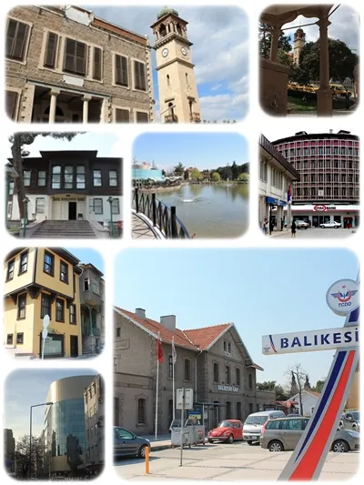 Balıkesir City, Balıkesir Province40 km NE
-
Korucu Bucağı Municipality, Balıkesir Province7.6 km W
-
İvrindi Bucağı Municipality, Balıkesir Province8.2 km N
-
 Havran City, Havran İlçesi32 km W
-
Savaştepe City, Savaştepe İlçesi21 km SE
-
Sarıbeyler Bucağı Municipality, Balıkesir Province15 km SE
Sources & licences
Data last updated: