- Elevation
- 108 m
- above sea level
- Local time
- UTC+03:00
- Europe/Istanbul · UTC+03:00
- Airports
- BZI Balıkesir Airport5 km
- EDO Balıkesir Koca Seyit Airport76 km
About Üzümcü Çayı
Üzümcü Çayı is a river. Location: Balıkesir Province, Turkey. The best months to visit are April–May, September–October. The nearest airport is Balıkesir Airport (5 km). Nearby sights include Nergis Çayı and Dedebayırı Tepesi.
Climate of Üzümcü Çayı
Best months for sightseeingBest months for sightseeing: April–May, September–October.
This month · November
Outside the best season
Day 16° · Night 5° · Rain 80 mm
Better nearby cities in November
- Aydin · 193 km south19°
- Hottest month
- July (day 32°)
- Coldest month
- January (night 1°)
- Wettest month
- December (114 mm)
- Driest month
- July (11 mm)
Bars: average monthly low and high temperature. Below: precipitation. Monthly averages for 1970–2000 at about 18 km resolution, adjusted for elevation. Highlighted months are mild and relatively dry. Source: WorldClim 2.1 (CC BY 4.0).
Show values as a table
| Month | Jan | Feb | Mar | Apr | May | Jun | Jul | Aug | Sep | Oct | Nov | Dec |
|---|---|---|---|---|---|---|---|---|---|---|---|---|
| Average high (°C) | 9° | 11° | 14° | 19° | 24° | 30° | 32° | 31° | 28° | 22° | 16° | 11° |
| Average low (°C) | 1° | 1° | 3° | 7° | 11° | 15° | 17° | 17° | 13° | 10° | 5° | 3° |
| Precipitation (mm) | 97 | 73 | 64 | 56 | 41 | 24 | 11 | 12 | 26 | 48 | 80 | 114 |
Other places to visit in this season: April May September October
How to get to Üzümcü Çayı
The nearest airport is Balıkesir Airport (BZI), 5 km to the northeast as the crow flies. For international flights: Balıkesir Koca Seyit Airport (EDO) (76 km). The nearest large city is Balıkesir, 7 km to the north.
Airports
- Balıkesir Airport (BZI) Balıkesir 5 kmnortheast
- Balıkesir Koca Seyit Airport (EDO) Edremit 76 kmwest
- Mytilene International Airport (MJT) Mytilene 126 kmsouthwest
Nearby large cities
- Balıkesir Population: 238.2K 7 kmnorth
- Mustafakemalpaşa Population: 101.4K 67 kmnortheast
- Bandırma Population: 107.6K 86 kmnorth
- Nilufer Population: 536.4K 112 kmnortheast
- Manisa Population: 244K 115 kmsouth
Straight-line distances; road distances are longer. Airport data: OurAirports.
Day trips from Üzümcü Çayı
Within 100 km: 21 historic and cultural sites, 190 natural sites, 202 lakes, rivers and coasts.
0–25 km20 places
- Yumaklı Dağ Mountain 24 kmS
- Türkmen Tepe Mountain 18 kmS
- Karyağdı Tepesi Mountain 23 kmSE
- Dedebayırı Tepesi Mountain 5 kmS
25–60 km105 places
- Kocabey Göleti Lake 38 kmSE
- Karapürcek Göleti Lake 52 kmNE
- Koruköy Göleti Lake 53 kmNW
- Gümüşler Göleti Lake 57 kmNW
60–100 km288 places
- Yeniköy Plaj Beach 100 kmNE
- Aslı Adacığı Island 98 kmW
- Sedef Adası Island 100 kmN
- Tavşan Adası Island 89 kmN
Straight-line distances.
Nearest towns and villages
-
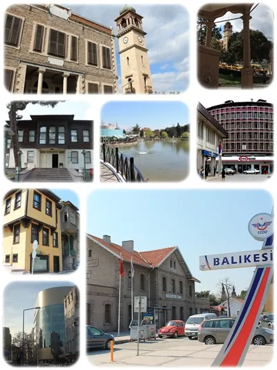 Balıkesir City, Balıkesir Province7.4 km N
-
Akçakaya Village, Altıeylül İlçesi2 km W
-
Hadrianotherai Village, Altıeylül İlçesi3.2 km NE
-
Küçükbostancı Village, Altıeylül İlçesi3.6 km E
-
Çayırhisar Village, Altıeylül İlçesi3.8 km N
-
Büyükbostancı Village, Altıeylül İlçesi4.4 km SE
Nearby attractions & nature
Everything nearby-
Nergis Çayı River, Balıkesir Province4.5 km E
-
Dedebayırı Tepesi Mountain, Altıeylül İlçesi4.9 km S
-
Değirmen Deresi River, Balıkesir Province6.6 km S
-
Aşçı Deresi River, Balıkesir Province9.5 km SE
-
Ovakoy River, Balıkesir Province10 km NE
-
Kazıklı Deresi River, Balıkesir Province11 km NE
-
Koca Dere River, Balıkesir Province13 km S
-
Kazan Deresi River, Balıkesir Province15 km S
Sources & licences
Data last updated: