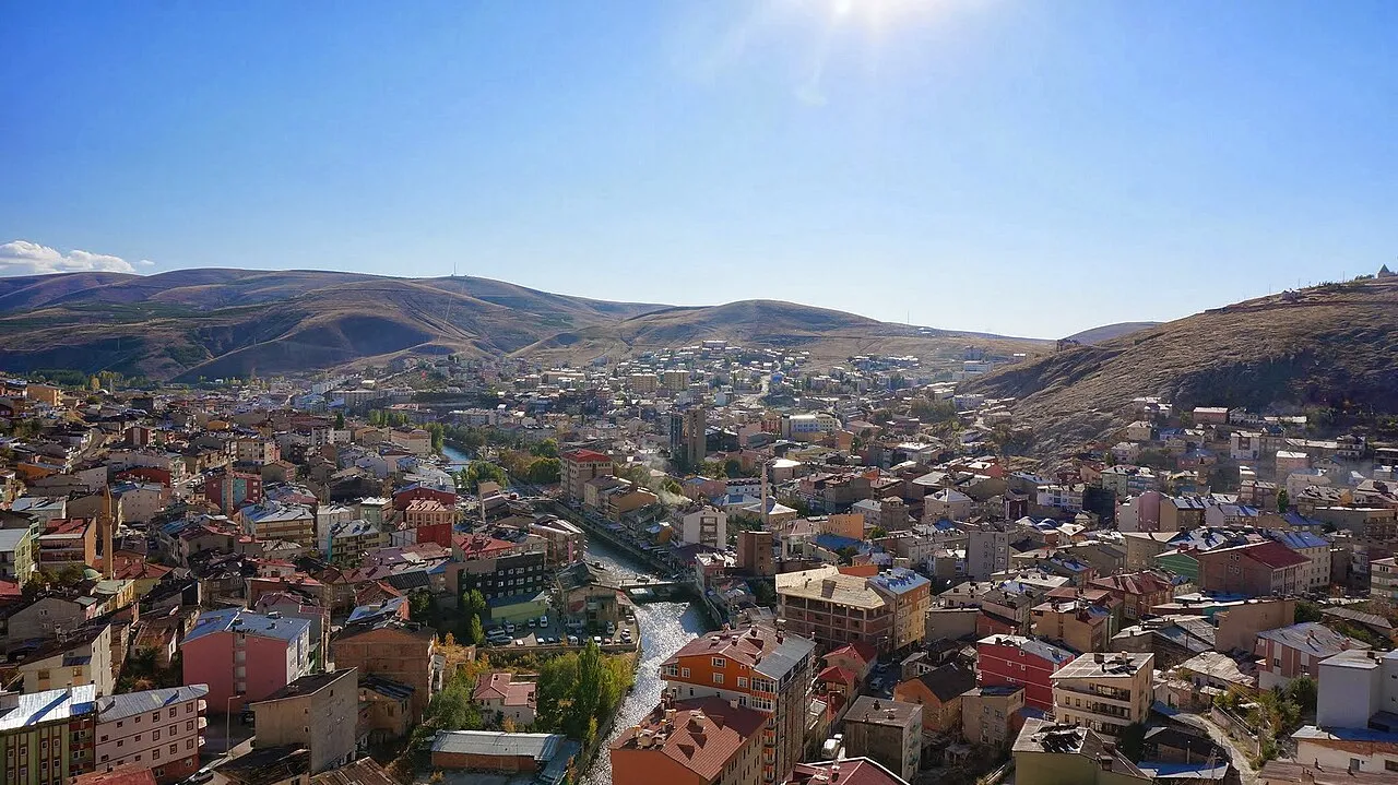
- Elevation
- 1,894 m
- above sea level
- Local time
- UTC+03:00
- Europe/Istanbul · UTC+03:00
- Places inside
- 172
- listed under Bayburt
- Airports
- ERZ Erzurum International Airport83 km
- ERC Erzincan Airport88 km
About Bayburt
Bayburt is a district. Location: Bayburt Province, Turkey. The best months to visit are June–September. The nearest airport is Erzurum International Airport (83 km). Nearby sights include Çayırin Deresi and Kapuzsuyu Deresi.
Climate of Bayburt
Best months for sightseeingBest months for sightseeing: June–September.
This month · November
A cold month
Day 7° · Night -3° · Rain 45 mm
Better nearby cities in November
- Viranşehir · 340 km south18°
- Kızıltepe · 342 km south19°
- Cizre · 364 km southeast20°
- Hottest month
- August (day 26°)
- Coldest month
- January (night -12°)
- Wettest month
- May (77 mm)
- Driest month
- August (16 mm)
Bars: average monthly low and high temperature. Below: precipitation. Monthly averages for 1970–2000 at about 18 km resolution, adjusted for elevation. Highlighted months are mild and relatively dry. Source: WorldClim 2.1 (CC BY 4.0).
Show values as a table
| Month | Jan | Feb | Mar | Apr | May | Jun | Jul | Aug | Sep | Oct | Nov | Dec |
|---|---|---|---|---|---|---|---|---|---|---|---|---|
| Average high (°C) | -3° | -1° | 3° | 11° | 16° | 21° | 25° | 26° | 22° | 15° | 7° | 0° |
| Average low (°C) | -12° | -11° | -6° | 0° | 4° | 7° | 10° | 9° | 6° | 2° | -3° | -8° |
| Precipitation (mm) | 34 | 32 | 45 | 68 | 77 | 52 | 17 | 16 | 22 | 47 | 45 | 39 |
Other places to visit in this season: June July August September
How to get to Bayburt
The nearest airport is Erzurum International Airport (ERZ), 83 km to the southeast as the crow flies. The nearest large city is Rize, 88 km to the north.
Airports
- Erzurum International Airport (ERZ) Erzurum 83 kmsoutheast
- Erzincan Airport (ERC) Erzincan 88 kmsouthwest
- Trabzon International Airport (TZX) Trabzon 92 kmnorthwest
Nearby large cities
- Rize Population: 119.8K 88 kmnorth
- Erzincan Population: 150.7K 88 kmsouthwest
- Erzurum Population: 767.8K 93 kmsoutheast
- Trabzon Population: 244.1K 96 kmnorthwest
- Bingoel Population: 128.9K 153 kmsouth
Straight-line distances; road distances are longer. Airport data: OurAirports.
Day trips from Bayburt
Within 100 km: 11 historic and cultural sites, 790 natural sites, 456 lakes, rivers and coasts.
0–25 km34 places
- Şehitosman Tepesi Mountain 8 kmNW
- Kızılkürtüs Dağı Mountain 14 kmS
- Divanyurdu Dağı Mountain 18 kmS
- Cöcke Dağı Mountain 22 kmS
25–60 km254 places
- Salyazı Barajı Lake 41 kmW
- Kara Göl Lake 31 kmN
- Mayram Mountains Mountain 41 kmS
- Kurugöl Tepesi Mountain 49 kmSE
60–100 km969 places
- Sera Gölü Lake 99 kmNW
- Yedi Göller Lake 68 kmSW
- Çakır Gölü Lake 62 kmNW
- Yedi Göller Lake 67 kmNE
Straight-line distances.
Places in Bayburt
172 places- 1 Bayburt 48K
- 2 Konursu 924
- 3 Erenli 486
- 4 Masat 485
- 5 Örence 470
- 6 Akhisar 470
- 7 Adabaşı 465
- 8 Mutlu 442
- 9 Danişment 370
- 10 Yeşilyurt 347
- 11 Kopköy 335
- 12 Balca 323
- 13 Kırkpınar 275
- 14 Yaylapınar 269
- 15 Oruçbeyli 256
- 16 Uğrak 252
- 17 Sogutlu 244
- 18 Sancaktepe 243
- 19 Çalıdere 240
- 20 Bayraktar 237
- 21 Çayırözü 231
- 22 Yazyurdu 231
- 23 Gençosman 230
- 24 Yoncalı 228
- 25 Arslandede 225
- 26 Yolaltı 219
- 27 Çayıryolu 204
- 28 Kitre 203
- 29 Helvaköy 203
- 30 Başçimağıl 199
- 31 Üzengili 191
- 32 Gümüşsu 190
- 33 Nişantaşı 188
- 34 Taşocağı 188
- 35 Çiğdemtepe 187
- 36 Darıca 185
- 37 Saraycık 178
- 38 Tahtköy 178
- 39 Karşıgeçit 175
- 40 Değirmencik 167
- 41 Ozansu 166
- 42 Alapelit 155
- 43 Dağtarla 155
- 44 Gezköy 154
- 45 Kabaçayır 153
- 46 Maden 153
- 47 Sakızlı 153
- 48 Ortaçimağıl 152
- 49 Çamlıkoz 150
- 50 Demirkaş 146
- 51 Güneydere 144
- 52 Çakırbağ 143
- 53 Ağören 136
- 54 Rüstüköy 132
- 55 Tomlacık 132
- 56 Ballıkaya 132
- 57 Yanıkçam 127
- 58 Yedigöze 123
- 59 Buğdaylı 121
- 60 Taşcılar 117
Bar: population relative to the most populous place in this list.
Nearby attractions & nature
Everything nearby-
Çayırin Deresi River, Bayburt Province3.4 km E
-
Kapuzsuyu Deresi River, Bayburt Province5.6 km S
-
Hamide Kaptajı Natural site, Bayburt Province8.9 km W
-
Çençül Deresi River, Bayburt Province13 km N
-
Masat Deresi River, Bayburt Province14 km SE
-
Kop Deresi River, Bayburt Province14 km SE
Sources & licences
Data last updated: