- Population
- 143,624
- 143.6K
- Elevation
- 1,600 m
- above sea level
- Local time
- UTC+03:00
- Europe/Istanbul · UTC+03:00
- Places inside
- 147
- listed under Bingol
- Airports
- BGG Bingöl Airport12 km
- MSR Muş Airport101 km
About Bingol
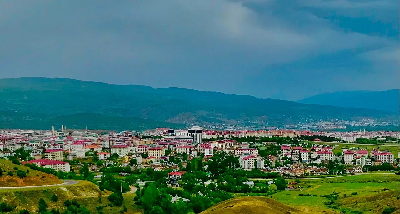
Bingol is a district. Location: Bingöl Province, Turkey. Population: 143,624. The best months to visit are May–June, September–October. The nearest airport is Bingöl Airport (12 km). Nearby sights include Bulanık Dere and Lihan Deresi.
Climate of Bingol
Best months for sightseeingBest months for sightseeing: May–June, September–October.
This month · November
A cold month
Day 10° · Night -1° · Rain 95 mm
Better nearby cities in November
- Kızıltepe · 196 km south19°
- Viranşehir · 204 km south18°
- Cizre · 231 km southeast20°
- Hottest month
- August (day 32°)
- Coldest month
- January (night -9°)
- Wettest month
- January (120 mm)
- Driest month
- August (5 mm)
Bars: average monthly low and high temperature. Below: precipitation. Monthly averages for 1970–2000 at about 18 km resolution, adjusted for elevation. Highlighted months are mild and relatively dry. Source: WorldClim 2.1 (CC BY 4.0).
Show values as a table
| Month | Jan | Feb | Mar | Apr | May | Jun | Jul | Aug | Sep | Oct | Nov | Dec |
|---|---|---|---|---|---|---|---|---|---|---|---|---|
| Average high (°C) | -1° | 1° | 6° | 13° | 20° | 26° | 32° | 32° | 27° | 19° | 10° | 2° |
| Average low (°C) | -9° | -8° | -3° | 3° | 7° | 12° | 16° | 15° | 10° | 5° | -1° | -6° |
| Precipitation (mm) | 120 | 112 | 117 | 116 | 79 | 23 | 7 | 5 | 10 | 58 | 95 | 108 |
Other places to visit in this season: May June September October
How to get to Bingol
The nearest airport is Bingöl Airport (BGG), 12 km to the southeast as the crow flies. The nearest large city is Bingoel, 8 km to the south.
Airports
- Bingöl Airport (BGG) Bingöl 12 kmsoutheast
- Muş Airport (MSR) Muş 101 kmeast
- Elazığ Airport (EZS) Elazığ 115 kmwest
Nearby large cities
- Bingoel Population: 128.9K 8 kmsouth
- Elâzığ Population: 443.4K 117 kmwest
- Diyarbakır Population: 1.8M 118 kmsouth
- Erzurum Population: 767.8K 124 kmnortheast
- Erzincan Population: 150.7K 125 kmnorthwest
Straight-line distances; road distances are longer. Airport data: OurAirports.
Day trips from Bingol
Within 100 km: 6 historic and cultural sites, 741 natural sites, 527 lakes, rivers and coasts.
0–25 km67 places
- Cayit Barajı Lake 19 kmNW
- Yayla Tepe Mountain 7 kmNE
- Şakorat Dağı Mountain 8 kmW
- Körhızır Dağı Mountain 23 kmW
25–60 km242 places
- Dipni Barajı Lake 59 kmSW
- Özlüce Barajı Lake 39 kmNW
- Ziyaret Tepesi Mountain 31 kmS
- Yaylım Dağı Mountain 43 kmSE
60–100 km965 places
- Seki Gölü Lake 83 kmE
- Keban Barajı Gölü Lake 96 kmW
- Batman Barajı Lake 94 kmSE
- Silvan Barajı Lake 68 kmS
Straight-line distances.
Places in Bingol
147 places- 1 Bingoel 128.9K
- 2 Ekinyolu 1.4K
- 3 Yenibaşlar 1.4K
- 4 Güveçli 1.3K
- 5 Sudugunu 1.2K
- 6 Çeltiksuyu 1.2K
- 7 Ağaçeli 1.1K
- 8 Göltepesi 1.1K
- 9 Çobantaşı 942
- 10 Elmalı 942
- 11 Dikköy 808
- 12 Gözer 592
- 13 Kardeşler 574
- 14 Alatepe 567
- 15 Yeniköy 552
- 16 Garip 528
- 17 İncesu 487
- 18 Kumgeçit 453
- 19 Ormanardı 434
- 20 Dikme 432
- 21 Çukurca 418
- 22 Çevrimpınar 401
- 23 Kılçadır 338
- 24 Yamaç 315
- 25 Gökdere 311
- 26 Sutgolu 311
- 27 Kurudere 300
- 28 Yeşilköy 300
- 29 Balıklıçay 271
- 30 Sancaklı 262
- 31 Kıran 247
- 32 Gökçeli 236
- 33 Kartal 218
- 34 Arıcılar 210
- 35 Küçük Tekören 210
- 36 Bilaloğlu 199
- 37 Suvaran 199
- 38 Yaygınçayır 199
- 39 Akdurmuş 175
- 40 Yazgülü 170
- 41 Köklü 158
- 42 Bahçeli 154
- 43 Kuşkondu 154
- 44 Alibir 153
- 45 Çiçekdere 153
- 46 Haziran 152
- 47 Ardıçtepe 146
- 48 Aşağı Akpınar 144
- 49 Uzunsavat 143
- 50 Çiçekyayla 112
- 51 Topalan 112
- 52 Kuşburnu 111
- 53 Çiriş 99
- 54 Uğurova 89
- 55 Düzyayla 77
- 56 Ağaçyolu 76
- 57 Erentepe 76
- 58 Çayboyu 75
- 59 Üçyaka 74
- 60 Dişbudak 73
Bar: population relative to the most populous place in this list.
Nearby attractions & nature
Everything nearby-
Bulanık Dere River, Bingöl Province5.3 km S
-
Lihan Deresi River, Bingöl Province6.1 km SE
-
Pemisa Dere River, Bingöl Province6.9 km SW
-
İdsuyu River, Bingöl Province8.2 km SE
-
Göynük Çayı River, Bingöl Province8.2 km SE
-
Yastık Deresi River, Bingöl Province8.3 km N
Sources & licences
Data last updated: