Kavakbaşı Bucağı
Located in Bitlis Province, Turkey Coordinates: 38°29′00″ N 41°49′11″ E
- Elevation
- 1,360 m
- above sea level
- Local time
- UTC+03:00
- Europe/Istanbul · UTC+03:00
- Airports
- MSR Muş Airport32 km
- BAL Batman Airport87 km
About Kavakbaşı Bucağı
Kavakbaşı Bucağı is a municipality. Location: Bitlis Province, Turkey. Elevation: 1,360 m. The best months to visit are May–June, September–October. The nearest airport is Muş Airport (32 km). Nearby sights include Yuvacık Deresi and Misor Deresi.
Climate of Kavakbaşı Bucağı
Best months for sightseeingBest months for sightseeing: May–June, September–October.
This month · November
A wet month
Day 11° · Night 2° · Rain 117 mm
Better nearby cities in November
- Cizre · 132 km south20°
- Silopi · 149 km south20°
- Kızıltepe · 181 km southwest19°
- Hottest month
- August (day 32°)
- Coldest month
- January (night -6°)
- Wettest month
- April (133 mm)
- Driest month
- July (5 mm)
Bars: average monthly low and high temperature. Below: precipitation. Monthly averages for 1970–2000 at about 18 km resolution, adjusted for elevation. Highlighted months are mild and relatively dry. Source: WorldClim 2.1 (CC BY 4.0).
Show values as a table
| Month | Jan | Feb | Mar | Apr | May | Jun | Jul | Aug | Sep | Oct | Nov | Dec |
|---|---|---|---|---|---|---|---|---|---|---|---|---|
| Average high (°C) | 1° | 3° | 7° | 14° | 21° | 27° | 32° | 32° | 28° | 20° | 11° | 4° |
| Average low (°C) | -6° | -5° | -1° | 5° | 9° | 13° | 18° | 17° | 13° | 8° | 2° | -3° |
| Precipitation (mm) | 108 | 120 | 122 | 133 | 79 | 22 | 5 | 5 | 11 | 75 | 117 | 122 |
Other places to visit in this season: May June September October
How to get to Kavakbaşı Bucağı
The nearest airport is Muş Airport (MSR), 32 km to the northwest as the crow flies. The nearest large city is Siirt, 62 km to the south.
Airports
- Muş Airport (MSR) Muş 32 kmnorthwest
- Batman Airport (BAL) Batman 87 kmsouthwest
- Bingöl Airport (BGG) Bingöl 115 kmwest
Nearby large cities
- Siirt Population: 114K 62 kmsouth
- Batman Population: 452.2K 89 kmsouthwest
- Bingoel Population: 128.9K 124 kmwest
- Cizre Population: 134K 132 kmsouth
- Van Population: 525K 136 kmeast
Straight-line distances; road distances are longer. Airport data: OurAirports.
Day trips from Kavakbaşı Bucağı
Within 100 km: 128 historic and cultural sites, 870 natural sites, 389 lakes, rivers and coasts.
0–25 km26 places
- Yorak Dağı Mountain 19 kmSW
- Rezi Dağı Mountain 25 kmSW
- Kuşçudağı Tepe Mountain 16 kmW
- Kel Tepe Mountain 18 kmE
25–60 km240 places
- Lake Nemrut Lake 38 kmNE
- Lake Nazik Lake 59 kmNE
- Garzan Barajı Lake 28 kmSW
- Ziyaret Tepesi Mountain 56 kmE
60–100 km1,121 places
- Demirkaya Historic site 75 kmS
- Avdu Adaları Island 97 kmE
- Simhaç Adası Island 72 kmE
- Şahur Adası Island 87 kmE
Straight-line distances.
Nearby attractions & nature
Everything nearby-
Yuvacık Deresi River, Bitlis Province5.5 km SW
-
Misor Deresi River, Bitlis Province5.9 km SW
-
Ayşehatun Dağı Mountain, Mutki İlçesi7.5 km SW
-
Büyük Dere River, Bitlis Province9 km SE
-
Mirkekösedağları Mountain, Bitlis Province17 km SE
-
Gümüşkanal Çayı River, Bitlis Province12 km SW
-
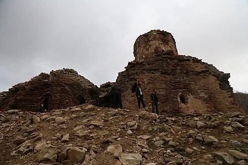 Aghperig Monastery Attraction, Mutki İlçesi22 km NW
-
Hindanik Deresi River, Bitlis Province14 km NW
Other cities and towns in Bitlis Province
-
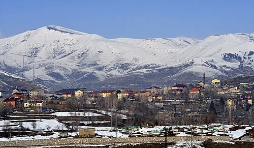 Bitlis City, Bitlis27 km E
-
Mutki City, Mutki İlçesi12 km SE
-
Mutki Bucağı Municipality, Bitlis Province12 km SE
-
Meydan Bucağı Municipality, Bitlis Province14 km S
-
Güroymak City, Güroymak İlçesi20 km NE
-
Geyikpınar Bucağı Municipality, Bitlis Province18 km S
Sources & licences
Data last updated: