- Population
- 98,743
- 98.7K
- Elevation
- 1,159 m
- above sea level
- Local time
- UTC+03:00
- Europe/Istanbul · UTC+03:00
- Places inside
- 78
- listed under Burdur
- Airports
- ISE Süleyman Demirel International Airport29 km
- DNZ Çardak Airport48 km
About Burdur
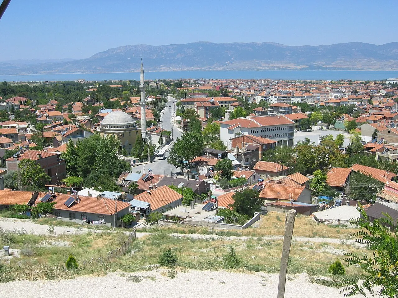
Burdur is a district. Location: Burdur Province, Turkey. Population: 98,743. The best months to visit are May–June, September–October. The nearest airport is Süleyman Demirel International Airport (29 km). Nearby sights include Suludere Dağları and Yudamid Deresi.
Climate of Burdur
Best months for sightseeingBest months for sightseeing: May–June, September–October.
This month · November
Outside the best season
Day 13° · Night 2° · Rain 46 mm
Better nearby cities in November
- Alanya · 200 km southeast21°
- Aydin · 209 km west19°
- Silifke · 359 km east21°
- Hottest month
- July (day 30°)
- Coldest month
- January (night -2°)
- Wettest month
- December (76 mm)
- Driest month
- August (13 mm)
Bars: average monthly low and high temperature. Below: precipitation. Monthly averages for 1970–2000 at about 18 km resolution, adjusted for elevation. Highlighted months are mild and relatively dry. Source: WorldClim 2.1 (CC BY 4.0).
Show values as a table
| Month | Jan | Feb | Mar | Apr | May | Jun | Jul | Aug | Sep | Oct | Nov | Dec |
|---|---|---|---|---|---|---|---|---|---|---|---|---|
| Average high (°C) | 6° | 7° | 11° | 16° | 21° | 26° | 30° | 30° | 26° | 20° | 13° | 7° |
| Average low (°C) | -2° | -2° | 0° | 4° | 8° | 12° | 15° | 14° | 11° | 6° | 2° | -1° |
| Precipitation (mm) | 74 | 65 | 55 | 50 | 51 | 30 | 16 | 13 | 16 | 38 | 46 | 76 |
Other places to visit in this season: May June September October
How to get to Burdur
The nearest airport is Süleyman Demirel International Airport (ISE), 29 km to the northeast as the crow flies. For international flights: Antalya International Airport (AYT) (97 km). The nearest large city is Isparta, 34 km to the northeast.
Airports
- Süleyman Demirel International Airport (ISE) Isparta 29 kmnortheast
- Çardak Airport (DNZ) Denizli 48 kmwest
- Antalya International Airport (AYT) Antalya 97 kmsoutheast
Nearby large cities
- Isparta Population: 172.3K 34 kmnortheast
- Antalya Population: 1.3M 91 kmsoutheast
- Muratpaşa Population: 450K 96 kmsoutheast
- Denizli Population: 313.2K 100 kmwest
- Merkezefendi Population: 280.3K 104 kmwest
Straight-line distances; road distances are longer. Airport data: OurAirports.
Day trips from Burdur
Within 100 km: 37 historic and cultural sites, 410 natural sites, 198 lakes, rivers and coasts.
0–25 km43 places
- Lake Yarışlı Lake 22 kmW
- Pınarbaşı Gölü Lake 23 kmSW
- Lake Burdur Lake 12 kmN
- Kürdlü Dağı Mountain 19 kmE
25–60 km145 places
- Lake Salda Lake 47 kmW
- Lake Karataş Lake 34 kmSW
- Gölcük Gölü Lake 28 kmNE
- Akgöl Lake 39 kmW
60–100 km457 places
- Konyaaltı Plajı Beach 93 kmSE
- Bambus Plajı Beach 96 kmSE
- Can Adası Island 64 kmNE
- Sıçan Adası Island 98 kmS
Straight-line distances.
Places in Burdur
78 places- 1 Burdur 95.4K
- 2 Askeriye 1.5K
- 3 Halıcılar 1.4K
- 4 Çatağıl 1.3K
- 5 Gökçebağ 1.2K
- 6 Kayış 1.1K
- 7 Kozluca 1K
- 8 Taşkapı 804
- 9 İlyasköy 556
- 10 Aziziye 548
- 11 Düğer 537
- 12 Yassıgüme 493
- 13 Suludere 396
- 14 Hacılar 380
- 15 Günalan 311
- 16 Karakent 287
- 17 Güneyyayla 267
- 18 Karaçal 241
- 19 Başmakçı 240
- 20 Kuruçay 234
- 21 Kartalpınar 229
- 22 Kavacık 213
- 23 Aşağı Müslimler 193
- 24 Yaylabeli 176
- 25 İğdeli 165
- 26 Kökez 165
- 27 Beşkavak 139
- 28 Karacaören 134
- 29 Boğaziçi 133
- 30 Bereket 131
- 31 Soğanlı 112
- 32 Kumluca 98
- 33 Bozlar 90
- 34 Ulupınar 90
- 35 Kapaklı 86
- 36 Yeşildağ 70
- 37 Erikli 63
- 38 Sarıova 40
- 39 Aksu 26
Bar: population relative to the most populous place in this list.
Cities & villages13
- Akkaya · Village
- Akyayla · Village
- Başakevler · Village
- Bayındır · Village
- Büğdüz · Village
- Burdur Bucağı · Municipality
- Çallıca · Village
- Çendik · Village
- Çinbilli · Village
- Gökpınar · Village
- Karaevli · Village
- Karşı Mahalle · Village
- Kayaltı · Village
Mountains & nature8
- Akdağ Tepe · Mountain
- Bekleme Tepesi · Mountain
- Beşparmak Dağı · Mountain
- Deliiskan Tepesi · Mountain
- Etre Dağı · Mountain
- Giresun Dağı · Mountain
- İlyasserancı Dağı · Mountain
- Katrancık Dağı · Mountain
Nearby attractions & nature
Everything nearby-
Suludere Dağları Mountain, Burdur Province1.6 km SE
-
Yudamid Deresi River, Burdur Province4.9 km W
-
Karanlıkkapısı Dere River, Burdur Province6.4 km W
-
Bereket Deresi River, Burdur Province7 km E
-
Büğdüz Çayı River, Burdur Province7.6 km NW
-
Boz Çay River, Burdur Province9.5 km W
Sources & licences
Data last updated: