- Population
- 358,265
- 358.3K
- Elevation
- 119 m
- above sea level
- Local time
- UTC+03:00
- Europe/Istanbul · UTC+03:00
- Places inside
- 57
- listed under Nilüfer
- Airports
- YEI Bursa Yenişehir Airport49 km
- SAW Istanbul Sabiha Gökçen International Airport81 km
About Nilüfer
Nilüfer is a district. Location: Bursa Province, Turkey. Population: 358,265. The best months to visit are May, September–October. The nearest airport is Bursa Yenişehir Airport (49 km). Nearby sights include Ziraaat Piknik Alanı and Atatürk Kent Ormanı.
Photos of Nilüfer
-

Bursa Grand Mosque Beñat Irasuegi · CC BY-SA 4.0 -
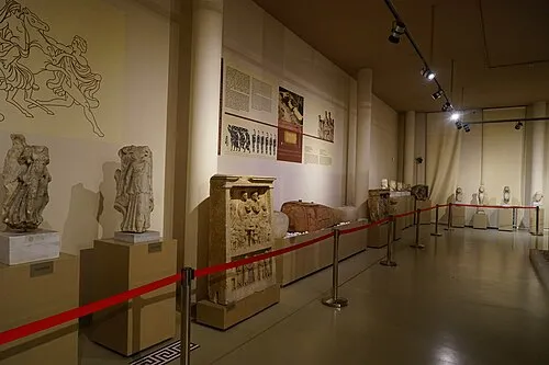
Bursa Archaeological Museum Canercangul · CC BY-SA 4.0


Climate of Nilüfer
Best months for sightseeingBest months for sightseeing: May, September–October.
This month · November
Outside the best season
Day 16° · Night 5° · Rain 72 mm
Better nearby cities in November
- Aydin · 281 km south19°
- Hottest month
- July (day 31°)
- Coldest month
- January (night 1°)
- Wettest month
- December (89 mm)
- Driest month
- August (18 mm)
Bars: average monthly low and high temperature. Below: precipitation. Monthly averages for 1970–2000 at about 18 km resolution, adjusted for elevation. Highlighted months are mild and relatively dry. Source: WorldClim 2.1 (CC BY 4.0).
Show values as a table
| Month | Jan | Feb | Mar | Apr | May | Jun | Jul | Aug | Sep | Oct | Nov | Dec |
|---|---|---|---|---|---|---|---|---|---|---|---|---|
| Average high (°C) | 9° | 10° | 13° | 18° | 23° | 28° | 31° | 30° | 27° | 21° | 16° | 11° |
| Average low (°C) | 1° | 2° | 3° | 7° | 11° | 15° | 17° | 17° | 13° | 9° | 5° | 3° |
| Precipitation (mm) | 83 | 63 | 59 | 50 | 40 | 28 | 19 | 18 | 33 | 55 | 72 | 89 |
How to get to Nilüfer
The nearest airport is Bursa Yenişehir Airport (YEI), 49 km to the east as the crow flies. For international flights: Istanbul Sabiha Gökçen International Airport (SAW) (81 km). The nearest large city is Nilufer, 6 km to the west.
Airports
- Bursa Yenişehir Airport (YEI) Yenişehir 49 kmeast
- Istanbul Sabiha Gökçen International Airport (SAW) Pendik, Istanbul 81 kmnorth
- Balıkesir Airport (BZI) Balıkesir 112 kmsouthwest
Nearby large cities
- Nilufer Population: 536.4K 6 kmwest
- Bursa Population: 3.1M 7 kmeast
- İnegöl Population: 134K 48 kmeast
- Mustafakemalpaşa Population: 101.4K 53 kmwest
- Gebze Population: 281.4K 76 kmnortheast
Straight-line distances; road distances are longer. Airport data: OurAirports.
Day trips from Nilüfer
Within 100 km: 142 historic and cultural sites, 163 natural sites, 274 lakes, rivers and coasts.
0–25 km48 places
- Kırbayır Tepesi Mountain 23 kmNE
- Gölcük Tepe Mountain 14 kmSW
- Akbaba Tepesi Mountain 5 kmS
- Üsküp Tepesi Mountain 21 kmNW
25–60 km128 places
- Yeniköy Plaj Beach 55 kmW
- Mutlu Adası Island 30 kmW
- İmralı Adası Island 53 kmNW
- Halilbey Adası Island 34 kmW
60–100 km403 places
- Sedef Adası Island 80 kmW
- Andirovitha Island Island 72 kmN
- Pita Island Island 75 kmN
- Mola Adaları Island 81 kmW
Straight-line distances.
Places in Nilüfer
57 places- 1 Nilufer 536.4K
- 2 Görükle 35.9K
- 3 Kayapa 2.4K
- 4 Yaylacık 2K
- 5 Büyükbalıklı 492
- 6 Atlas 381
- 7 Yörükyenicesi 368
- 8 Çaylı 322
- 9 Korubaşı 298
- 10 Maksempınar 263
- 11 Başköy 252
- 12 Ayva 160
- 13 Kadriye 121
- 14 Özlüce 102
- 15 Kuruçeşme 84
Bar: population relative to the most populous place in this list.
Cities & villages38
- Ahmet Yesevi · Neighbourhood
- Akçalar · Village
- Alaaddinbey · Neighbourhood
- Ataevler · Neighbourhood
- Badırga · Village
- Balat · Neighbourhood
- Beşevler · Neighbourhood
- Caesareia Germanica · Village
- Çalı · Village
- Çatalağıl · Village
- Dağyenice · Village
- Demirci · Neighbourhood
- Doğanköy · Village
- Ertuğrul · Neighbourhood
- Fadıllı · Village
- Fethiye · Neighbourhood
- Gökçe · Village
- Gölyazı · Village
- Gümüştepe · Village
- Güngören · Village
- Hasanağa · Village
- İhsaniye · Neighbourhood
- İnegazi · Village
- İrfaniye · Village
- İrfaniye · Village
- Işıktepe · Neighbourhood
- Karacaoba · Village
- Karaman · Neighbourhood
- Kite · Village
- Konaklı · Village
- Kultur · Village
- Minareliçavuş · Neighbourhood
- Odunluk · Neighbourhood
- Sultaniye · Village
- Tahtalı · Village
- Üçpınar · Village
- Unçukuru · Village
- Yolçatı · Village
Mountains & nature3
- Gölcük Tepe · Mountain
- Kule Tepesi · Mountain
- Mihraplı Parkı · Natural site
Heritage & sights1
- Nilüfer Hatun Bridge · Landmark
Nearby attractions & nature
Everything nearby-
Ziraaat Piknik Alanı Natural site, Osmangazi District1.8 km N
-
Atatürk Kent Ormanı Natural site, Bursa Province2.9 km S
-
Karaoğlan Deresi River, Bursa Province3.1 km SE
-
Teoman Özalp Parkı Natural site, Osmangazi District2.9 km N
-
Bursa Archaeological Museum Museum, Osmangazi District5.1 km SE
-
Bursa Grand Mosque Attraction, Osmangazi District7.4 km SE
Sources & licences
Data last updated: