Bozcaada Kalesi
Located in Çanakkale Province, Turkey Coordinates: 39°50′11″ N 26°04′22″ E
- Local time
- UTC+03:00
- Europe/Istanbul · UTC+03:00
- Elevation
- 14 m
- above sea level
- Airports
- CKZ Çanakkale Airport45 km
- EDO Balıkesir Koca Seyit Airport86 km
About Bozcaada Kalesi
Bozcaada Kalesi is a historic site. Location: Çanakkale Province, Turkey. The best months to visit are May–June, September–October. The nearest airport is Çanakkale Airport (45 km). Nearby sights include Mount Sana and Ortafener Adası Light (historical).
Climate of Bozcaada Kalesi
Best months for sightseeingBest months for sightseeing: May–June, September–October.
This month · November
Outside the best season
Day 16° · Night 9° · Rain 76 mm
Better nearby cities in November
- Aydin · 269 km southeast19°
- Hottest month
- July (day 30°)
- Coldest month
- January (night 4°)
- Wettest month
- December (108 mm)
- Driest month
- August (9 mm)
Bars: average monthly low and high temperature. Below: precipitation. Monthly averages for 1970–2000 at about 18 km resolution, adjusted for elevation. Highlighted months are mild and relatively dry. Source: WorldClim 2.1 (CC BY 4.0).
Show values as a table
| Month | Jan | Feb | Mar | Apr | May | Jun | Jul | Aug | Sep | Oct | Nov | Dec |
|---|---|---|---|---|---|---|---|---|---|---|---|---|
| Average high (°C) | 11° | 11° | 13° | 18° | 22° | 27° | 30° | 29° | 26° | 21° | 16° | 13° |
| Average low (°C) | 4° | 5° | 6° | 10° | 14° | 18° | 20° | 20° | 17° | 13° | 9° | 6° |
| Precipitation (mm) | 88 | 77 | 59 | 38 | 30 | 16 | 11 | 9 | 24 | 34 | 76 | 108 |
Other places to visit in this season: May June September October
How to get to Bozcaada Kalesi
The nearest airport is Çanakkale Airport (CKZ), 45 km to the northeast as the crow flies. For international flights: Balıkesir Koca Seyit Airport (EDO) (86 km). The nearest large city is Çanakkale, 46 km to the northeast.
Airports
- Çanakkale Airport (CKZ) Çanakkale 45 kmnortheast
- Balıkesir Koca Seyit Airport (EDO) Edremit 86 kmeast
- Mytilene International Airport (MJT) Mytilene 98 kmsoutheast
Nearby large cities
- Çanakkale Population: 143.6K 46 kmnortheast
- Balıkesir Population: 238.2K 157 kmeast
- Bandırma Population: 107.6K 172 kmeast
- Çiğli Population: 214.1K 172 kmsoutheast
- Tekirdağ Population: 122.3K 176 kmnortheast
Straight-line distances; road distances are longer. Airport data: OurAirports.
Day trips from Bozcaada Kalesi
Within 100 km: 56 historic and cultural sites, 198 natural sites, 213 lakes, rivers and coasts.
0–25 km52 places
- V Beach Beach 25 kmN
- Mavro Island Island 11 kmN
- Karayer Adaları Island 10 kmN
- Praso Island Island 11 kmN
25–60 km197 places
- W Beach Beach 25 kmN
- S Beach Beach 27 kmNE
- X Beach Beach 27 kmN
- Gully Beach Beach 28 kmN
60–100 km218 places
- Agios Georgios Attraction 67 kmW
- Pınar Adası Island 72 kmSE
- Maden Adası Island 67 kmSE
- Kız Adası Island 72 kmSE
Straight-line distances.
Nearby attractions & nature
Everything nearby-
Mount Sana Mountain, Bozcaada0.8 km W
-
Ortafener Adası Light (historical) Landmark, Çanakkale Province2 km E
-
Taş Adası Island, Çanakkale Province1.2 km SE
-
Mount Elias Mountain, Bozcaada1.8 km W
-
Küçük Eşek Adası Island, Çanakkale Province1.8 km E
-
Poyraz Limanı Natural site, Çanakkale Province1.8 km S
-
Great Gadaro Island Island, Çanakkale Province2 km E
-
Petro Islet Island, Çanakkale Province2.1 km NW
Nearest towns and villages
-
Tenedos City, Bozcaada0.3 km SW
-
Bozcaada Bucağı Municipality, Çanakkale Province1.3 km SW
-
Geyikli Village, Ezine İlçesi12 km E
-
Achaiion Village, Ezine İlçesi8.2 km E
More sights in Çanakkale Province
-
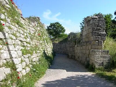 Troy Historic site, Canakkale20 km NE
-
Ponente Point Lighthouse Landmark, Çanakkale Province9.3 km W
-
Tavşan Adası Lighthouse Landmark, Ezine İlçesi11 km N
-
Alexandria Troas Historic site, Ezine İlçesi13 km SE
-
Yeniköy Historic site, Ezine İlçesi14 km NE
-
Yenişehir Harabeleri Historic site, Canakkale19 km NE
Sources & licences
Data last updated: