Boğazkale Bucağı
Located in Çorum Province, Turkey Coordinates: 40°01′03″ N 34°36′19″ E
- Elevation
- 1,061 m
- above sea level
- Local time
- UTC+03:00
- Europe/Istanbul · UTC+03:00
- Airports
- MZH Amasya Merzifon Airport119 km
- ESB Esenboğa International Airport138 km
About Boğazkale Bucağı
Boğazkale Bucağı is a municipality. Location: Çorum Province, Turkey. Elevation: 1,061 m. The best months to visit are May–July, September. The nearest airport is Amasya Merzifon Airport (119 km). Nearby sights include Hattusa and Yazılıkaya Açıkhava Mabedi.
Photos of Boğazkale Bucağı
-
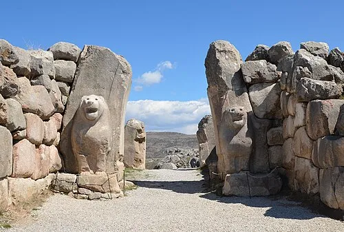
Hattusa Carole Raddato from FRANKFURT, Germany · CC BY-SA 2.0

Climate of Boğazkale Bucağı
Best months for sightseeingBest months for sightseeing: May–July, September.
This month · November
A cold month
Day 12° · Night 1° · Rain 41 mm
Better nearby cities in November
- Adana · 343 km south21°
- Tarsus · 346 km south22°
- Mersin · 356 km south22°
- Hottest month
- August (day 28°)
- Coldest month
- January (night -5°)
- Wettest month
- May (58 mm)
- Driest month
- August (13 mm)
Bars: average monthly low and high temperature. Below: precipitation. Monthly averages for 1970–2000 at about 18 km resolution, adjusted for elevation. Highlighted months are mild and relatively dry. Source: WorldClim 2.1 (CC BY 4.0).
Show values as a table
| Month | Jan | Feb | Mar | Apr | May | Jun | Jul | Aug | Sep | Oct | Nov | Dec |
|---|---|---|---|---|---|---|---|---|---|---|---|---|
| Average high (°C) | 3° | 5° | 11° | 16° | 21° | 25° | 28° | 28° | 25° | 19° | 12° | 5° |
| Average low (°C) | -5° | -4° | -1° | 4° | 7° | 11° | 13° | 13° | 9° | 5° | 1° | -2° |
| Precipitation (mm) | 50 | 42 | 45 | 53 | 58 | 42 | 16 | 13 | 19 | 35 | 41 | 56 |
Other places to visit in this season: May June July September
How to get to Boğazkale Bucağı
The nearest airport is Amasya Merzifon Airport (MZH), 119 km to the northeast as the crow flies. For international flights: Esenboğa International Airport (ESB) (138 km). The nearest large city is Çorum, 66 km to the northeast.
Airports
- Amasya Merzifon Airport (MZH) Amasya 119 kmnortheast
- Esenboğa International Airport (ESB) Ankara 138 kmwest
- Nevşehir Kapadokya Airport (NAV) Nevşehir 138 kmsouth
Nearby large cities
- Çorum Population: 269.6K 66 kmnortheast
- Kirikkale Population: 187K 96 kmwest
- Kırşehir Population: 150.7K 104 kmsouth
- Amasya Population: 114.9K 126 kmnortheast
- Turhal Population: 110.9K 132 kmeast
Straight-line distances; road distances are longer. Airport data: OurAirports.
Day trips from Boğazkale Bucağı
Within 100 km: 78 historic and cultural sites, 601 natural sites, 164 lakes, rivers and coasts.
0–25 km167 places
- Alaca Sulama Göleti Lake 22 kmNE
- Yellibelen Tepesi Mountain 25 kmSW
- Çatal Tepe Mountain 20 kmS
- Akçadağ Tepesi Mountain 16 kmSE
25–60 km176 places
- Elekçi Gölü Lake 46 kmNW
- Örükaya Göleti Lake 27 kmE
- Topçu Göleti Lake 36 kmSE
- Mükremin Göleti Lake 58 kmSE
60–100 km500 places
- Alışar Höyük Historic site 72 kmSE
- İnandıktepe Historic site 100 kmNW
- Maşat Höyük Historic site 100 kmE
- Lake Suğla Lake 91 kmS
Straight-line distances.
Nearby attractions & nature
Everything nearby-
Hattusa Historic site, Boğazkale İlçesi0.9 km E
-
Yazılıkaya Açıkhava Mabedi Historic site, Boğazkale İlçesi2.1 km NW
-
Hattuşas Historic site, Boğazkale İlçesi3.4 km SW
-
Ziyaret Tepesi Mountain, Alaca İlçesi5.2 km E
-
Sarıyüce Tepesi Mountain, Boğazkale İlçesi4.8 km W
-
Türbe Tepesi Mountain, Yozgat Province6 km S
-
Boğazkale Alaçahöyük Milli Parkı Natural site, Boğazkale İlçesi6.5 km N
-
Küme Deresi River, Yozgat Province7.7 km W
Other cities and towns in Çorum Province
-
Alaca City, Alaca İlçesi26 km NE
-
Sungurlu City, Sungurlu26 km NW
-
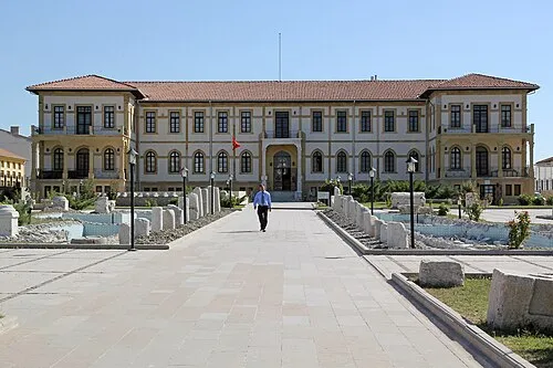 Çorum City, Corum66 km NE
-
Alaca Bucağı Municipality, Çorum Province25 km NE
-
Sungurlu Bucağı Municipality, Çorum Province26 km NW
-
Uğurludağ City, Uğurludağ İlçesi49 km N
Sources & licences
Data last updated: