Akarsu Bucağı
Located in Erzincan Province, Turkey Coordinates: 39°56′04″ N 38°37′28″ E
- Elevation
- 1,533 m
- above sea level
- Local time
- UTC+03:00
- Europe/Istanbul · UTC+03:00
- Airports
- ERC Erzincan Airport81 km
- OGU Ordu–Giresun Airport123 km
About Akarsu Bucağı
Akarsu Bucağı is a municipality. Location: Erzincan Province, Turkey. Elevation: 1,533 m. The best months to visit are June–September. The nearest airport is Erzincan Airport (81 km). Nearby sights include Kayacık Deresi and Binasor Deresi.
Climate of Akarsu Bucağı
Best months for sightseeingBest months for sightseeing: June–September.
This month · November
A cold month
Day 10° · Night 1° · Rain 57 mm
Better nearby cities in November
- Viranşehir · 317 km south18°
- Suruç · 329 km south20°
- Kızıltepe · 349 km southeast19°
- Hottest month
- August (day 28°)
- Coldest month
- January (night -6°)
- Wettest month
- May (82 mm)
- Driest month
- August (8 mm)
Bars: average monthly low and high temperature. Below: precipitation. Monthly averages for 1970–2000 at about 18 km resolution, adjusted for elevation. Highlighted months are mild and relatively dry. Source: WorldClim 2.1 (CC BY 4.0).
Show values as a table
| Month | Jan | Feb | Mar | Apr | May | Jun | Jul | Aug | Sep | Oct | Nov | Dec |
|---|---|---|---|---|---|---|---|---|---|---|---|---|
| Average high (°C) | 0° | 2° | 7° | 14° | 20° | 24° | 28° | 28° | 25° | 18° | 10° | 3° |
| Average low (°C) | -6° | -5° | -1° | 5° | 8° | 11° | 14° | 14° | 11° | 6° | 1° | -3° |
| Precipitation (mm) | 52 | 46 | 60 | 78 | 82 | 45 | 11 | 8 | 18 | 48 | 57 | 60 |
Other places to visit in this season: June July August September
How to get to Akarsu Bucağı
The nearest airport is Erzincan Airport (ERC), 81 km to the east as the crow flies. The nearest large city is Erzincan, 77 km to the east.
Airports
- Erzincan Airport (ERC) Erzincan 81 kmeast
- Ordu–Giresun Airport (OGU) Ordu 123 kmnorth
- Sivas Nuri Demirağ Airport (VAS) Sivas 148 kmwest
Nearby large cities
- Erzincan Population: 150.7K 77 kmeast
- Giresun Population: 125.7K 111 kmnorth
- Ordu Population: 229.2K 132 kmnorthwest
- Sivas Population: 264K 139 kmwest
- Elâzığ Population: 443.4K 149 kmsouth
Straight-line distances; road distances are longer. Airport data: OurAirports.
Day trips from Akarsu Bucağı
Within 100 km: 10 historic and cultural sites, 242 natural sites, 241 lakes, rivers and coasts.
0–25 km25 places
- Aşağıtepecik Gölü Lake 12 kmN
- Kızıl Dağ Mountain 23 kmW
- Karadağ Mountain 23 kmSW
- Hışhış Tepesi Mountain 15 kmSW
25–60 km154 places
- Palat Gölü Lake 45 kmS
- Kılıçkaya Barajı Lake 36 kmNW
- Çatalgöl Lake 41 kmN
- Vank Dağı Mountain 29 kmSE
60–100 km314 places
- Kuru Göl Lake 95 kmW
- Tötürge Gölü Lake 88 kmW
- Beş Göller Lake 64 kmNE
- Koç Gölü Lake 77 kmSE
Straight-line distances.
Nearby attractions & nature
Everything nearby-
Kayacık Deresi River, Erzincan Province4 km N
-
Binasor Deresi River, Erzincan Province4.1 km N
-
Dumanlı Dağ Mountain, Refahiye İlçesi6.3 km SE
-
Köse Dağları Mountain, Erzincan Province11 km W
-
Avşarözü Deresi River, Erzincan Province13 km SE
-
Çardaklı Dere River, Erzincan Province14 km E
-
Çukur Deresi River, Erzincan Province15 km E
-
Maden Çayı River, Erzincan Province16 km SW
Other cities and towns in Erzincan Province
-
Refahiye City, Refahiye İlçesi13 km E
-
Refahiye Bucağı Municipality, Erzincan Province13 km E
-
Gümüşakar Bucağı Municipality, Erzincan Province16 km S
-
Çatalçam Bucağı Municipality, Erzincan Province20 km E
-
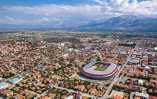 Erzincan City, Erzincan77 km E
-
Cengerli Bucağı Municipality, Erzincan Province25 km SE
Sources & licences
Data last updated: