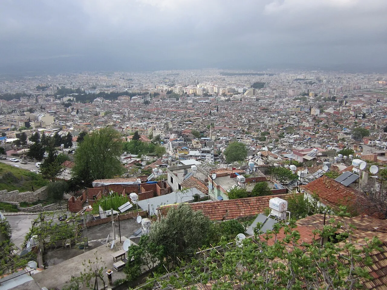
- Population
- 399,045
- 399K
- Elevation
- 104 m
- above sea level
- Local time
- UTC+03:00
- Europe/Istanbul · UTC+03:00
- Airports
- HTY Hatay Airport21 km
- LTK Latakia International Airport91 km
About Antakya
Antakya is a city. Location: Antakya İlçesi, Hatay Province. Population: 399,045. Elevation: 104 m.
Antakya (Turkish pronunciation: [anˈtakja]), Turkish form of Antioch, is a municipality and the capital district of Hatay Province, Turkey, with an area of 703 km2 (271 sq mi) and a population of around 400,000 people as of 2022. It is in the Hatay Province, which is the southernmost region of Turkey. The city is located in a well-watered and fertile valley on the Orontes River, about 20 kilometres (12 mi) from the Levantine Sea.
Source: Wikipedia · CC BY-SA 4.0
Photos of Antakya
-

Orhan Erkılıç · Public domain -

NASA Earth Observatory images by Lauren Dauphin, using Black Marble data courtesy of Ranjay Shrestha/NASA Goddard Space · Public domain -

Vikiçizer · CC BY-SA 4.0 -

Volker Höhfeld · CC BY-SA 4.0 -

Ben Bender · CC BY-SA 3.0


Travel notes for Antakya
From Wikivoyage
Antakya is the capital of Hatay Province, a part of Turkey since 1939. It's best known as the site of Antioch-on-the-Orontes, described in the Bible as one of the first Christian communities. In 2022 the city population was 368,000, but in 2023 Hatay suffered a major earthquake and has not yet fully recovered.
Understand+
Acts 11:26: "So it was that for an entire year they met with the church and taught a great many people, and it was in Antioch that the disciples were first called Christians."
Seleucus I Nicator was a general serving Alexander the Great, who after Alexander died controlled a swathe of Asia stretching clear to India. He fought rivals for territory further south and west, and his war elephants from India helped him win the Battle of Ipsos in 301 BC and gain Syria. He founded four cities in Syria, making Antioch capital of his Seleucid Empire. Indeed he's said to have founded 16 cities called Antioch (plus nine Seleucias and six Laodiceas), but many were later creations associating themselves with his famous name, as others did with his boss Alexander.
In 63 BC the Seleucid Empire succumbed to the Romans, who continued to treat Antioch as a major metropolis, surpassing Alexandria. At that time it was a seaport, with a cosmopolitan mix of population, including Jews escaping unrest in Jerusalem. Many in Antioch might feel that their traditional gods hadn't done much for them, and be a ready audience for radicals preaching a new creed. Around 42 AD, Barnabas the Apostle met up with Saul / Paul of Tarsus and brought him to Antioch to continue their missionary work together. Crucially, they sought to convert gentiles direct to their creed, so Christianity was no longer just a sect within Judaism. It spread across Asia Minor to become a global religion.
Get in+
By plane:
1 Hatay Airport (HTY IATA). Turkish Airlines fly three times a day from Istanbul (IST) and twice from Istanbul (SAW), taking 1 hr 50 min. One flight a day is from Ankara. Pegasus also fly twice a day from Istanbul (SAW). No international flights but Istanbul has excellent connections. Hatay airport has been patched up after the earthquake but has only basic facilities. (updated Jun 2026)
The airport is 25 km north of city centre. The Havas bus is supposed to meet flights and run downtown, taking an hour to the stop at İnönü Cd 30, near the main square and Hacı Durmuş bridge. Good luck with that.
Otherwise look for a dolmuş or taxi.
By train:
The nearest station is in Iskenderun, but trains from Adana and Mersin remain suspended because of interminable track works.
By bus:
Buses from Istanbul run every couple of hours and take 14 hours via Ankara, Niğde, Adana and Iskenderun. Buses no longer run from Beirut or Aleppo.
Bus lines are Metro Turizm, Kamil Koç (now part of Flixbus) and Has Turizm. For online tickets select "Hatay" as the destination, bus websites don't recognise "Antakya".
2 Antakya Otogarı is the intercity bus station, on the bypass 5 km northwest of city centre. It was badly damaged by the earthquake, and as of June 2026 is not yet rebuilt, with makeshift facilities. Dolmuşes run downtown.
By road:
From Istanbul or Ankara take the motorway (toll) to Adana then O-52 east onto E91, a fast divided highway. It joins D817 south of İskenderun, to twist and turn over Belen Pass (the ancient Syrian Gates) through the Amanos Mountains and join D825.
A scenic detour is to follow the coast road south from İskenderun via Arsuz, Çevlik and Samandağ then take D420 east to Antakya.
From Gaziantep, quickest is to take D400 or O-52 (toll) west to Nurdağı to join D825, which heads south across the dusty plains east of the mountains. Or you could could go south on D850 to Kilis, then follow D410 along the Syrian border to join D825.
Source: Wikivoyage · CC BY-SA 4.0 · abridged
Places bordering Antakya
- Arsuz
Twin towns and sister cities of Antakya
- Aalen· Germany
Source: Wikidata. Only places with a page on this site are shown.
Climate of Antakya
Best months for sightseeingBest months for sightseeing: April–May, November.
This month · November
A good month to visit
Day 21° · Night 12° · Rain 100 mm
- Hottest month
- August (day 33°)
- Coldest month
- January (night 6°)
- Wettest month
- December (187 mm)
- Driest month
- August (8 mm)
Bars: average monthly low and high temperature. Below: precipitation. Monthly averages for 1970–2000 at about 18 km resolution, adjusted for elevation. Highlighted months are mild and relatively dry. Source: WorldClim 2.1 (CC BY 4.0).
Show values as a table
| Month | Jan | Feb | Mar | Apr | May | Jun | Jul | Aug | Sep | Oct | Nov | Dec |
|---|---|---|---|---|---|---|---|---|---|---|---|---|
| Average high (°C) | 13° | 15° | 18° | 23° | 27° | 30° | 33° | 33° | 32° | 27° | 21° | 15° |
| Average low (°C) | 6° | 7° | 10° | 14° | 17° | 21° | 24° | 25° | 22° | 17° | 12° | 8° |
| Precipitation (mm) | 165 | 146 | 129 | 86 | 53 | 19 | 10 | 8 | 26 | 72 | 100 | 187 |
How to get to Antakya
The nearest airport is Hatay Airport (HTY), 21 km to the northeast as the crow flies. For international flights: Aleppo International Airport (ALP) (96 km). The nearest large city is Samandağ, 22 km to the southwest.
Airports
- Hatay Airport (HTY) Antakya 21 kmnortheast
- Latakia International Airport (LTK) Latakia 91 kmsouth
- Aleppo International Airport (ALP) Aleppo 96 kmeast
Nearby large cities
- Samandağ Population: 123.4K 22 kmsouthwest
- Arsuz Population: 109.6K 33 kmnorthwest
- İskenderun Population: 251.7K 42 kmnorth
- Osmaniye Population: 202.8K 97 kmnorth
- Kilis Population: 111.6K 103 kmnortheast
Straight-line distances; road distances are longer. Airport data: OurAirports.
Day trips from Antakya
Within 100 km: 35 historic and cultural sites, 322 natural sites, 140 lakes, rivers and coasts.
0–25 km53 places
- Tell Atchana Historic site 21 kmE
- Lake Arin Lake 21 kmNE
- Musa Dagh Mountain 20 kmW
- Kurt Tepesi Mountain 25 kmN
25–60 km152 places
- Balık Gölü Lake 45 kmNE
- Demrekgölü Lake 57 kmNE
- Sivri Tepe Mountain 43 kmN
- Karlık Tepe Mountain 33 kmN
60–100 km292 places
- Küçük Ada Island 78 kmNW
- Nergizi Adasi Island 74 kmNW
- Ömer Gölü Island 73 kmNW
- Yapı Gölü Lake 76 kmNW
Straight-line distances.
Antakya and similar cities
Side by side with cities of similar size in the same country: population, elevation and climate.
| Measure | Antakya | Samsun | Kahramanmaraş | Beylikduzu |
|---|---|---|---|---|
| Population | 399K | 394K | 385K | 415.3K |
| Elevation | 104 m | 64 m | 564 m | 102 m |
| Summer day (hottest month) | 33° | 27° | 35° | 28° |
| Winter night (coldest month) | 6° | 3° | 1° | 2° |
| Annual rainfall | 1,001 mm | 670 mm | 654 mm | 679 mm |
| Best months | Apr–May, Nov | May–Sep | Apr–May, Oct | May–Oct |
| Distance | — | 563 km | 168 km | 842 km |
Climate values are 1970–2000 monthly averages; straight-line distance.
Nearby attractions & nature
Everything nearby-
Nacar Dağı Mountain, Hatay Province2.1 km SE
-
Hatay Archeological Museum - Hatay Arkeoloji Müzesi Museum, Antakya İlçesi2.9 km NE
-
Barbarlı Dere River, Hatay Province2.2 km S
-
Kartal Tepe Mountain, Defne5.4 km S
-
Nacar Dağı Mountain, Defne5.3 km S
-
Maran Tepe Mountain, Antakya İlçesi7.3 km NW
-
Kartal Tepesi Mountain, Defne5.4 km S
-
Aliderviş Tepe Mountain, Defne8.2 km SW
Sources & licences
Data last updated: · 2 independent sources