- Elevation
- 294 m
- above sea level
- Local time
- UTC+03:00
- Europe/Istanbul · UTC+03:00
- Airports
- HTY Hatay Airport39 km
- LTK Latakia International Airport74 km
About Soğucak
Soğucak is a village. Location: Defne, Hatay Province. Elevation: 294 m. The best months to visit are April–June, October–November. The nearest airport is Hatay Airport (39 km). Nearby sights include Samandağ Tepesi and Ziyaret Dağı.
Climate of Soğucak
Best months for sightseeingBest months for sightseeing: April–June, October–November.
This month · November
A good month to visit
Day 19° · Night 10° · Rain 99 mm
- Hottest month
- August (day 32°)
- Coldest month
- January (night 5°)
- Wettest month
- December (196 mm)
- Driest month
- August (7 mm)
Bars: average monthly low and high temperature. Below: precipitation. Monthly averages for 1970–2000 at about 18 km resolution, adjusted for elevation. Highlighted months are mild and relatively dry. Source: WorldClim 2.1 (CC BY 4.0).
Show values as a table
| Month | Jan | Feb | Mar | Apr | May | Jun | Jul | Aug | Sep | Oct | Nov | Dec |
|---|---|---|---|---|---|---|---|---|---|---|---|---|
| Average high (°C) | 12° | 14° | 17° | 22° | 25° | 28° | 31° | 32° | 30° | 26° | 19° | 14° |
| Average low (°C) | 5° | 6° | 9° | 13° | 16° | 20° | 23° | 24° | 21° | 16° | 10° | 7° |
| Precipitation (mm) | 169 | 150 | 130 | 83 | 48 | 17 | 9 | 7 | 26 | 71 | 99 | 196 |
Other places to visit in this season: April May June October November
How to get to Soğucak
The nearest airport is Hatay Airport (HTY), 39 km to the northeast as the crow flies. For international flights: Aleppo International Airport (ALP) (106 km). The nearest large city is Samandağ, 7 km to the west.
Airports
- Hatay Airport (HTY) Antakya 39 kmnortheast
- Latakia International Airport (LTK) Latakia 74 kmsouth
- Aleppo International Airport (ALP) Aleppo 106 kmeast
Nearby large cities
- Samandağ Population: 123.4K 7 kmwest
- Antakya Population: 399K 18 kmnortheast
- Arsuz Population: 109.6K 41 kmnorth
- İskenderun Population: 251.7K 59 kmnorth
- Osmaniye Population: 202.8K 113 kmnorth
Straight-line distances; road distances are longer. Airport data: OurAirports.
Day trips from Soğucak
Within 100 km: 26 historic and cultural sites, 226 natural sites, 108 lakes, rivers and coasts.
0–25 km40 places
- Musa Dagh Mountain 17 kmNW
- Alidevris Tepesi Mountain 11 kmN
- Kartal Tepesi Mountain 15 kmNE
- Çatal Tepe Mountain 20 kmE
25–60 km84 places
- Tell Atchana Historic site 35 kmNE
- Lake Arin Lake 40 kmNE
- Karlık Tepe Mountain 48 kmN
- İkiz Tepe Mountain 34 kmNW
60–100 km236 places
- Küçük Ada Island 81 kmNW
- Nergizi Adasi Island 79 kmNW
- Ömer Gölü Island 81 kmNW
- Yapı Gölü Lake 83 kmNW
Straight-line distances.
Nearby attractions & nature
Everything nearby-
Samandağ Tepesi Mountain, Samandağ3.9 km N
-
Ziyaret Dağı Mountain, Yayladağı İlçesi5.8 km SE
-
Bitgen Dağı Mountain, Hatay Province6.2 km S
-
Büyükkara Çay River, Hatay Province5 km NE
-
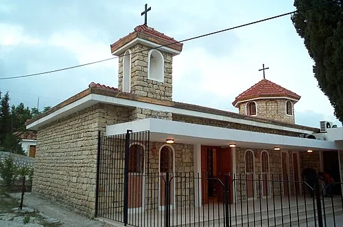 Church of the Holy Mother of God Attraction, Samandağ9.1 km NW
-
Aliderviş Tepe Mountain, Defne11 km N
Sources & licences
Data last updated: