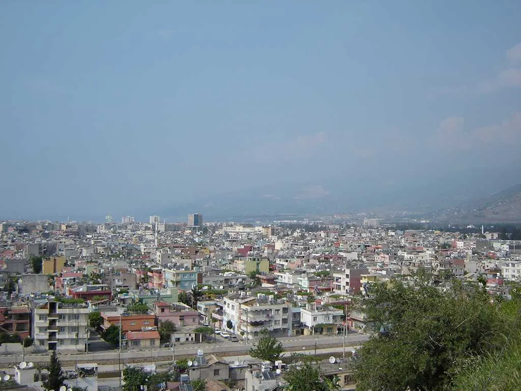
- Population
- 251,682
- 251.7K
- Elevation
- 9 m
- above sea level
- Local time
- UTC+03:00
- Europe/Istanbul · UTC+03:00
- Airports
- HTY Hatay Airport27 km
- COV Çukurova International Airport104 km
About İskenderun
İskenderun is a city. Location: İskenderun İlçesi, Hatay Province. Population: 251,682. Elevation: 9 m.
İskenderun (Arabic: إسكندرونة), historically known as Alexandretta (Greek: Αλεξανδρέττα, lit. 'little Alexandria') and Scanderoon, is a municipality and district of Hatay Province, Turkey. Its area is 247 km2, and its population is 251,682 (2022). It is on the Mediterranean coast. Located on an alluvial plain, the city was heavily damaged by powerful earthquakes in February 2023 and subsequent aftershocks, floods and fires. The city's history dates back to the Hellenistic period.
Source: Wikipedia · CC BY-SA 4.0
Photos of İskenderun
-

Melinguven · CC BY-SA 4.0 -

Original uploader was Ali TINAZ at tr.wikipedia · CC BY-SA 2.5 -

Ahmet KAYNARPUNAR · CC BY-SA 3.0 -

Bdx · CC0 -

Dosseman · CC BY-SA 4.0


Travel notes for İskenderun
From Wikivoyage
İskenderun is a city in Hatay, on the Mediterranean coast of Turkey close to the border with Syria. It's a major port and has heavy industry. In 2022 its population was 187,000 but in 2023 this region suffered a major earthquake and is still recovering.
Understand+
This is one of many cities named for Alexander the Great; he and his successors subdued vast swathes of Asia and North Africa. It stands on the coast at the foot of a pass through the mountains towards Antakya and Syria, and in 333 BC Alexander was victorious at the Battle of Issus somewhere on the plains on the other side. Medieval travellers called the city Alexandretta, the smaller one, to distinguish it from its greater namesake in Egypt.
The Ottomans conquered the region of Hatay in the 15th century, but after the First World War this was initially not incorporated into the new Republic of Turkey, but awarded to the victors France. It remained part of French Syria till 1938, was briefly independent, then was absorbed into Turkey. The city has long been industrial, with grimy petrochemical plants and steelworks in its north suburbs. The 1989 film Indiana Jones and the Last Crusade has its climactic scenes supposedly in Hatay during independence, but the location scouts took one look at Iskenderun and decided to film in southern Spain.
Get in+
By plane:
Hatay Airport (HTY IATA) has flights several times a day from Istanbul (both IST and SAW) and daily from Ankara. It's 45 km south near Antakya: driving takes 45-60 min as the highway snakes over Belen pass.
By road:
From Adana take motorway O-52 (toll) east onto O-53 / E91 then south, 133 km, say 1 hr 40 min. From Gaziantep follow O-52 west past Osmaniye to join O-53. The coast road D817 flanks O-53: it's toll-free but congested with trucks and far from scenic.
South of İskenderun O-53 joins D817 and then D825 southwards to Antakya. This is a good divided highway but twists and turns over Belen Pass through the Amanos Mountains. Highways from Antakya continue towards Syria: south for Latakia, Tartus, Tripoli and Beirut, east for Aleppo, Hama and Damascus.
By bus:
Buses from Istanbul run every couple of hours and take 13 hours via Ankara, Niğde and Adana, heading to Antakya. Buses no longer run from Beirut or Aleppo.
Bus lines are Metro Turizm, Kamil Koç (now part of Flixbus) and Has Turizm.
1 İskenderun Otogarı the bus station on Sanayi Cd was already a tatty crumbling place before the earthquake, and now has only makeshift facilities. Many Turkish cities have migrated their bus terminals to the highways edge of town, to avoid traffic snarls, but there's no word on where or when a new station might be built here.
By train:
Trains to Iskenderun are suspended long-term because of interminable engineering works around Adana.
İskenderun Garı the station is therefore a forlorn place.
By boat:
İskenderun's port facilities were wrecked in the 2023 earthquake. Ferries no longer sail from Kyrenia in Northern Cyprus: the nearest route is via Mersin.
The ferry port was at Madenli, 22 km southwest along the road to Arsuz. It's not known when it might be rebuilt.
Source: Wikivoyage · CC BY-SA 4.0 · abridged
Places bordering İskenderun
- Arsuz
- Payas
Twin towns and sister cities of İskenderun
- Lankaran· Azerbaijan
Source: Wikidata. Only places with a page on this site are shown.
Population of İskenderun over time
| 2012 | 184,833 | |
|---|---|---|
| 2015 | 246,207 | |
| 2018 | 248,335 | |
| 2020 | 250,964 | |
| 2022 | 251,682 |
Censuses and official estimates; source: Wikidata.
Climate of İskenderun
Best months for sightseeingBest months for sightseeing: April–May, November.
This month · November
A good month to visit
Day 22° · Night 12° · Rain 87 mm
- Hottest month
- August (day 35°)
- Coldest month
- January (night 7°)
- Wettest month
- December (158 mm)
- Driest month
- July (7 mm)
Bars: average monthly low and high temperature. Below: precipitation. Monthly averages for 1970–2000 at about 18 km resolution, adjusted for elevation. Highlighted months are mild and relatively dry. Source: WorldClim 2.1 (CC BY 4.0).
Show values as a table
| Month | Jan | Feb | Mar | Apr | May | Jun | Jul | Aug | Sep | Oct | Nov | Dec |
|---|---|---|---|---|---|---|---|---|---|---|---|---|
| Average high (°C) | 14° | 16° | 19° | 24° | 28° | 32° | 34° | 35° | 33° | 29° | 22° | 16° |
| Average low (°C) | 7° | 7° | 10° | 14° | 18° | 22° | 25° | 25° | 22° | 18° | 12° | 9° |
| Precipitation (mm) | 144 | 128 | 119 | 84 | 55 | 20 | 7 | 8 | 22 | 60 | 87 | 158 |
How to get to İskenderun
The nearest airport is Hatay Airport (HTY), 27 km to the south as the crow flies. For international flights: Çukurova International Airport (COV) (104 km). The nearest large city is Arsuz, 32 km to the southwest.
Airports
- Hatay Airport (HTY) Antakya 27 kmsouth
- Çukurova International Airport (COV) Tarsus 104 kmwest
- Aleppo International Airport (ALP) Aleppo 105 kmsoutheast
Nearby large cities
- Arsuz Population: 109.6K 32 kmsouthwest
- Antakya Population: 399K 42 kmsouth
- Osmaniye Population: 202.8K 54 kmnorth
- Samandağ Population: 123.4K 59 kmsouth
- Kilis Population: 111.6K 85 kmeast
Straight-line distances; road distances are longer. Airport data: OurAirports.
Day trips from İskenderun
Within 100 km: 47 historic and cultural sites, 449 natural sites, 203 lakes, rivers and coasts.
0–25 km111 places
- Sivri Tepe Mountain 7 kmE
- Nur Mountains Mountain 23 kmNE
- Karlık Tepe Mountain 13 kmSW
- Almadagh Mountain 3 kmNE
25–60 km309 places
- Tell Atchana Historic site 43 kmSE
- Ömer Gölü Island 48 kmW
- Yapı Gölü Lake 55 kmW
- Eşemen Gölü Lake 50 kmW
60–100 km279 places
- Karatepe Aslantaşı Milli Parkı Natural site 79 kmN
- Küçük Ada Island 68 kmW
- Nergizi Adasi Island 60 kmW
- Örmeli Göl Lake 79 kmNE
Straight-line distances.
İskenderun and similar cities
Side by side with cities of similar size in the same country: population, elevation and climate.
| Measure | İskenderun | Afyonkarahisar | Trabzon | Manisa |
|---|---|---|---|---|
| Population | 251.7K | 251.8K | 244.1K | 244K |
| Elevation | 9 m | 1,019 m | 39 m | 77 m |
| Summer day (hottest month) | 35° | 29° | 26° | 34° |
| Winter night (coldest month) | 7° | -4° | 4° | 4° |
| Annual rainfall | 892 mm | 496 mm | 933 mm | 744 mm |
| Best months | Apr–May, Nov | May–Jun, Sep–Oct | May–Sep | Apr–May, Oct |
| Distance | — | 552 km | 579 km | 804 km |
Climate values are 1970–2000 monthly averages; straight-line distance.
Nearby attractions & nature
Everything nearby-
Zorlu Tepe Mountain, İskenderun İlçesi2.6 km S
-
Almadagh Mountain, İskenderun İlçesi2.8 km NE
-
Çağşak Tepesi Mountain, İskenderun İlçesi3.9 km E
-
Daz Tepesi Mountain, İskenderun İlçesi5.7 km SE
-
Mys Sakhri-Sakaliya Natural site, İskenderun İlçesi5.2 km NE
-
Koca Dere River, Hatay Province3.6 km NE
-
Karaincir Tepesi Mountain, İskenderun İlçesi6.6 km E
-
Kabak Tepe Mountain, İskenderun İlçesi6.8 km SE
Other cities and towns in İskenderun İlçesi
-
 Denizciler Town, İskenderun İlçesi7 km NE
-
Karayılan Town, İskenderun İlçesi14 km N
Sources & licences
Data last updated: · 2 independent sources