
- Population
- 367
- 367
- Elevation
- 1,724 m
- above sea level
- Local time
- UTC+03:00
- Europe/Istanbul · UTC+03:00
- Airports
- EVN Zvartnots International Airport41 km
- IGD Iğdır Airport48 km
About Yenidoğan
Yenidoğan is a village. Location: Aralık İlçesi, Iğdır Province. Population: 367. Elevation: 1,724 m.
Yenidoğan (Armenian: Ակոռի, romanized: Akoři; Kurdish: Axurî; Russian: Ахури, Akhuri) is a village in eastern Turkey, on the northeastern slope of Mount Ararat, adjacent to the point where the borders of Turkey, Iran, and Armenia meet. Historically called Akori in Armenian, it was known in Turkey as Ahora until 1965. The village is a part of the Aralık District of Turkey's Iğdır Province, which largely corresponds to the historic region of Surmalu. Its population is 367 (2022).
Source: Wikipedia · CC BY-SA 4.0
Population of Yenidoğan over time
| 2013 | 680 | |
|---|---|---|
| 2014 | 653 | |
| 2015 | 590 | |
| 2016 | 528 | |
| 2017 | 507 | |
| 2018 | 520 | |
| 2019 | 486 | |
| 2020 | 475 | |
| 2021 | 435 | |
| 2022 | 367 | |
| 2023 | 341 | |
| 2024 | 322 |
Censuses and official estimates; source: Wikidata.
Climate of Yenidoğan
Best months for sightseeingBest months for sightseeing: June, September.
This month · November
A cold month
Day 8° · Night -1° · Rain 26 mm
Better nearby cities in November
- Silopi · 327 km southwest20°
- Cizre · 332 km southwest20°
- Hottest month
- August (day 28°)
- Coldest month
- January (night -10°)
- Wettest month
- May (66 mm)
- Driest month
- September (17 mm)
Bars: average monthly low and high temperature. Below: precipitation. Monthly averages for 1970–2000 at about 18 km resolution, adjusted for elevation. Highlighted months are mild and relatively dry. Source: WorldClim 2.1 (CC BY 4.0).
Show values as a table
| Month | Jan | Feb | Mar | Apr | May | Jun | Jul | Aug | Sep | Oct | Nov | Dec |
|---|---|---|---|---|---|---|---|---|---|---|---|---|
| Average high (°C) | -2° | 0° | 5° | 13° | 18° | 23° | 28° | 28° | 24° | 16° | 8° | 1° |
| Average low (°C) | -10° | -9° | -4° | 3° | 6° | 10° | 15° | 14° | 10° | 4° | -1° | -6° |
| Precipitation (mm) | 20 | 24 | 32 | 50 | 66 | 48 | 24 | 19 | 17 | 37 | 26 | 21 |
How to get to Yenidoğan
The nearest airport is Zvartnots International Airport (EVN), 41 km to the north as the crow flies. The nearest large city is Iğdır, 33 km to the northwest.
Airports
- Zvartnots International Airport (EVN) Yerevan 41 kmnorth
- Iğdır Airport (IGD) Iğdır 48 kmnorthwest
- Nakhchivan International Airport (NAJ) Nakhchivan 113 kmsoutheast
Nearby large cities
- Iğdır Population: 101.7K 33 kmnorthwest
- Ağrı Population: 124.5K 115 kmwest
- Van Population: 525K 166 kmsouthwest
- Ganja Population: 330.7K 196 kmnortheast
- Rustavi Population: 128.2K 205 kmnorth
Straight-line distances; road distances are longer. Airport data: OurAirports.
Day trips from Yenidoğan
Within 100 km: 7 historic and cultural sites, 117 natural sites, 66 lakes, rivers and coasts.
0–25 km17 places
- Tekaltıdağı Tepesi Mountain 6 kmSE
- Aracık Dağı Mountain 13 kmNW
- Mount Ararat Mountain 11 kmSW
- Arpa Tepe Mountain 9 kmNW
25–60 km49 places
- Saz Gölü Lake 30 kmSW
- Gölyüzü Gölü Lake 28 kmSW
- Erhacı Gölü Lake 26 kmNW
- Yalıntaşdağı Tepesi Mountain 37 kmSW
60–100 km124 places
- Razvaliny Lizbirt Historic site 89 kmE
- Lake Balık Lake 70 kmW
- Kazlıgöl Lake 67 kmSW
- Abbasgöl Lake 65 kmW
Straight-line distances.
Nearby attractions & nature
Everything nearby-
Tekaltıdağı Tepesi Mountain, Aralık İlçesi5.8 km SE
-
Gömik Historic site, Aralık İlçesi6.1 km SE
-
Kopgel Mountain, Aralık İlçesi8.3 km SW
-
Kūh-e Ārārāt-e Bozorg Mountain, Aralık İlçesi9 km SW
-
Great Ararat Mountain, Aralık İlçesi11 km SW
-
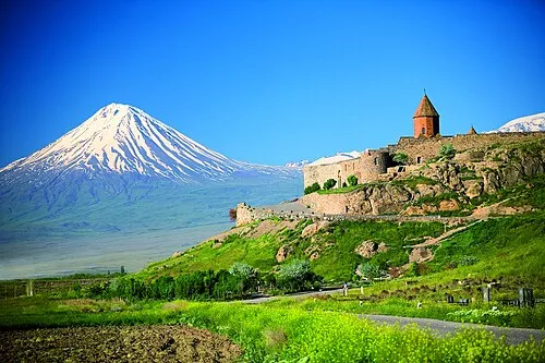 Little Ararat Mountain, Doğubayazıt District14 km S
Sources & licences
Data last updated: · 2 independent sources