- Elevation
- 1,001 m
- above sea level
- Local time
- UTC+03:00
- Europe/Istanbul · UTC+03:00
- Airports
- ISE Süleyman Demirel International Airport75 km
- AYT Antalya International Airport86 km
About Başak Deresi
Başak Deresi is a river. Location: Isparta Province, Turkey. The best months to visit are May–June, September–October. The nearest airport is Süleyman Demirel International Airport (75 km). Nearby sights include Aksu Çayı and Gök Dağ.
Climate of Başak Deresi
Best months for sightseeingBest months for sightseeing: May–June, September–October.
This month · November
Outside the best season
Day 14° · Night 4° · Rain 61 mm
Better nearby cities in November
- Alanya · 140 km southeast21°
- Silifke · 282 km southeast21°
- Aydin · 294 km west19°
- Hottest month
- July (day 31°)
- Coldest month
- January (night -2°)
- Wettest month
- December (99 mm)
- Driest month
- July (13 mm)
Bars: average monthly low and high temperature. Below: precipitation. Monthly averages for 1970–2000 at about 18 km resolution, adjusted for elevation. Highlighted months are mild and relatively dry. Source: WorldClim 2.1 (CC BY 4.0).
Show values as a table
| Month | Jan | Feb | Mar | Apr | May | Jun | Jul | Aug | Sep | Oct | Nov | Dec |
|---|---|---|---|---|---|---|---|---|---|---|---|---|
| Average high (°C) | 7° | 8° | 12° | 17° | 22° | 27° | 31° | 31° | 27° | 20° | 14° | 8° |
| Average low (°C) | -2° | -1° | 2° | 6° | 10° | 14° | 17° | 16° | 12° | 8° | 4° | 0° |
| Precipitation (mm) | 92 | 77 | 65 | 62 | 55 | 36 | 13 | 13 | 17 | 48 | 61 | 99 |
Other places to visit in this season: May June September October
How to get to Başak Deresi
The nearest airport is Süleyman Demirel International Airport (ISE), 75 km to the west as the crow flies. For international flights: Antalya International Airport (AYT) (86 km). The nearest large city is Isparta, 57 km to the west.
Airports
- Süleyman Demirel International Airport (ISE) Isparta 75 kmwest
- Antalya International Airport (AYT) Antalya 86 kmsouth
- Konya Airport (KYA) Konya 129 kmeast
Nearby large cities
- Isparta Population: 172.3K 57 kmwest
- Muratpaşa Population: 450K 88 kmsouthwest
- Antalya Population: 1.3M 89 kmsouthwest
- Konya Population: 1.4M 119 kmeast
- Afyonkarahisar Population: 251.8K 138 kmnorthwest
Straight-line distances; road distances are longer. Airport data: OurAirports.
Day trips from Başak Deresi
Within 100 km: 77 historic and cultural sites, 958 natural sites, 244 lakes, rivers and coasts.
0–25 km30 places
- Mihraplı Tepe Mountain 20 kmS
- Kördikmen Dağı Mountain 16 kmS
- Kocabulduk Tepe Mountain 8 kmSW
- Kızıl Dağ Mountain 16 kmNW
25–60 km152 places
- Orta Ada Island 33 kmNE
- Orta Ada Island 27 kmE
- Uzun Ada Island 34 kmNE
- Külbent Adası Island 45 kmE
60–100 km1,097 places
- Konyaaltı Plajı Beach 96 kmSW
- Bambus Plajı Beach 92 kmSW
- Kumköy Plajı Beach 88 kmS
- Özlü Plajı Beach 88 kmS
Straight-line distances.
Nearest towns and villages
Nearby attractions & nature
Everything nearby-
Aksu Çayı River, Isparta Province1.3 km E
-
Gök Dağ Mountain, Aksu İlçesi4.4 km E
-
Kuyucak Dağı Mountain, Sütçüler İlçesi9.9 km SW
-
Kocabulduk Tepe Mountain, Sütçüler İlçesi8.5 km SW
-
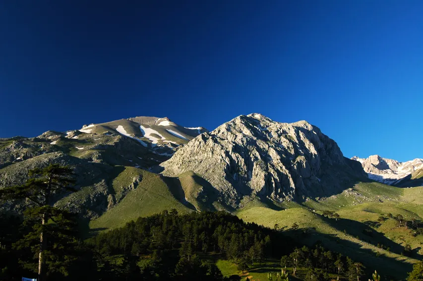 Dedegöl Dağları Mountain, Turkey12 km E
-
Adrildağları Mountain, Isparta Province21 km N
-
Yaka Deresi River, Isparta Province12 km N
-
Ak Dağ Mountain, Aksu İlçesi16 km N
Sources & licences
Data last updated: