- Elevation
- 1,100 m
- above sea level
- Local time
- UTC+03:00
- Europe/Istanbul · UTC+03:00
- Airports
- ISE Süleyman Demirel International Airport24 km
- DNZ Çardak Airport80 km
About Darı Derersi
Darı Derersi is a river. Location: Isparta Province, Turkey. The best months to visit are May–June, September–October. The nearest airport is Süleyman Demirel International Airport (24 km). Nearby sights include Fabrika Çayı and Kara Tepe.
Climate of Darı Derersi
Best months for sightseeingBest months for sightseeing: May–June, September–October.
This month · November
Outside the best season
Day 13° · Night 1° · Rain 49 mm
Better nearby cities in November
- Alanya · 182 km southeast21°
- Aydin · 243 km west19°
- Silifke · 332 km southeast21°
- Hottest month
- July (day 30°)
- Coldest month
- January (night -3°)
- Wettest month
- December (78 mm)
- Driest month
- August (13 mm)
Bars: average monthly low and high temperature. Below: precipitation. Monthly averages for 1970–2000 at about 18 km resolution, adjusted for elevation. Highlighted months are mild and relatively dry. Source: WorldClim 2.1 (CC BY 4.0).
Show values as a table
| Month | Jan | Feb | Mar | Apr | May | Jun | Jul | Aug | Sep | Oct | Nov | Dec |
|---|---|---|---|---|---|---|---|---|---|---|---|---|
| Average high (°C) | 6° | 7° | 11° | 16° | 22° | 27° | 30° | 30° | 26° | 20° | 13° | 7° |
| Average low (°C) | -3° | -2° | 0° | 4° | 8° | 12° | 15° | 14° | 10° | 6° | 1° | -1° |
| Precipitation (mm) | 73 | 69 | 58 | 55 | 52 | 32 | 15 | 13 | 15 | 41 | 49 | 78 |
Other places to visit in this season: May June September October
How to get to Darı Derersi
The nearest airport is Süleyman Demirel International Airport (ISE), 24 km to the northwest as the crow flies. For international flights: Antalya International Airport (AYT) (95 km). The nearest large city is Isparta, 5 km to the northwest.
Airports
- Süleyman Demirel International Airport (ISE) Isparta 24 kmnorthwest
- Çardak Airport (DNZ) Denizli 80 kmwest
- Antalya International Airport (AYT) Antalya 95 kmsouth
Nearby large cities
- Isparta Population: 172.3K 5 kmnorthwest
- Antalya Population: 1.3M 93 kmsouth
- Muratpaşa Population: 450K 96 kmsouth
- Afyonkarahisar Population: 251.8K 112 kmnorth
- Denizli Population: 313.2K 134 kmwest
Straight-line distances; road distances are longer. Airport data: OurAirports.
Day trips from Darı Derersi
Within 100 km: 50 historic and cultural sites, 435 natural sites, 206 lakes, rivers and coasts.
0–25 km27 places
- Gölcük Gölü Lake 10 kmW
- Koca Göl Lake 18 kmS
- Yayla Dağı Mountain 15 kmNW
- Tekçalı Tepe Mountain 18 kmSE
25–60 km146 places
- Can Adası Island 27 kmNE
- Lake Yarışlı Lake 59 kmW
- Pınarbaşı Gölü Lake 58 kmSW
- Kovada Gölü Lake 28 kmSE
60–100 km518 places
- Konyaaltı Plajı Beach 98 kmS
- Bambus Plajı Beach 98 kmS
- Orta Ada Island 75 kmE
- Orta Ada Island 77 kmE
Straight-line distances.
Nearest towns and villages
-
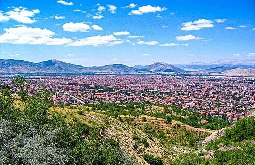 Isparta City, Isparta4.9 km NW
-
Direkli Village, Isparta3 km SE
-
Savköy Village, Isparta4.4 km NE
-
Yazısöğüt Village, Isparta4 km N
-
Darıderesi Village, Isparta4.1 km SW
-
Davraz Mahallesi Neighbourhood, Isparta4.5 km N
Nearby attractions & nature
Everything nearby-
Fabrika Çayı River, Isparta Province2.5 km N
-
Kara Tepe Mountain, Isparta4.5 km W
-
Ak Dağ Mountain, Isparta5.6 km SW
-
Gelincik Dağı Mountain, Ağlasun İlçesi6.8 km S
-
Gölcük Gölü Lake, Isparta Province9.6 km W
-
Davraz Tepe Mountain, Isparta11 km E
-
Akdağ Tepe Mountain, Burdur16 km W
-
Giresun Dağı Mountain, Burdur17 km W
More lakes, rivers and coasts in Turkey
-
Darıören Derersi River, Isparta Province14 km SE
-
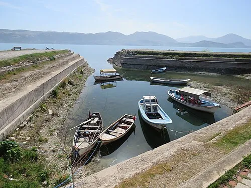 Yeşil Ada Island, Isparta Province28 km NE
-
Çukur Deresi River, Isparta Province19 km SE
-
Sulu Dere River, Isparta Province17 km N
-
Keçiborlu Çayı River, Isparta Province23 km NW
-
Doğan Dere River, Isparta Province24 km E
Sources & licences
Data last updated: