- Population
- 33,494
- 33.5K
- Elevation
- 930 m
- above sea level
- Local time
- UTC+03:00
- Europe/Istanbul · UTC+03:00
- Places inside
- 57
- listed under Eğirdir İlçesi
- Airports
- ISE Süleyman Demirel International Airport40 km
- DNZ Çardak Airport99 km
About Eğirdir İlçesi
Eğirdir İlçesi is a district. Location: Isparta Province, Turkey. Population: 33,494. The best months to visit are May–June, September–October. The nearest airport is Süleyman Demirel International Airport (40 km). Nearby sights include Yeşil Ada and Can Adası.
Photos of Eğirdir İlçesi
-
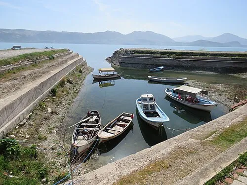
Yeşil Ada Calistemon · CC BY-SA 4.0

Climate of Eğirdir İlçesi
Best months for sightseeingBest months for sightseeing: May–June, September–October.
This month · November
Outside the best season
Day 14° · Night 3° · Rain 50 mm
Better nearby cities in November
- Alanya · 182 km southeast21°
- Aydin · 262 km west19°
- Silifke · 323 km southeast21°
- Hottest month
- July (day 31°)
- Coldest month
- January (night -1°)
- Wettest month
- December (82 mm)
- Driest month
- August (12 mm)
Bars: average monthly low and high temperature. Below: precipitation. Monthly averages for 1970–2000 at about 18 km resolution, adjusted for elevation. Highlighted months are mild and relatively dry. Source: WorldClim 2.1 (CC BY 4.0).
Show values as a table
| Month | Jan | Feb | Mar | Apr | May | Jun | Jul | Aug | Sep | Oct | Nov | Dec |
|---|---|---|---|---|---|---|---|---|---|---|---|---|
| Average high (°C) | 7° | 8° | 12° | 17° | 22° | 27° | 31° | 30° | 27° | 20° | 14° | 8° |
| Average low (°C) | -1° | -1° | 2° | 6° | 10° | 13° | 16° | 16° | 12° | 7° | 3° | 0° |
| Precipitation (mm) | 74 | 70 | 58 | 54 | 52 | 33 | 14 | 12 | 15 | 42 | 50 | 82 |
Other places to visit in this season: May June September October
How to get to Eğirdir İlçesi
The nearest airport is Süleyman Demirel International Airport (ISE), 40 km to the west as the crow flies. For international flights: Antalya International Airport (AYT) (109 km). The nearest large city is Isparta, 27 km to the southwest.
Airports
- Süleyman Demirel International Airport (ISE) Isparta 40 kmwest
- Çardak Airport (DNZ) Denizli 99 kmwest
- Antalya International Airport (AYT) Antalya 109 kmsouth
Nearby large cities
- Isparta Population: 172.3K 27 kmsouthwest
- Afyonkarahisar Population: 251.8K 100 kmnorth
- Antalya Population: 1.3M 109 kmsouth
- Muratpaşa Population: 450K 110 kmsouth
- Konya Population: 1.4M 147 kmeast
Straight-line distances; road distances are longer. Airport data: OurAirports.
Day trips from Eğirdir İlçesi
Within 100 km: 21 historic and cultural sites, 293 natural sites, 185 lakes, rivers and coasts.
0–25 km24 places
- Can Adası Island 4 kmE
- Lake Eğirdir Lake 19 kmN
- Eğirdir Gölü Lake 13 kmN
- İkiz Tepe Mountain 21 kmE
25–60 km146 places
- Orta Ada Island 55 kmE
- Uzun Ada Island 48 kmE
- Kızkulesi Adası Island 58 kmE
- Eşek Adası Island 57 kmE
60–100 km329 places
- Orta Ada Island 61 kmE
- Külbent Adası Island 74 kmE
- Hacıâkif Adası Island 65 kmSE
- Çifte Adalar Island 63 kmE
Straight-line distances.
Places in Eğirdir İlçesi
57 placesBar: population relative to the most populous place in this list.
Cities & villages41
- Ağılköy · Village
- Akbelenli · Village
- Akdoğan · Village
- Akpınar · Village
- Alisarnıçlı · Village
- Anamas · Village
- Aşağıgökdere · Village
- Asak Mahallesi · Village
- Bademli · Village
- Bağacık · Village
- Bağıllı · Village
- Bağören · Village
- Bahçıvanlar · Village
- Baklan · Village
- Balkırı · Village
- Banos · Village
- Barla · Village
- Beydere · Village
- Çayköy · Village
- Çiftlik · Village
- Corcan · Village
- Erenler · Village
- Eyüpler · Village
- Göktaş · Village
- Hacıramazanlar · Village
- Havutlu · Village
- Kırıntı · Village
- Mahmutlar · Village
- Pazarköy · Village
- Pınarpazar · Village
- Sarıidris · Village
- Serpilköy · Village
- Sipahiler · Village
- Sorkuncak · Village
- Tepe · Village
- Tepeli · Village
- Yılgıncak · Village
- Yukarıgökdere · Village
- Yukarı Mahalle · Village
- Yuvalı · Village
- Zamkadın · Village
Mountains & nature10
- Akpınar Dağı · Mountain
- Bayboğan Dağı · Mountain
- Dulup Tepe · Mountain
- Güllüce Dağı · Mountain
- İkiz Tepe · Mountain
- Karakeriş Tepesi · Mountain
- Kara Tepe · Mountain
- Kaymaz Tepe · Mountain
- Kızıl Dağ · Mountain
- Kovada Gölü Milli Parkı · Natural site
Lakes, rivers & coasts1
- Eğirdir Gölü · Lake
Heritage & sights1
- Eğirdir Kalesi · Historic site
Nearby attractions & nature
Everything nearby-
Yeşil Ada Island, Isparta Province4.4 km E
-
Can Adası Island, Isparta Province3.8 km E
-
Şamlı Dere River, Isparta Province8.9 km NW
-
Koca Dere River, Isparta Province13 km SE
-
Doğan Dere River, Isparta Province14 km S
-
Barla Dağı Mountain, Isparta Province21 km NW
Sources & licences
Data last updated: