- Elevation
- 1,054 m
- above sea level
- Local time
- UTC+03:00
- Europe/Istanbul · UTC+03:00
- Airports
- AYT Antalya International Airport84 km
- ISE Süleyman Demirel International Airport91 km
About Gülsular
Gülsular is a village. Location: Sütçüler İlçesi, Isparta Province. Elevation: 1,054 m. The best months to visit are May–June, September–October. The nearest airport is Antalya International Airport (84 km). Nearby sights include Kartüz Dağı and Kördikmen Dağı.
Climate of Gülsular
Best months for sightseeingBest months for sightseeing: May–June, September–October.
This month · November
Outside the best season
Day 14° · Night 3° · Rain 61 mm
Better nearby cities in November
- Alanya · 126 km southeast21°
- Silifke · 266 km southeast21°
- Mersin · 305 km east22°
- Hottest month
- July (day 31°)
- Coldest month
- January (night -2°)
- Wettest month
- December (99 mm)
- Driest month
- July (13 mm)
Bars: average monthly low and high temperature. Below: precipitation. Monthly averages for 1970–2000 at about 18 km resolution, adjusted for elevation. Highlighted months are mild and relatively dry. Source: WorldClim 2.1 (CC BY 4.0).
Show values as a table
| Month | Jan | Feb | Mar | Apr | May | Jun | Jul | Aug | Sep | Oct | Nov | Dec |
|---|---|---|---|---|---|---|---|---|---|---|---|---|
| Average high (°C) | 6° | 8° | 12° | 17° | 22° | 27° | 31° | 30° | 27° | 20° | 14° | 8° |
| Average low (°C) | -2° | -1° | 2° | 6° | 10° | 13° | 16° | 16° | 12° | 7° | 3° | 0° |
| Precipitation (mm) | 92 | 77 | 65 | 62 | 55 | 36 | 13 | 13 | 17 | 48 | 61 | 99 |
Other places to visit in this season: May June September October
How to get to Gülsular
The nearest airport is Antalya International Airport (AYT), 84 km to the southwest as the crow flies. The nearest large city is Isparta, 72 km to the west.
Airports
- Antalya International Airport (AYT) Antalya 84 kmsouthwest
- Süleyman Demirel International Airport (ISE) Isparta 91 kmnorthwest
- Konya Airport (KYA) Konya 121 kmnortheast
Nearby large cities
- Isparta Population: 172.3K 72 kmwest
- Muratpaşa Population: 450K 86 kmsouthwest
- Antalya Population: 1.3M 89 kmsouthwest
- Konya Population: 1.4M 110 kmeast
- Alanya Population: 364.2K 126 kmsoutheast
Straight-line distances; road distances are longer. Airport data: OurAirports.
Day trips from Gülsular
Within 100 km: 79 historic and cultural sites, 1,288 natural sites, 256 lakes, rivers and coasts.
0–25 km35 places
- Orta Ada Island 21 kmNE
- Hacıâkif Adası Island 18 kmNE
- Çifte Adalar Island 21 kmNE
- Tınaz Tepe Mountain 21 kmSE
25–60 km150 places
- Orta Ada Island 34 kmN
- Uzun Ada Island 39 kmN
- Külbent Adası Island 39 kmNE
- Kızkulesi Adası Island 31 kmNE
60–100 km1,438 places
- Çenger Mevki, Side, Manavgat/Antalya Beach 98 kmS
- Konyaaltı Plajı Beach 95 kmSW
- Bambus Plajı Beach 91 kmSW
- Kumköy Plajı Beach 83 kmSW
Straight-line distances.
Nearby attractions & nature
Everything nearby-
Kartüz Dağı Mountain, Sütçüler İlçesi3.2 km E
-
Kördikmen Dağı Mountain, Sütçüler İlçesi10 km SW
-
Mihraplı Tepe Mountain, Sütçüler İlçesi12 km SW
-
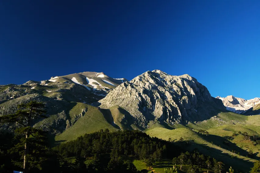 Dedegöl Dağları Mountain, Turkey14 km N
-
Kuyucak Dağı Mountain, Sütçüler İlçesi19 km W
-
Gökkayaçayır Dağı Mountain, Beyşehir İlçesi11 km E
Sources & licences
Data last updated: