- Elevation
- 2 m
- above sea level
- Local time
- UTC+03:00
- Europe/Istanbul · UTC+03:00
- Airports
- ADB Adnan Menderes International Airport23 km
- JKH Chios Island National Airport69 km
About Yağ Çayı
Yağ Çayı is a river. Location: İzmir Province, Turkey. The best months to visit are April–May, October. The nearest airport is Adnan Menderes International Airport (23 km). Nearby sights include Onbeş Yıl Atatürk Anı Ormanı and Catalkaya Tepesi.
Climate of Yağ Çayı
Best months for sightseeingBest months for sightseeing: April–May, October.
This month · November
Outside the best season
Day 18° · Night 10° · Rain 88 mm
Better nearby cities in November
- Aydin · 100 km southeast19°
- Hottest month
- July (day 33°)
- Coldest month
- January (night 5°)
- Wettest month
- December (136 mm)
- Driest month
- August (4 mm)
Bars: average monthly low and high temperature. Below: precipitation. Monthly averages for 1970–2000 at about 18 km resolution, adjusted for elevation. Highlighted months are mild and relatively dry. Source: WorldClim 2.1 (CC BY 4.0).
Show values as a table
| Month | Jan | Feb | Mar | Apr | May | Jun | Jul | Aug | Sep | Oct | Nov | Dec |
|---|---|---|---|---|---|---|---|---|---|---|---|---|
| Average high (°C) | 12° | 13° | 16° | 20° | 25° | 31° | 33° | 32° | 29° | 24° | 18° | 14° |
| Average low (°C) | 5° | 6° | 7° | 11° | 15° | 19° | 22° | 22° | 18° | 14° | 10° | 7° |
| Precipitation (mm) | 118 | 94 | 77 | 46 | 28 | 9 | 5 | 4 | 14 | 41 | 88 | 136 |
How to get to Yağ Çayı
The nearest airport is Adnan Menderes International Airport (ADB), 23 km to the southeast as the crow flies. The nearest large city is Konak, 15 km to the east.
Airports
- Adnan Menderes International Airport (ADB) Gaziemir 23 kmsoutheast
- Chios Island National Airport (JKH) Chios Island 69 kmwest
- Samos Airport (SMI) Samos Island 77 kmsouth
Nearby large cities
- Konak Population: 332.3K 15 kmeast
- Çiğli Population: 214.1K 18 kmnortheast
- Karabağlar Population: 479.3K 18 kmeast
- Cordaleo Population: 339.6K 18 kmnortheast
- Izmir Population: 2.9M 19 kmeast
Straight-line distances; road distances are longer. Airport data: OurAirports.
Day trips from Yağ Çayı
Within 100 km: 84 historic and cultural sites, 197 natural sites, 204 lakes, rivers and coasts.
0–25 km78 places
- Chustan Island Island 23 kmNW
- Taş Adası Island 12 kmW
- Hekim Adasi Island 15 kmNW
- Eşek Adası Island 25 kmSW
25–60 km200 places
- Karabel relief Historic site 46 kmE
- Uzunadalar Island 54 kmW
- Platia Islet Island 48 kmW
- Tavşan Adası Island 52 kmN
60–100 km207 places
- Moní Megális Panagías Attraction 77 kmS
- Panaghia Mirtidhiotisa Monastery Attraction 69 kmW
- Aghia Matrona Attraction 74 kmW
- Kadınlar Plajı Beach 66 kmSE
Straight-line distances.
Nearest towns and villages
-
Bademli Village, Narlıdere2.8 km E
-
Maltepe Neighbourhood, Güzelbahçe0.9 km SW
-
Liman Reis Neighbourhood, Narlıdere1 km E
-
Yaka Neighbourhood, Güzelbahçe2.5 km SW
-
Yalı Neighbourhood, Güzelbahçe3.2 km W
-
Güzelbahçe Bucağı Municipality, İzmir Province5 km SW
Nearby attractions & nature
Everything nearby-
Onbeş Yıl Atatürk Anı Ormanı Natural site, İzmir Province4.4 km SW
-
Catalkaya Tepesi Mountain, Narlıdere4.9 km SE
-
Dikmen Dağı Mountain, İzmir Province8.1 km SE
-
Çamli Deresi River, İzmir Province6.3 km W
-
Eskigediz Mecrası River, İzmir Province6.9 km N
-
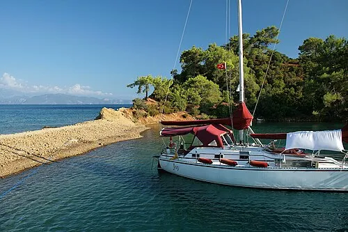 Saint John Island Island, İzmir Province12 km W
-
Koca Tepe Mountain, Urla İlçesi10 km SW
-
Aykavuştu Dere River, İzmir Province9.3 km SW
Sources & licences
Data last updated: