Çağlayancerit Bucağı
Located in Kahramanmaraş Province, Turkey Coordinates: 37°44′43″ N 37°17′10″ E
- Elevation
- 1,086 m
- above sea level
- Local time
- UTC+03:00
- Europe/Istanbul · UTC+03:00
- Airports
- KCM Kahramanmaraş Airport37 km
- GZT Gaziantep Oğuzeli International Airport90 km
About Çağlayancerit Bucağı
Çağlayancerit Bucağı is a municipality. Location: Kahramanmaraş Province, Turkey. Elevation: 1,086 m. The best months to visit are May, October. The nearest airport is Kahramanmaraş Airport (37 km). Nearby sights include Öksüz Dağı and Kütüklütarla Tepe.
Climate of Çağlayancerit Bucağı
Best months for sightseeingBest months for sightseeing: May, October.
This month · November
Outside the best season
Day 14° · Night 3° · Rain 64 mm
Better nearby cities in November
- Osmaniye · 118 km southwest21°
- Suruç · 132 km southeast20°
- İskenderun · 162 km southwest22°
- Hottest month
- August (day 33°)
- Coldest month
- January (night -4°)
- Wettest month
- December (86 mm)
- Driest month
- August (4 mm)
Bars: average monthly low and high temperature. Below: precipitation. Monthly averages for 1970–2000 at about 18 km resolution, adjusted for elevation. Highlighted months are mild and relatively dry. Source: WorldClim 2.1 (CC BY 4.0).
Show values as a table
| Month | Jan | Feb | Mar | Apr | May | Jun | Jul | Aug | Sep | Oct | Nov | Dec |
|---|---|---|---|---|---|---|---|---|---|---|---|---|
| Average high (°C) | 4° | 6° | 10° | 17° | 23° | 28° | 33° | 33° | 29° | 22° | 14° | 7° |
| Average low (°C) | -4° | -3° | 1° | 6° | 10° | 13° | 16° | 16° | 12° | 7° | 3° | -1° |
| Precipitation (mm) | 78 | 67 | 79 | 68 | 53 | 18 | 5 | 4 | 9 | 43 | 64 | 86 |
How to get to Çağlayancerit Bucağı
The nearest airport is Kahramanmaraş Airport (KCM), 37 km to the southwest as the crow flies. For international flights: Gaziantep Oğuzeli International Airport (GZT) (90 km). The nearest large city is Kahramanmaraş, 36 km to the southwest.
Airports
- Kahramanmaraş Airport (KCM) Kahramanmaraş 37 kmsouthwest
- Gaziantep Oğuzeli International Airport (GZT) Gaziantep 90 kmsouth
- Malatya Erhaç Airport (MLX) Malatya 104 kmnortheast
Nearby large cities
- Kahramanmaraş Population: 385K 36 kmsouthwest
- Gaziantep Population: 2.2M 77 kmsouth
- Adıyaman Population: 290.9K 87 kmeast
- Malatya Population: 750.5K 113 kmnortheast
- Kilis Population: 111.6K 115 kmsouth
Straight-line distances; road distances are longer. Airport data: OurAirports.
Day trips from Çağlayancerit Bucağı
Within 100 km: 28 historic and cultural sites, 409 natural sites, 197 lakes, rivers and coasts.
0–25 km25 places
- İnekli Göl Lake 20 kmE
- Azaplı Göl Lake 23 kmE
- Öksüz Dağı Mountain 4 kmSW
- Koç Dağı Mountain 25 kmNW
25–60 km148 places
- Gölbaşı Gölü Lake 33 kmE
- Menzelet Barajı Lake 36 kmW
- Yumaklı Tepe Mountain 28 kmSE
- Taşlıalan Mountain 27 kmSW
60–100 km461 places
- Sazlıca Gölü Lake 91 kmNE
- Örmeli Göl Lake 83 kmSW
- Arıklıkaş Göleti Lake 94 kmSW
- Kara Göl Lake 82 kmSW
Straight-line distances.
Nearby attractions & nature
Everything nearby-
Öksüz Dağı Mountain, Çağlayancerit İlçesi4.2 km SW
-
Kütüklütarla Tepe Mountain, Dulkadiroğlu11 km W
-
Üçoluk Pınarı Natural site, Kahramanmaraş Province13 km S
-
Kandil Dağı Mountain, Pazarcık İlçesi12 km S
-
Karyağan Tepe Mountain, Kahramanmaraş Province21 km E
-
Engizek Dağı Mountain, Dulkadiroğlu21 km NW
-
Kuzkaya Tepe Mountain, Çağlayancerit İlçesi16 km E
-
Sakıbaba Tepe Mountain, Pazarcık İlçesi13 km S
Other cities and towns in Kahramanmaraş Province
-
Kahramanmaraş City, Kahramanmaraş Province36 km SW
-
Ağabeyli Bucağı Municipality, Kahramanmaraş Province15 km W
-
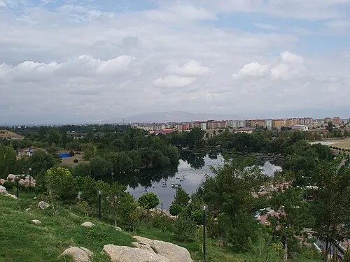 Elbistan City, Elbistan İlçesi52 km N
-
Pazarcık Town, Pazarcık İlçesi29 km S
-
Nurhak City, Nurhak İlçesi28 km NE
-
Narlı Town, Pazarcık İlçesi41 km S
Sources & licences
Data last updated: