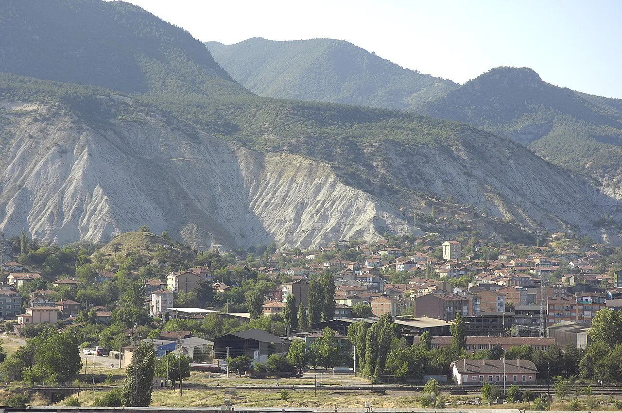
- Elevation
- 431 m
- above sea level
- Local time
- UTC+03:00
- Europe/Istanbul · UTC+03:00
- Places inside
- 75
- listed under Karabuk
- Airports
- ONQ Zonguldak Çaycuma Airport59 km
- KFS Kastamonu Airport101 km
About Karabuk
Karabuk is a district. Location: Karabük Province, Turkey. The best months to visit are May–June, September–October. The nearest airport is Zonguldak Çaycuma Airport (59 km). Nearby sights include Eskipazar Çayı and Araç Çayı.
Climate of Karabuk
Best months for sightseeingBest months for sightseeing: May–June, September–October.
This month · November
Outside the best season
Day 13° · Night 5° · Rain 62 mm
- Hottest month
- July (day 29°)
- Coldest month
- January (night 0°)
- Wettest month
- December (88 mm)
- Driest month
- August (30 mm)
Bars: average monthly low and high temperature. Below: precipitation. Monthly averages for 1970–2000 at about 18 km resolution, adjusted for elevation. Highlighted months are mild and relatively dry. Source: WorldClim 2.1 (CC BY 4.0).
Show values as a table
| Month | Jan | Feb | Mar | Apr | May | Jun | Jul | Aug | Sep | Oct | Nov | Dec |
|---|---|---|---|---|---|---|---|---|---|---|---|---|
| Average high (°C) | 6° | 8° | 13° | 18° | 23° | 26° | 29° | 29° | 26° | 20° | 13° | 8° |
| Average low (°C) | 0° | 1° | 3° | 7° | 11° | 14° | 16° | 16° | 13° | 9° | 5° | 2° |
| Precipitation (mm) | 78 | 58 | 59 | 64 | 77 | 50 | 35 | 30 | 30 | 45 | 62 | 88 |
Other places to visit in this season: May June September October
How to get to Karabuk
The nearest airport is Zonguldak Çaycuma Airport (ONQ), 59 km to the northwest as the crow flies. For international flights: Esenboğa International Airport (ESB) (118 km). The nearest large city is Karabük, 6 km to the north.
Airports
- Zonguldak Çaycuma Airport (ONQ) Zonguldak 59 kmnorthwest
- Kastamonu Airport (KFS) Kastamonu 101 kmeast
- Esenboğa International Airport (ESB) Ankara 118 kmsouth
Nearby large cities
- Karabük Population: 125.4K 6 kmnorth
- Zonguldak Population: 101.7K 76 kmnorthwest
- Bolu Population: 184.7K 96 kmsouthwest
- Kastamonu Population: 125.6K 101 kmeast
- Düzce Population: 194.1K 127 kmwest
Straight-line distances; road distances are longer. Airport data: OurAirports.
Day trips from Karabuk
Within 100 km: 5 historic and cultural sites, 277 natural sites, 212 lakes, rivers and coasts.
0–25 km50 places
- Yenidağ Mountain 16 kmW
- Uluziyaret Tepe Mountain 16 kmNW
- Tarakçı Tepesi Mountain 16 kmW
- Sarıçiçek Tepesi Mountain 23 kmN
25–60 km169 places
- Koca Gölü Lake 37 kmS
- Keçi Gölü Lake 38 kmS
- Bozoğlu Göleti Lake 49 kmSE
- Kise Dağı Mountain 53 kmW
60–100 km275 places
- Büyük Ada Island 69 kmN
- Yeniçağa Gölü Lake 64 kmSW
- Aladağ Göleti Lake 100 kmSW
- Eğrekkaya Barajı Lake 74 kmS
Straight-line distances.
Places in Karabuk
75 places- 1 Karabük 125.4K
- 2 Cumayanı 3.1K
- 3 Zopran 2.5K
- 4 Akören 945
- 5 Bulak 696
- 6 Çukurca 383
- 7 Kahyalar 367
- 8 Sipahiler 317
- 9 Burunsuz 304
- 10 Cemaller 274
- 11 Ödemiş 249
- 12 Davutlar 231
- 13 Acıöz 225
- 14 Mehterler 223
- 15 Bolkuş 206
- 16 Tandır 200
- 17 Gölören 198
- 18 Demirciler 193
- 19 Yukarıkızılcaören 182
- 20 Düzçam 180
- 21 Üçbaş 177
- 22 Karaağaç 174
- 23 Ortaca 173
- 24 Başköy 162
- 25 Salmanlar 154
- 26 Karaşar 143
- 27 Şenler 117
- 28 Güneşli 116
- 29 Kapaklı 108
Bar: population relative to the most populous place in this list.
Cities & villages23
- Aksökü · Village
- Arıcık · Village
- Aşağıkızılcaören · Village
- Bannar · Village
- Bedirler · Village
- Belen · Village
- Besirağa · Village
- Boyalı · Village
- Bürnük · Village
- Büyükdüzşirketbinası · Village
- Çakaloğlu · Village
- Çerçiler · Village
- Çiğdemler · Village
- Dayışlar · Village
- Durhanlar · Village
- Elezler · Village
- Hanköy · Village
- Kabaoğlu · Village
- Kadıköy · Village
- Kalecik · Village
- Kamışköy · Village
- Kapullu · Village
- Karaağaç · Village
Mountains & nature8
- Aktaşerenleri Tepesi · Mountain
- Aladağ · Mountain
- Çakmak Tepesi · Mountain
- Çaldağ · Mountain
- Çatalardıç Tepesi · Mountain
- Esendoğdu Tepesi · Mountain
- Gözür Dağı · Mountain
- Hacıdede Tepesi · Mountain
Nearby attractions & nature
Everything nearby-
Eskipazar Çayı River, Karabük Province3.4 km N
-
Araç Çayı River, Karabük Province4.1 km N
-
Karaağaç Deresi River, Karabük Province6.4 km W
-
Öküz Deresi River, Karabük Province6.4 km SW
-
Belen Deresi River, Karabük Province6.5 km W
-
Üçbaş Deresi River, Karabük Province8.6 km SE
Sources & licences
Data last updated: