- Elevation
- 1,105 m
- above sea level
- Local time
- UTC+03:00
- Europe/Istanbul · UTC+03:00
- Airports
- KYA Konya Airport112 km
- GZP Gazipaşa-Alanya Airport120 km
About Seydihisar Deresi
Seydihisar Deresi is a river. Location: Karaman Province, Turkey. The best months to visit are May–June, September–October. The nearest airport is Konya Airport (112 km). Nearby sights include Çardaklar Dere and Körünkuyusu Dere.
Climate of Seydihisar Deresi
Best months for sightseeingBest months for sightseeing: May–June, September–October.
This month · November
Outside the best season
Day 13° · Night 2° · Rain 44 mm
Better nearby cities in November
- Silifke · 105 km southeast21°
- Alanya · 123 km southwest21°
- Mersin · 133 km east22°
- Hottest month
- July (day 31°)
- Coldest month
- January (night -3°)
- Wettest month
- January (68 mm)
- Driest month
- August (5 mm)
Bars: average monthly low and high temperature. Below: precipitation. Monthly averages for 1970–2000 at about 18 km resolution, adjusted for elevation. Highlighted months are mild and relatively dry. Source: WorldClim 2.1 (CC BY 4.0).
Show values as a table
| Month | Jan | Feb | Mar | Apr | May | Jun | Jul | Aug | Sep | Oct | Nov | Dec |
|---|---|---|---|---|---|---|---|---|---|---|---|---|
| Average high (°C) | 5° | 7° | 11° | 17° | 22° | 27° | 31° | 31° | 27° | 20° | 13° | 7° |
| Average low (°C) | -3° | -2° | 1° | 5° | 9° | 12° | 15° | 14° | 10° | 6° | 2° | -1° |
| Precipitation (mm) | 68 | 55 | 54 | 45 | 41 | 21 | 6 | 5 | 9 | 36 | 44 | 66 |
Other places to visit in this season: May June September October
How to get to Seydihisar Deresi
The nearest airport is Konya Airport (KYA), 112 km to the northwest as the crow flies. The nearest large city is Karaman, 9 km to the north.
Airports
- Konya Airport (KYA) Konya 112 kmnorthwest
- Gazipaşa-Alanya Airport (GZP) Gazipaşa 120 kmsouthwest
- Çukurova International Airport (COV) Tarsus 169 kmeast
Nearby large cities
- Karaman Population: 175.4K 9 kmnorth
- Heraclea Population: 156.3K 89 kmnortheast
- Silifke Population: 132.7K 105 kmsoutheast
- Konya Population: 1.4M 105 kmnorthwest
- Alanya Population: 364.2K 123 kmsouthwest
Straight-line distances; road distances are longer. Airport data: OurAirports.
Day trips from Seydihisar Deresi
Within 100 km: 18 historic and cultural sites, 1,411 natural sites, 224 lakes, rivers and coasts.
0–25 km34 places
- Yelattı Dağı Mountain 13 kmS
- Taurus Mountains Mountain 24 kmSW
- Karga Dağı Mountain 22 kmS
- Buzlu Dağ Mountain 21 kmW
25–60 km288 places
- Acı Göl Lake 42 kmN
- Hotamış Gölü Lake 47 kmN
- Tilkilik Tepesi Mountain 42 kmSE
- Telek Dağı Mountain 45 kmSW
60–100 km1,331 places
- Meyil Gölü Lake 99 kmN
- Lake Meke Lake 76 kmNE
- Ermenek Baraj Gölü Lake 64 kmSW
- Ziyaret Tepesi Mountain 60 kmSE
Straight-line distances.
Nearest towns and villages
-
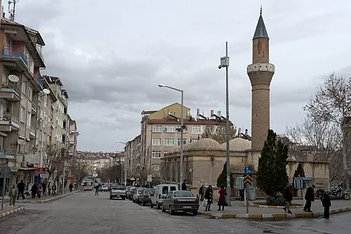 Karaman City, Karaman8.9 km N
-
Çavuşpınarı Village, Karaman4.5 km NW
-
Kürtderesi Village, Karaman5.2 km NW
-
Boyalı Village, Karaman5.4 km S
-
Anamas Village, Karaman6.3 km S
-
Seyithasan Village, Karaman6.7 km SE
Nearby attractions & nature
Everything nearby-
Çardaklar Dere River, Karaman Province0.3 km NW
-
Körünkuyusu Dere River, Karaman Province2.3 km W
-
Atatürk Ormanı Natural site, Karaman Province3 km E
-
Köyözü Dere River, Karaman Province4.4 km NW
-
Duman Dere River, Karaman Province6.1 km SW
-
Karaköprü Deresi River, Karaman Province6.4 km NE
-
Deli Çay River, Karaman Province7.1 km NW
-
Çimen Deresi River, Karaman Province8 km NW
Sources & licences
Data last updated: