- Population
- 574
- 574
- Elevation
- 1,731 m
- above sea level
- Local time
- UTC+03:00
- Europe/Istanbul · UTC+03:00
- Airports
- KSY Kars Airport27 km
- LWN Shirak International Airport40 km
About Subatan
Subatan is a village. Location: Kars, Kars Province. Population: 574. Elevation: 1,731 m. The best months to visit are June–September. The nearest airport is Kars Airport (27 km). Nearby sights include Kerimoğlu Tepesi and Bagnayr Monastery.
Climate of Subatan
Best months for sightseeingBest months for sightseeing: June–September.
This month · November
A cold month
Day 7° · Night -3° · Rain 29 mm
Better nearby cities in November
- Cizre · 380 km south20°
- Silopi · 383 km south20°
- Hottest month
- August (day 26°)
- Coldest month
- January (night -13°)
- Wettest month
- May (84 mm)
- Driest month
- January (20 mm)
Bars: average monthly low and high temperature. Below: precipitation. Monthly averages for 1970–2000 at about 18 km resolution, adjusted for elevation. Highlighted months are mild and relatively dry. Source: WorldClim 2.1 (CC BY 4.0).
Show values as a table
| Month | Jan | Feb | Mar | Apr | May | Jun | Jul | Aug | Sep | Oct | Nov | Dec |
|---|---|---|---|---|---|---|---|---|---|---|---|---|
| Average high (°C) | -4° | -2° | 3° | 11° | 16° | 21° | 26° | 26° | 23° | 15° | 7° | -1° |
| Average low (°C) | -13° | -12° | -7° | 0° | 4° | 7° | 11° | 11° | 6° | 2° | -3° | -9° |
| Precipitation (mm) | 20 | 25 | 27 | 51 | 84 | 71 | 45 | 37 | 29 | 38 | 29 | 23 |
Other places to visit in this season: June July August September
How to get to Subatan
The nearest airport is Kars Airport (KSY), 27 km to the west as the crow flies. For international flights: Shirak International Airport (LWN) (40 km). The nearest large city is Iğdır, 92 km to the southeast.
Airports
- Kars Airport (KSY) Kars 27 kmwest
- Shirak International Airport (LWN) Gyumri 40 kmnortheast
- Iğdır Airport (IGD) Iğdır 79 kmsoutheast
Nearby large cities
- Iğdır Population: 101.7K 92 kmsoutheast
- Ağrı Population: 124.5K 104 kmsouth
- Rustavi Population: 128.2K 168 kmnortheast
- Tbilisi Population: 1M 169 kmnortheast
- Batumi Population: 186.9K 190 kmnorthwest
Straight-line distances; road distances are longer. Airport data: OurAirports.
Day trips from Subatan
Within 100 km: 64 historic and cultural sites, 204 natural sites, 204 lakes, rivers and coasts.
0–25 km81 places
- Ani Historic site 16 kmSE
- Mustafa Gölü Lake 13 kmNW
- Mişk Gölü Lake 11 kmNW
- Lake Kuyucuk Lake 15 kmN
25–60 km138 places
- Büyük Ada Island 54 kmN
- Rus Adası Island 54 kmN
- Lavaş Gölü Lake 40 kmN
- Turna Gölü Lake 44 kmSW
60–100 km253 places
- Didi Abuli Mountain 94 kmN
- Kumurdo Cathedral Attraction 88 kmN
- Vanis Kvabebi Attraction 87 kmN
- Tmogvi Castle Historic site 89 kmN
Straight-line distances.
Nearby attractions & nature
Everything nearby-
Kerimoğlu Tepesi Mountain, Kars7.5 km N
-
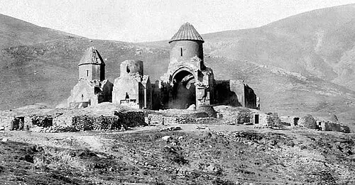 Bagnayr Monastery Historic site, Kars11 km SE
-
Dumanlı Dağ Mountain, Kars10 km S
-
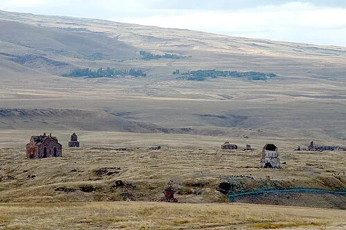 Ani Historic site, Kars16 km SE
-
Nalbant Tepesi Mountain, Kars11 km SW
-
Büyükyahni Tepesi Mountain, Kars9.3 km W
Sources & licences
Data last updated: