- Population
- 15,184
- 15.2K
- Elevation
- 3 m
- above sea level
- Local time
- UTC+03:00
- Europe/Istanbul · UTC+03:00
- Airports
- COV Çukurova International Airport124 km
- ECN Ercan International Airport134 km
About Taşucu
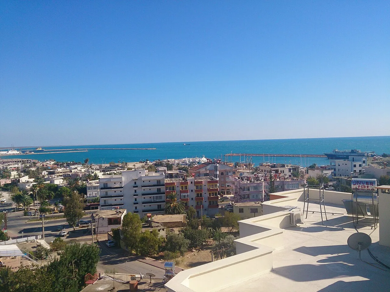
Taşucu is a town. Location: Silifke İlçesi, Mersin Province. Population: 15,184. Elevation: 3 m.
Taşucu is a neighbourhood in the municipality and district of Silifke, Mersin Province, Turkey. Its population is 15,184 (2022). Before the 2013 reorganisation, it was a town (belde). It had obtained the status of belde after the local elections in Turkey, 1955. In 2000 a military pier, Agalar, was built 6 kilometres (3.7 mi) south-west of the town. During the Syrian Civil War the pier was used to ship weapons to Syrian rebel groups as part of the U.S. Timber Sycamore program.
Source: Wikipedia · CC BY-SA 4.0
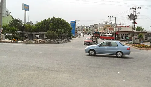
Photos of Taşucu
-

Cobija · CC BY-SA 3.0 -

Cobija · CC BY-SA 3.0 -

Zeynel Cebeci · CC BY-SA 4.0


Travel notes for Taşucu
From Wikivoyage
Taşucu is a town in the Cilician Mountains on the Mediterranean coast of Turkey, with a population of 17,000 in 2023. The main reason to come is to take the ferry to Kyrenia in Northern Cyprus.
The ferry port is east edge of town and Kum is a modern beach resort east of there.
Get in+
By road:
The town stands on D400, the coast highway between Antalya, Alanya, Silifke, Mersin and Adana. The road east is wide and smooth, but west is narrow and tortuous through the mountains as far as Alanya.
Daily buses run from Istanbul and Ankara via Konya and Karaman to Silifke 15 km north of Taşucu, where you change to a dolmuş for the last leg. They're timed to connect with the ferries.
Four buses a day from Antalya take 7 hr 20 min via Alanya and Anamur to Taşucu. They continue to Silifke, Erdemli, Mersin and Adana.
The bus lines are Metro Turizm and Flixbus.
Buses make several stops along D400 including the junction for the ferry port, but the bus station there has closed.
By boat:
1 Ceyport Taşucu or İskele is the ferry port, 1.5 km east of the historic village and harbour.
From Kyrenia (Girne) in Northern Cyprus, Akgunlerdenizcilik operate a year-road car ferry (Feribot), and a summer-only fast cat (Deniz Otobüsü) for foot passengers.
March-Oct the car ferry sails from Kyrenia M, W, Th, F, taking six hours, and returns from Taşucu Tu, W, Th, Su. Most sailings are towards midnight, enabling a same-day connection to and from Ankara. Sailings Nov-Feb are only once or twice a week. This is the only vehicle ferry between Cyprus and Turkey, and the only one to run all year, so it carries lots of trucks. The fast cat sails Apr-Oct most days, taking 2 hours 30 min.
The fast ferry sank on 30 Aug 2026 shortly after leaving Kyrenia. The implications for other sailings are not yet known.
Ferries no longer sail from Lebanon.
Source: Wikivoyage · CC BY-SA 4.0 · abridged
Climate of Taşucu
Best months for sightseeingBest months for sightseeing: April–May, November.
This month · November
A good month to visit
Day 21° · Night 12° · Rain 77 mm
- Hottest month
- August (day 33°)
- Coldest month
- January (night 7°)
- Wettest month
- December (137 mm)
- Driest month
- August (1 mm)
Bars: average monthly low and high temperature. Below: precipitation. Monthly averages for 1970–2000 at about 18 km resolution, adjusted for elevation. Highlighted months are mild and relatively dry. Source: WorldClim 2.1 (CC BY 4.0).
Show values as a table
| Month | Jan | Feb | Mar | Apr | May | Jun | Jul | Aug | Sep | Oct | Nov | Dec |
|---|---|---|---|---|---|---|---|---|---|---|---|---|
| Average high (°C) | 15° | 16° | 18° | 22° | 26° | 30° | 32° | 33° | 31° | 27° | 21° | 16° |
| Average low (°C) | 7° | 7° | 9° | 13° | 17° | 21° | 24° | 24° | 21° | 17° | 12° | 8° |
| Precipitation (mm) | 119 | 88 | 61 | 31 | 22 | 8 | 5 | 1 | 6 | 44 | 77 | 137 |
How to get to Taşucu
The nearest airport is Çukurova International Airport (COV), 124 km to the northeast as the crow flies. The nearest large city is Silifke, 8 km to the northeast.
Airports
- Çukurova International Airport (COV) Tarsus 124 kmnortheast
- Ercan International Airport (ECN) Tymbou (Kirklar) 134 kmsouth
- Gazipaşa-Alanya Airport (GZP) Gazipaşa 142 kmwest
Nearby large cities
- Silifke Population: 132.7K 8 kmnortheast
- Mersin Population: 537.8K 87 kmnortheast
- Tarsus Population: 350.7K 112 kmnortheast
- Karaman Population: 175.4K 112 kmnorthwest
- Heraclea Population: 156.3K 133 kmnorth
Straight-line distances; road distances are longer. Airport data: OurAirports.
Day trips from Taşucu
Within 100 km: 107 historic and cultural sites, 1,154 natural sites, 169 lakes, rivers and coasts.
0–25 km29 places
- Dana Adası Island 18 kmSW
- Boğsak Adası Island 8 kmSW
- Paradeniz Gölü Lake 11 kmE
- Ak Göl Lake 7 kmE
25–60 km345 places
- Ovacık Adası Island 25 kmSW
- Babadil Adası Island 38 kmSW
- Büyük Ada Island 52 kmSW
- Yelkenli Ada Island 51 kmSW
60–100 km1,056 places
- Nisídes Kordýlia Island 92 kmSE
- Nisída Gláros Island 90 kmSE
- Nisída Lefkónisos Island 89 kmSE
- Nisídes Skaloúdia Island 88 kmS
Straight-line distances.
Nearby attractions & nature
Everything nearby-
Bahçe Deresi River, Mersin Province2.1 km NE
-
Liman Kalesi Historic site, Mersin Province6.3 km SW
-
Ak Göl Lake, Mersin Province6.6 km E
-
Boğsak Adası Island, Mersin Province7.7 km SW
-
Taşucu Körfezi Natural site, Mersin Province8.1 km S
-
Karakuz Dağı Mountain, Silifke İlçesi13 km SW
-
Kargacı Tepesi Mountain, Silifke İlçesi17 km N
-
Ada Dağı Mountain, Silifke İlçesi22 km SW
Other cities and towns in Silifke İlçesi
Sources & licences
Data last updated: · 2 independent sources