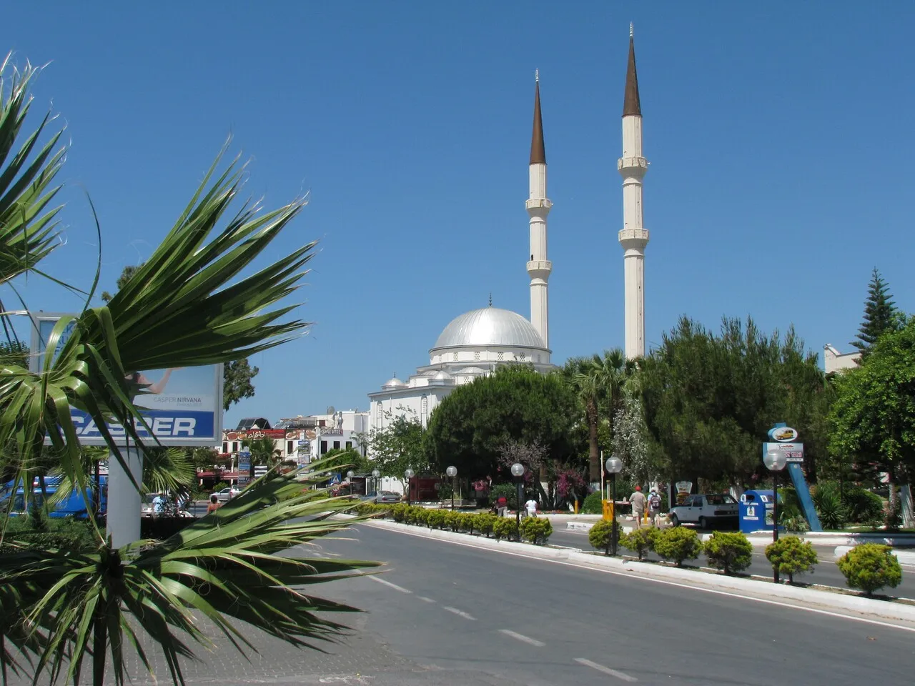
- Population
- 16,490
- 16.5K
- Elevation
- 18 m
- above sea level
- Local time
- UTC+03:00
- Europe/Istanbul · UTC+03:00
- Airports
- KGS Kos International Airport "Ippokratis"29 km
- BJV Milas Bodrum International Airport44 km
About Turgutreis
Turgutreis is a town. Location: Bodrum, Muğla Province. Population: 16,490. Elevation: 18 m.
Turgutreis is a neighbourhood of the municipality and district of Bodrum, Muğla Province, Turkey. Its population is 6,041 (2022). Before the 2013 reorganisation, it was a town (belde). It is the second largest town on the Bodrum peninsula. The town is a popular holiday destination with 5 kilometres of sandy beaches, waterfront restaurants and bars, and is considered a resort town. The town is named after the Ottoman admiral Turgut Reis who was born there in 1485.
Source: Wikipedia · CC BY-SA 4.0
Photos of Turgutreis
-

Tanya Dedyukhina · CC BY 3.0 -

Tanya Dedyukhina · CC BY 3.0 -

Tanya Dedyukhina · CC BY 3.0


Travel notes for Turgutreis
From Wikivoyage
Turgutreis is a resort in the Southern Aegean region of Turkey. It's on the west coast of the peninsula beyond Bodrum, and is the largest of the outlying resorts associated with that city. Its population is no longer separately enumerated but is probably close to the 20,705 recorded in 2013. This page covers the west coast strip from Turgutreis south to Akyarlar, while Gümüşlük the next resort north is described on its own page.
Understand+
"They have dared the white republics up the cape of Italy, they have dashed the Adriatic round the lion of the sea . . . "
That poem Lepanto by GK Chesterton commemorates the sea battle of 1571 when a western fleet checked Ottoman expansion in the Med, and the balance of power on land swung towards Austria-Hungary. But in the preceding decades, that expansion was swift and inexorable, and the outstanding Ottoman navy commander was Turgut Reis (1485-1565), also known as Dragut or Torghoud. He was born here in Karatoprak, and was all of 12 when his talent was spotted. He had a glittering career but was fatally wounded during the siege of Malta. He gives his name to several Turkish ships, such as the frigate F-241, and in 1972 Karatoprak was renamed Turgutreis in his honour.
It's possible that his family were Greek Christians, but the Ottomans captured Bodrum in 1522 and the area became Islamic. (Bodrum's previous holders, the Knights Hospitaller, scuttled off to Malta without battle but resisted the later siege there.) These bays and coves then became a sleepy backwater for the next 400 years, until the even swifter inexorable advance of western tourism. Within a few years hotels, apartment blocks and city-dwellers' holiday homes encrusted the coast. One famous resident was the artist Burhan Doğançay (1929-2013) who divided his last years between New York and Turgutreis. His artistic schtick was about walls as mirrors and emblems of urban life, and there were enough here to satisfy him.
Get in+
Long-distance travel is via Bodrum at the pinch-point on the peninsula. This is 35 km from Milas-Bodrum Airport (BJV IATA) and has buses from Istanbul (11 hr), Izmir (3 hr) and other cities. These arrive at Yeni Otogar, the new bus station 5 km northeast of the city, and terminus for local buses.
Bus 2-34 runs from Yeni Otogar to downtown Bodrum, Gürece, İslamhaneleri, Akçaalan and Turgutreis, every ten minutes daily 07:00-00:00.
Bus 2-4 runs from Yeni Otogar to downtown Bodrum, Konacık, Gürece, Bağla and Akyarlar at the south tip of the peninsula, M-Sa hourly 08:00-19:00.
By road follow D330 west past Bodrum. For Akyarlar you could also wind along the south coast road, which is narrow but tarmac.
Ferries no longer sail to Turgutreis from the Greek islands of Kos, Kalymnos or Leros. Use the Greek ferry network to reach Kos then take the fast catamaran to Bodrum.
With your own boat, Turgutreis is not a Port of Entry into Turkey so if you arrive from Greek waters, you need to sail first to Bodrum to clear immigration and customs. Both sides are vigilant for small craft dodging across the border and up to no good.
Source: Wikivoyage · CC BY-SA 4.0 · abridged
Climate of Turgutreis
Best months for sightseeingBest months for sightseeing: April–May, October–November.
This month · November
A good month to visit
Day 20° · Night 12° · Rain 89 mm
- Hottest month
- July (day 34°)
- Coldest month
- January (night 8°)
- Wettest month
- January (157 mm)
- Driest month
- July (2 mm)
Bars: average monthly low and high temperature. Below: precipitation. Monthly averages for 1970–2000 at about 18 km resolution, adjusted for elevation. Highlighted months are mild and relatively dry. Source: WorldClim 2.1 (CC BY 4.0).
Show values as a table
| Month | Jan | Feb | Mar | Apr | May | Jun | Jul | Aug | Sep | Oct | Nov | Dec |
|---|---|---|---|---|---|---|---|---|---|---|---|---|
| Average high (°C) | 15° | 15° | 17° | 21° | 26° | 31° | 34° | 33° | 30° | 25° | 20° | 16° |
| Average low (°C) | 8° | 8° | 10° | 12° | 16° | 20° | 23° | 23° | 20° | 16° | 12° | 10° |
| Precipitation (mm) | 157 | 118 | 80 | 37 | 17 | 8 | 2 | 5 | 17 | 46 | 89 | 157 |
Other places to visit in this season: April May October November
How to get to Turgutreis
The nearest airport is Kos International Airport "Ippokratis" (KGS), 29 km to the southwest as the crow flies. The nearest large city is Aydin, 105 km to the northeast.
Airports
- Kos International Airport "Ippokratis" (KGS) Kos Island 29 kmsouthwest
- Milas Bodrum International Airport (BJV) Bodrum 44 kmnortheast
- Samos Airport (SMI) Samos Island 81 kmnorthwest
Nearby large cities
- Aydin Population: 163K 105 kmnortheast
- Nazilli Population: 119.4K 137 kmnortheast
- Karabağlar Population: 479.3K 152 kmnorth
- Konak Population: 332.3K 154 kmnorth
- Izmir Population: 2.9M 155 kmnorth
Straight-line distances; road distances are longer. Airport data: OurAirports.
Day trips from Turgutreis
Within 100 km: 72 historic and cultural sites, 172 natural sites, 188 lakes, rivers and coasts.
0–25 km66 places
- Nisída Krevvatió Island 15 kmSW
- Gümbet Plajı Beach 12 kmE
- Bardakçı Plajı Beach 14 kmE
- Paşatarlası Plajı Beach 16 kmE
25–60 km121 places
- Iasos Historic site 41 kmNE
- Taşlık Plajı Beach 50 kmSE
- Kumluk Plajı Beach 49 kmSE
- Hastanealtı Plajı Beach 49 kmSE
60–100 km245 places
- Moní Megális Panagías Attraction 84 kmNW
- Kadınlar Plajı Beach 92 kmN
- Uzunyalı Plajı Beach 90 kmE
- Yediadalar Island 70 kmE
Straight-line distances.
Nearby attractions & nature
Everything nearby-
Ezeden Dağı Mountain, Bodrum4 km S
-
Pitta Adası Island, Muğla Province2.6 km NW
-
Çatal Adası Island, Muğla Province4.1 km W
-
Hüseyin Burnu Feneri Landmark, Bodrum5.7 km S
-
Tüllüce Adası Island, Muğla Province4.7 km SW
-
Sariot Adası Island, Muğla Province4.7 km SW
-
Çobanada Island, Muğla Province6 km SW
-
Pazar Dağı Mountain, Bodrum9.3 km NE
Sources & licences
Data last updated: · 2 independent sources