
- Elevation
- 145 m
- above sea level
- Local time
- UTC+03:00
- Europe/Istanbul · UTC+03:00
- Airports
- DLM Dalaman International Airport30 km
- RHO Rhodes International Airport "Diagoras"92 km
About Kayaköy
Kayaköy is a village. Location: Fethiye, Muğla Province. Elevation: 145 m.
Kayaköy (also: Kaya or Livissi) is a neighbourhood of the municipality and district of Fethiye, Muğla Province, Turkey. In 2022, its population was 975. Situated 8 kilometres (5.0 mi) south of Fethiye, it is mostly abandoned. It was anciently known in Greek as Karmylessos (Ancient Greek: Καρμυλησσός), shortened to Lebessos (Ancient Greek: Λεβέσσος) and pronounced in Modern Greek as Leivissi (Greek: Λειβίσσι).
Source: Wikipedia · CC BY-SA 4.0
Photos of Kayaköy
-
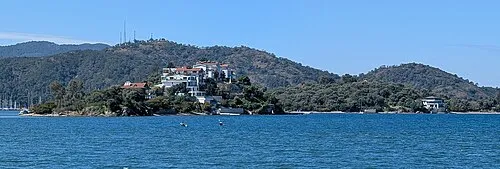
Cavaliere Island Vano111ru · CC BY-SA 4.0

Climate of Kayaköy
Best months for sightseeingBest months for sightseeing: April–May, October.
This month · November
A wet month
Day 20° · Night 11° · Rain 110 mm
Better nearby cities in November
- Aydin · 179 km northwest19°
- Alanya · 260 km east21°
- Hottest month
- July (day 33°)
- Coldest month
- January (night 7°)
- Wettest month
- December (185 mm)
- Driest month
- August (5 mm)
Bars: average monthly low and high temperature. Below: precipitation. Monthly averages for 1970–2000 at about 18 km resolution, adjusted for elevation. Highlighted months are mild and relatively dry. Source: WorldClim 2.1 (CC BY 4.0).
Show values as a table
| Month | Jan | Feb | Mar | Apr | May | Jun | Jul | Aug | Sep | Oct | Nov | Dec |
|---|---|---|---|---|---|---|---|---|---|---|---|---|
| Average high (°C) | 14° | 15° | 17° | 21° | 25° | 30° | 33° | 33° | 30° | 25° | 20° | 16° |
| Average low (°C) | 7° | 7° | 8° | 11° | 15° | 19° | 22° | 22° | 19° | 15° | 11° | 8° |
| Precipitation (mm) | 177 | 136 | 82 | 42 | 26 | 10 | 6 | 5 | 18 | 63 | 110 | 185 |
How to get to Kayaköy
The nearest airport is Dalaman International Airport (DLM), 30 km to the northwest as the crow flies. The nearest large city is Denizli, 132 km to the north.
Airports
- Dalaman International Airport (DLM) Dalaman 30 kmnorthwest
- Rhodes International Airport "Diagoras" (RHO) Rhodes 92 kmwest
- Çardak Airport (DNZ) Denizli 144 kmnorth
Nearby large cities
- Denizli Population: 313.2K 132 kmnorth
- Merkezefendi Population: 280.3K 136 kmnorth
- Antalya Population: 1.3M 148 kmeast
- Muratpaşa Population: 450K 154 kmeast
- Nazilli Population: 119.4K 163 kmnorthwest
Straight-line distances; road distances are longer. Airport data: OurAirports.
Day trips from Kayaköy
Within 100 km: 29 historic and cultural sites, 324 natural sites, 256 lakes, rivers and coasts.
0–25 km52 places
- Çalış Beach Beach 9 kmN
- Ölüdeniz Plajı Beach 5 kmSE
- Kidrak Beach Beach 7 kmSE
- Kabak Beach Beach 14 kmS
25–60 km179 places
- Öksüz Adası Island 55 kmSE
- Rothea Island Island 30 kmW
- Heybeli Ada Island 52 kmSE
- Boğazcık Adası Island 52 kmSE
60–100 km378 places
- Uzunyalı Plajı Beach 80 kmW
- Yediadalar Island 99 kmW
- Uzun Ada Island 98 kmW
- Tavşan Adası Island 94 kmW
Straight-line distances.
Nearby attractions & nature
Everything nearby-
Kara Dağ Mountain, Fethiye2.3 km SW
-
Belen Dağı Mountain, Fethiye4.3 km NW
-
Levisi Bay Natural site, Muğla Province2.9 km S
-
Saint Nikolo Island Island, Muğla Province3.5 km SW
-
Ölüdeniz Plajı Beach, Fethiye5 km SE
-
Oyuk Tepe Mountain, Fethiye5.8 km N
Sources & licences
Data last updated: · 2 independent sources