- Elevation
- 107 m
- above sea level
- Local time
- UTC+03:00
- Europe/Istanbul · UTC+03:00
- Airports
- BJV Milas Bodrum International Airport6 km
- KGS Kos International Airport "Ippokratis"67 km
About Kemikler
Kemikler is a village. Location: Milas, Muğla Province. Elevation: 107 m. The best months to visit are April–May, October–November. The nearest airport is Milas Bodrum International Airport (6 km). Nearby sights include Asar Tepesi and Iasos.
Climate of Kemikler
Best months for sightseeingBest months for sightseeing: April–May, October–November.
This month · November
A good month to visit
Day 19° · Night 11° · Rain 92 mm
- Hottest month
- July (day 34°)
- Coldest month
- January (night 6°)
- Wettest month
- December (157 mm)
- Driest month
- July (4 mm)
Bars: average monthly low and high temperature. Below: precipitation. Monthly averages for 1970–2000 at about 18 km resolution, adjusted for elevation. Highlighted months are mild and relatively dry. Source: WorldClim 2.1 (CC BY 4.0).
Show values as a table
| Month | Jan | Feb | Mar | Apr | May | Jun | Jul | Aug | Sep | Oct | Nov | Dec |
|---|---|---|---|---|---|---|---|---|---|---|---|---|
| Average high (°C) | 14° | 15° | 17° | 21° | 26° | 31° | 34° | 33° | 30° | 25° | 19° | 15° |
| Average low (°C) | 6° | 7° | 8° | 11° | 15° | 19° | 22° | 21° | 18° | 15° | 11° | 8° |
| Precipitation (mm) | 152 | 118 | 80 | 42 | 24 | 12 | 4 | 5 | 17 | 46 | 92 | 157 |
Other places to visit in this season: April May October November
How to get to Kemikler
The nearest airport is Milas Bodrum International Airport (BJV), 6 km to the north as the crow flies. The nearest large city is Aydin, 74 km to the north.
Airports
- Milas Bodrum International Airport (BJV) Bodrum 6 kmnorth
- Kos International Airport "Ippokratis" (KGS) Kos Island 67 kmsouthwest
- Samos Airport (SMI) Samos Island 86 kmnorthwest
Nearby large cities
- Aydin Population: 163K 74 kmnorth
- Nazilli Population: 119.4K 99 kmnortheast
- Merkezefendi Population: 280.3K 140 kmnortheast
- Karabağlar Population: 479.3K 140 kmnorth
- Denizli Population: 313.2K 142 kmnortheast
Straight-line distances; road distances are longer. Airport data: OurAirports.
Day trips from Kemikler
Within 100 km: 95 historic and cultural sites, 248 natural sites, 240 lakes, rivers and coasts.
0–25 km43 places
- Iasos Historic site 11 kmNW
- Yıldız Adaları Island 24 kmS
- Ufak Ada Island 13 kmW
- Salih Adası Island 13 kmW
25–60 km227 places
- Nisída Krevvatió Island 54 kmSW
- Gümbet Plajı Beach 29 kmSW
- Bardakçı Plajı Beach 28 kmSW
- Paşatarlası Plajı Beach 27 kmSW
60–100 km313 places
- Moní Megális Panagías Attraction 91 kmNW
- Kadınlar Plajı Beach 81 kmNW
- Uzunyalı Plajı Beach 66 kmSE
- Uzun Ada Island 61 kmSE
Straight-line distances.
Nearby attractions & nature
Everything nearby-
Asar Tepesi Mountain, Milas3.3 km SE
-
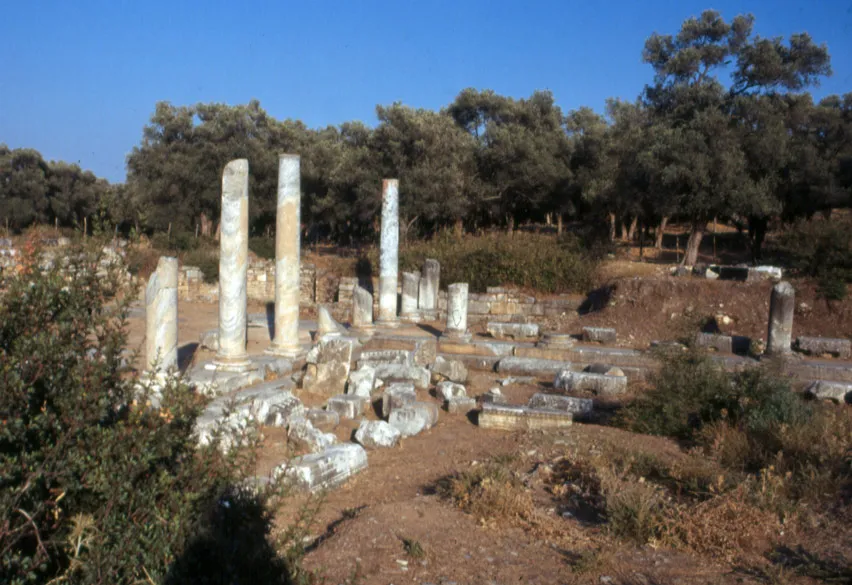 Iasos Historic site, Milas11 km NW
-
Güllük Limanı Natural site, Muğla Province6.6 km NW
-
Karaoğlan Dağı Mountain, Milas12 km N
-
Yusufca Deresi River, Muğla Province8.2 km N
-
Yılan Adası Island, Muğla Province9.3 km W
Sources & licences
Data last updated: