- Elevation
- 1,330 m
- above sea level
- Local time
- UTC+03:00
- Europe/Istanbul · UTC+03:00
- Airports
- VAS Sivas Nuri Demirağ Airport72 km
- TJK Tokat Airport126 km
About Acısu Irmağı
Acısu Irmağı is a river. Location: Sivas Province, Turkey. The best months to visit are June–September. The nearest airport is Sivas Nuri Demirağ Airport (72 km). Nearby sights include Şemlik Deresi and Pirköçek Irmağı.
Climate of Acısu Irmağı
Best months for sightseeingBest months for sightseeing: June–September.
This month · November
A cold month
Day 11° · Night 0° · Rain 48 mm
Better nearby cities in November
- Suruç · 327 km south20°
- Osmaniye · 336 km southwest21°
- Viranşehir · 342 km southeast18°
- Hottest month
- August (day 28°)
- Coldest month
- January (night -7°)
- Wettest month
- May (76 mm)
- Driest month
- July (10 mm)
Bars: average monthly low and high temperature. Below: precipitation. Monthly averages for 1970–2000 at about 18 km resolution, adjusted for elevation. Highlighted months are mild and relatively dry. Source: WorldClim 2.1 (CC BY 4.0).
Show values as a table
| Month | Jan | Feb | Mar | Apr | May | Jun | Jul | Aug | Sep | Oct | Nov | Dec |
|---|---|---|---|---|---|---|---|---|---|---|---|---|
| Average high (°C) | 1° | 3° | 8° | 15° | 20° | 24° | 28° | 28° | 25° | 18° | 11° | 4° |
| Average low (°C) | -7° | -5° | -1° | 4° | 7° | 10° | 12° | 12° | 8° | 5° | 0° | -4° |
| Precipitation (mm) | 47 | 44 | 53 | 73 | 76 | 42 | 10 | 10 | 18 | 41 | 48 | 55 |
Other places to visit in this season: June July August September
How to get to Acısu Irmağı
The nearest airport is Sivas Nuri Demirağ Airport (VAS), 72 km to the west as the crow flies. The nearest large city is Sivas, 63 km to the west.
Airports
- Sivas Nuri Demirağ Airport (VAS) Sivas 72 kmwest
- Tokat Airport (TJK) Tokat 126 kmnorthwest
- Ordu–Giresun Airport (OGU) Ordu 126 kmnorth
Nearby large cities
- Sivas Population: 264K 63 kmwest
- Tokat Province Population: 129.7K 113 kmnorthwest
- Ordu Population: 229.2K 124 kmnorth
- Giresun Population: 125.7K 129 kmnortheast
- Erzincan Population: 150.7K 151 kmeast
Straight-line distances; road distances are longer. Airport data: OurAirports.
Day trips from Acısu Irmağı
Within 100 km: 8 historic and cultural sites, 211 natural sites, 245 lakes, rivers and coasts.
0–25 km17 places
- Kuru Göl Lake 21 kmSW
- Tötürge Gölü Lake 12 kmW
- Ziyarettepeleri | Çobanevliyası Mountain 18 kmSE
- Yağsıyan Tepe Mountain 12 kmSE
25–60 km124 places
- Büyük Göl Lake 31 kmW
- Kılıçkaya Barajı Lake 59 kmNE
- Ziyaret Tepesi Mountain 58 kmS
- Büyük Yılanlı Dağı Mountain 53 kmSW
60–100 km323 places
- Kuşaklı Historic site 94 kmSW
- Palat Gölü Lake 85 kmSE
- Aşağıtepecik Gölü Lake 75 kmE
- Serpincik Göleti Lake 71 kmW
Straight-line distances.
Nearest towns and villages
-
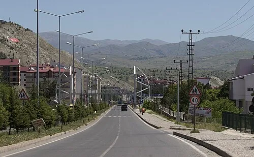 Zara City, Zara4.1 km NE
-
Kadriye Village, Zara1.4 km W
-
Tekke Village, Zara1.8 km SE
-
Zara Bucağı Municipality, Sivas Province3.6 km N
-
Mahmutağa Çiftliği Village, Zara6.9 km SW
-
Ekinli Village, Zara6.6 km W
Nearby attractions & nature
Everything nearby-
Şemlik Deresi River, Sivas Province9.2 km S
-
Pirköçek Irmağı River, Sivas Province12 km S
-
Yağsıyan Tepe Mountain, Zara12 km SE
-
Kırınbaşı Tepesi Mountain, Zara20 km N
-
Çotuk Deresi River, Sivas Province11 km NE
-
Kaşkaya Tepesi Mountain, Zara24 km N
-
Tuzlasuyu Deresi River, Sivas Province15 km SW
-
Tötürge Gölü Lake, Sivas Province12 km W
Sources & licences
Data last updated: