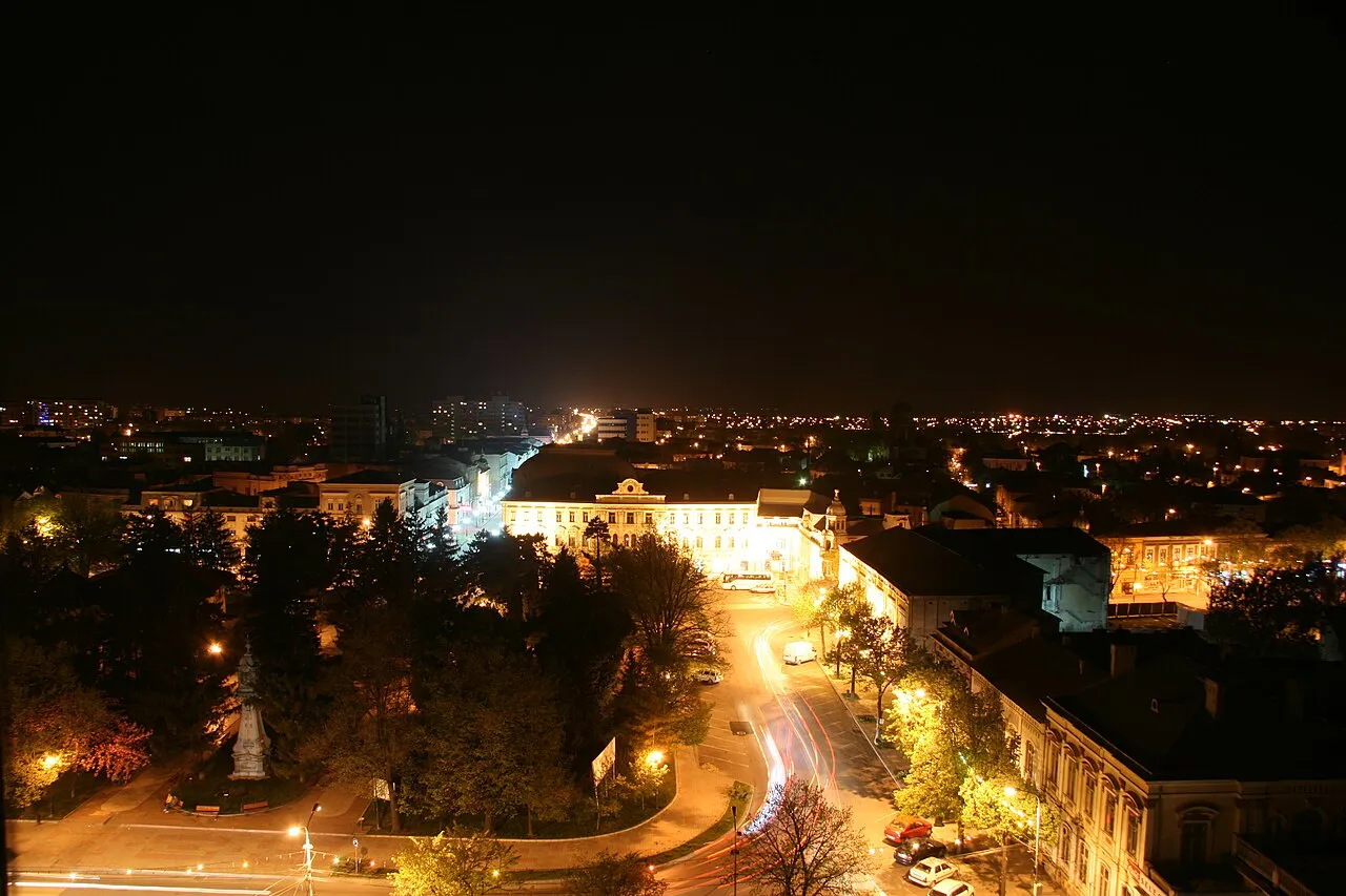
- Population
- 154,686
- 154.7K
- Elevation
- 22 m
- above sea level
- Local time
- UTC+02:00
- Europe/Bucharest · UTC+02:00
- Airports
- CND Mihail Kogălniceanu International Airport109 km
- BCM Bacău George Enescu International Airport162 km
About Brăila
Brăila is a city. Location: Municipiul Brãila, Brăila County. Population: 154,686. Elevation: 22 m. The best months to visit are May, September. The nearest airport is Mihail Kogălniceanu International Airport (109 km). Nearby sights include Valea Jijilei and Valea Grecilor.
Photos of Brăila
-

Ioan Cepaliga · CC BY 3.0 -

Ioan Cepaliga · CC BY 3.0 -

Josep Lluis Pellicer / Enrique Alba · Public domain -

Wikimedia Commons · Public domain -

Andymxm · CC BY-SA 4.0


Travel notes for Brăila
From Wikivoyage
Brăila is a port city on the Danube river in southeastern Romania. The city is situated on the Wallachian Plain.
Get in+
By train:
There are 6 trains daily (two Intercity type, three Rapid and one Accelerat) from Bucharest.
1 Brăila railway station (Gara Brăila), Strada General Eremia Grigorescu 1. (updated Jul 2021)
Source: Wikivoyage · CC BY-SA 4.0 · abridged
Climate of Brăila
Best months for sightseeingBest months for sightseeing: May, September.
This month · November
A cold month
Day 9° · Night 1° · Rain 35 mm
- Hottest month
- July (day 29°)
- Coldest month
- January (night -5°)
- Wettest month
- June (64 mm)
- Driest month
- January (23 mm)
Bars: average monthly low and high temperature. Below: precipitation. Monthly averages for 1970–2000 at about 18 km resolution, adjusted for elevation. Highlighted months are mild and relatively dry. Source: WorldClim 2.1 (CC BY 4.0).
Show values as a table
| Month | Jan | Feb | Mar | Apr | May | Jun | Jul | Aug | Sep | Oct | Nov | Dec |
|---|---|---|---|---|---|---|---|---|---|---|---|---|
| Average high (°C) | 2° | 4° | 9° | 17° | 23° | 26° | 29° | 28° | 23° | 17° | 9° | 3° |
| Average low (°C) | -5° | -4° | 0° | 6° | 11° | 15° | 17° | 16° | 12° | 6° | 1° | -3° |
| Precipitation (mm) | 23 | 27 | 29 | 38 | 51 | 64 | 49 | 44 | 43 | 31 | 35 | 30 |
How to get to Brăila
The nearest airport is Mihail Kogălniceanu International Airport (CND), 109 km to the south as the crow flies. The nearest large city is Galati, 19 km to the north.
Airports
- Mihail Kogălniceanu International Airport (CND) Constanța 109 kmsouth
- Bacău George Enescu International Airport (BCM) Bacău 162 kmnorthwest
- Bucharest Henri Coandă International Airport (OTP) Otopeni 167 kmsouthwest
Nearby large cities
- Galati Population: 217.9K 19 kmnorth
- Buzău Population: 103.5K 91 kmwest
- Constanța Population: 317.8K 132 kmsoutheast
- Ploieşti Population: 180.5K 158 kmwest
- Bacau Population: 136.1K 166 kmnorthwest
Straight-line distances; road distances are longer. Airport data: OurAirports.
Day trips from Brăila
Within 100 km: 3 historic and cultural sites, 15 natural sites, 2 lakes, rivers and coasts.
0–25 km3 places
- Valea Jijilei Natural site 18 kmE
- Valea Grecilor Natural site 20 kmE
- Lozova River 22 kmNW
25–60 km1 place
- Valea Capaclia Natural site 38 kmE
60–100 km16 places
- Valea Petroasa Natural site 88 kmNW
- Valea Ograda Natural site 80 kmSW
- Valea Băneasa Natural site 85 kmN
- Valea Tulcei Natural site 76 kmE
Straight-line distances.
Brăila and similar cities
Side by side with cities of similar size in the same country: population, elevation and climate.
| Measure | Brăila | Arad | Piteşti | Bacau |
|---|---|---|---|---|
| Population | 154.7K | 169.1K | 141.3K | 136.1K |
| Elevation | 22 m | 109 m | 307 m | 165 m |
| Summer day (hottest month) | 29° | 28° | 27° | 27° |
| Winter night (coldest month) | -5° | -5° | -5° | -6° |
| Annual rainfall | 464 mm | 571 mm | 605 mm | 534 mm |
| Best months | May, Sep | May–Jun, Sep | May–Jun, Sep | May–Sep |
| Distance | — | 528 km | 249 km | 166 km |
Climate values are 1970–2000 monthly averages; straight-line distance.
Nearby attractions & nature
Everything nearby-
Valea Jijilei Natural site, Romania18 km E
-
Valea Grecilor Natural site, Romania20 km E
-
Lozova River, Galați County22 km NW
Sources & licences
Data last updated: