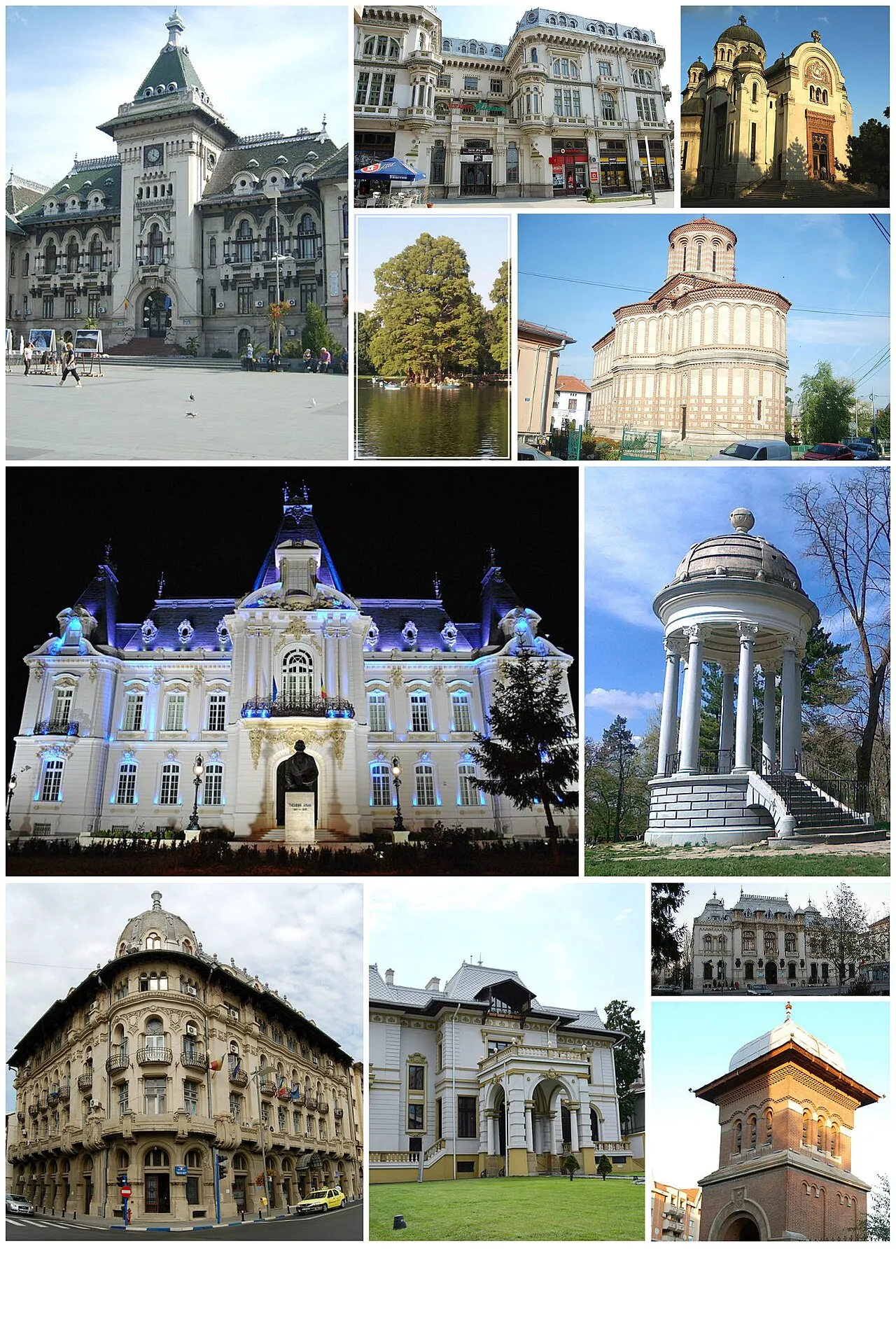
- Population
- 234,140
- 234.1K
- Elevation
- 105 m
- above sea level
- Local time
- UTC+02:00
- Europe/Bucharest · UTC+02:00
- Airports
- CRA Craiova International Airport7 km
- SBZ Sibiu International Airport165 km
About Craiova
Craiova is a city. Location: Municipiul Craiova, Dolj County. Population: 234,140. Elevation: 105 m. The best months to visit are May, September. The nearest airport is Craiova International Airport (7 km). Nearby sights include Valea Jiului and Valea Lânga.
Photos of Craiova
-

Marines from Arlington, VA, United States · Public domain -

kossxtreeme · CC BY-SA 3.0 -

Alessandro Galantucci · CC BY 3.0 -

Diridam · CC0 -

Unic Bogdan · CC0


).jpg)


Travel notes for Craiova
From Wikivoyage
Craiova with 306,000 inhabitants (2016), is one of the five largest cities of Romania. Craiova is in the southwestern region of the country and hosts the administrative buildings of the Dolj County and of the Oltenia district.
Get in+
1 Craiova International Airport (CRA IATA). Flights from Birmingham, Bologna, Charleroi, London-Luton, Milan-Bergamo and Rome, provided by Wizz Air. There are no domestic flights. (updated Mar 2024)
Or fly into Henri Coanda Aeroport in Bucharest and then go by train to Craiova, which takes 3 hours.
2 Craiova railway station. There are 17 trains daily from Bucharest (3 hr 15 min, €12), 8 from Timişoara (7 hr, €20), two from Sibiu and one from Cluj Napoca. Online timetables and prices can be found here. The conditions in Accelerat trains are the same as those in Rapid or Intercity, but the price is lower. (updated Apr 2023)
Autogara Nord the bus station is next to the railway station. Maxitaxis leave from there to Bucharest (30-35 lei, every 30 minutes), Piteşti (15 lei, two daily), Calafat (10-15 lei, at least two daily). Also some rural routes from here.
Oz Murat travel agency outside the bus station runs a bus to Istanbul via Bucharest, departing at 10:30 daily, except Saturday (€90 return).
Source: Wikivoyage · CC BY-SA 4.0 · abridged
Climate of Craiova
Best months for sightseeingBest months for sightseeing: May, September.
This month · November
A cold month
Day 9° · Night 1° · Rain 48 mm
- Hottest month
- July (day 29°)
- Coldest month
- January (night -4°)
- Wettest month
- June (73 mm)
- Driest month
- January (34 mm)
Bars: average monthly low and high temperature. Below: precipitation. Monthly averages for 1970–2000 at about 18 km resolution, adjusted for elevation. Highlighted months are mild and relatively dry. Source: WorldClim 2.1 (CC BY 4.0).
Show values as a table
| Month | Jan | Feb | Mar | Apr | May | Jun | Jul | Aug | Sep | Oct | Nov | Dec |
|---|---|---|---|---|---|---|---|---|---|---|---|---|
| Average high (°C) | 3° | 5° | 11° | 18° | 23° | 27° | 29° | 29° | 24° | 17° | 9° | 4° |
| Average low (°C) | -4° | -3° | 1° | 6° | 11° | 15° | 16° | 16° | 12° | 6° | 1° | -3° |
| Precipitation (mm) | 34 | 36 | 39 | 50 | 68 | 73 | 63 | 45 | 39 | 42 | 48 | 43 |
How to get to Craiova
The nearest airport is Craiova International Airport (CRA), 7 km to the east as the crow flies. The nearest large city is Piteşti, 103 km to the northeast.
Airports
- Craiova International Airport (CRA) Craiova 7 kmeast
- Sibiu International Airport (SBZ) Sibiu 165 kmnorth
- Sofia Airport (SOF) Sofia 183 kmsouth
Nearby large cities
- Piteşti Population: 141.3K 103 kmnortheast
- Sibiu Population: 134.3K 167 kmnorth
- Rousse Population: 121.2K 180 kmeast
- Sofia Population: 1.2M 184 kmsouth
- Ploieşti Population: 180.5K 189 kmnortheast
Straight-line distances; road distances are longer. Airport data: OurAirports.
Day trips from Craiova
Within 100 km: 1 historic or cultural site, 82 natural sites, 4 lakes, rivers and coasts.
0–25 km8 places
- Valea Leului Natural site 15 kmS
- Valea Petroaia Natural site 16 kmNW
- Valea Frasinului Natural site 22 kmW
- Valea Ungurenilor Natural site 20 kmNE
25–60 km27 places
- Valea Prisăceaua Natural site 59 kmW
- Valea Potopinului Natural site 40 kmE
- Valea Plăvaia Natural site 58 kmN
- Valea Pietroasa Natural site 40 kmNE
60–100 km52 places
- Valea Răchita Natural site 62 kmN
- Valea Purcărelul Natural site 64 kmNW
- Valea Pârâului Natural site 71 kmN
- Valea Olteanul Natural site 93 kmNW
Straight-line distances.
Craiova and similar cities
Side by side with cities of similar size in the same country: population, elevation and climate.
| Measure | Craiova | Timișoara | Galati | Brasov |
|---|---|---|---|---|
| Population | 234.1K | 250.8K | 217.9K | 253.2K |
| Elevation | 105 m | 96 m | 24 m | 573 m |
| Summer day (hottest month) | 29° | 28° | 28° | 23° |
| Winter night (coldest month) | -4° | -4° | -5° | -6° |
| Annual rainfall | 580 mm | 589 mm | 469 mm | 636 mm |
| Best months | May, Sep | May–Jun, Sep | May, Sep | Jun–Sep |
| Distance | — | 258 km | 358 km | 205 km |
Climate values are 1970–2000 monthly averages; straight-line distance.
Nearby attractions & nature
Everything nearby-
Valea Jiului Natural site, Romania3.2 km NE
-
Valea Lânga Natural site, Romania16 km E
-
Valea Petroaia Natural site, Romania16 km NW
-
Valea Leului Natural site, Romania15 km S
-
Valea Ungurenilor Natural site, Romania20 km NE
-
Valea Strâmba Natural site, Romania21 km NE
-
Valea Frasinului Natural site, Romania22 km W
-
Valea Brabova Natural site, Romania25 km W
Sources & licences
Data last updated: