Armășeni
Located in Comuna Ciucsângeorgiu, Harghita County Coordinates: 46°21′13″ N 25°57′38″ E
- Population
- 726
- 726
- Elevation
- 814 m
- above sea level
- Local time
- UTC+02:00
- Europe/Bucharest · UTC+02:00
- Airports
- BCM Bacău George Enescu International Airport75 km
- GHV Brașov-Ghimbav International Airport80 km
About Armășeni
Armășeni is a village. Location: Comuna Ciucsângeorgiu, Harghita County. Population: 726. Elevation: 814 m. The best months to visit are June–August. The nearest airport is Bacău George Enescu International Airport (75 km). Nearby sights include Jigodin and Pădurea Bradului.
Climate of Armășeni
Best months for sightseeingBest months for sightseeing: June–August.
This month · November
A cold month
Day 5° · Night -4° · Rain 24 mm
- Hottest month
- July (day 22°)
- Coldest month
- January (night -9°)
- Wettest month
- June (96 mm)
- Driest month
- January (23 mm)
Bars: average monthly low and high temperature. Below: precipitation. Monthly averages for 1970–2000 at about 18 km resolution, adjusted for elevation. Highlighted months are mild and relatively dry. Source: WorldClim 2.1 (CC BY 4.0).
Show values as a table
| Month | Jan | Feb | Mar | Apr | May | Jun | Jul | Aug | Sep | Oct | Nov | Dec |
|---|---|---|---|---|---|---|---|---|---|---|---|---|
| Average high (°C) | -1° | 0° | 5° | 12° | 17° | 21° | 22° | 22° | 17° | 12° | 5° | 0° |
| Average low (°C) | -9° | -9° | -5° | 1° | 6° | 9° | 10° | 9° | 5° | 1° | -4° | -7° |
| Precipitation (mm) | 23 | 24 | 28 | 48 | 70 | 96 | 89 | 72 | 44 | 33 | 24 | 29 |
How to get to Armășeni
The nearest airport is Bacău George Enescu International Airport (BCM), 75 km to the east as the crow flies. The nearest large city is Piatra Neamţ, 69 km to the northeast.
Airports
- Bacău George Enescu International Airport (BCM) Bacău 75 kmeast
- Brașov-Ghimbav International Airport (GHV) Brașov (Ghimbav) 80 kmsouthwest
- Târgu Mureş Transilvania International Airport (TGM) Recea 120 kmwest
Nearby large cities
- Piatra Neamţ Population: 102.7K 69 kmnortheast
- Bacau Population: 136.1K 77 kmeast
- Brasov Population: 253.2K 83 kmsouth
- Târgu Mureş Population: 212.8K 110 kmwest
- Buzău Population: 103.5K 150 kmsoutheast
Straight-line distances; road distances are longer. Airport data: OurAirports.
Day trips from Armășeni
Within 100 km: 228 natural sites, 1 lake, river or coast.
0–25 km15 places
- Ciuc Mountain 22 kmSW
- Ciomatul Mare Mountain 25 kmS
- Tetele Mountain 24 kmS
- Lazaresti Mountain 23 kmS
25–60 km86 places
- Bodos Mountain 57 kmS
- Motilor Mountain 56 kmSW
- Piatra Mare Mountain 58 kmSW
- La Movile Mountain 51 kmSW
60–100 km128 places
- Valea Orbicului Natural site 69 kmNE
- Valea Nirajului Natural site 89 kmW
- Valea Chiherului Natural site 93 kmNW
- Valea Bicaz Natural site 62 kmN
Straight-line distances.
Nearby attractions & nature
Everything nearby-
Jigodin Mountain, Municipiul Miercurea Ciuc17 km W
-
Pădurea Bradului Mountain, Municipiul Miercurea Ciuc15 km W
-
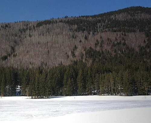 Ciomatul Mare Mountain, Comuna Cozmeni25 km S
-
Dealul Fagului Mountain, Municipiul Miercurea Ciuc18 km W
-
Haramul Mare Mountain, Comuna Tuşnad23 km S
-
Lazaresti Mountain, Comuna Plãieşii De Jos23 km S
Sources & licences
Data last updated: