- Population
- 12,761
- 12.8K
- Elevation
- 7 m
- above sea level
- Local time
- UTC+02:00
- Europe/Bucharest · UTC+02:00
- Airports
- CND Mihail Kogălniceanu International Airport73 km
- OTP Bucharest Henri Coandă International Airport124 km
About Ţăndărei
Ţăndărei is a town. Location: Oraş Ţãndãrei, Ialomița County. Population: 12,761. Elevation: 7 m. The best months to visit are May, September. The nearest airport is Mihail Kogălniceanu International Airport (73 km). Nearby sights include Valea Ograda and Valea Strachina.
Climate of Ţăndărei
Best months for sightseeingBest months for sightseeing: May, September.
This month · November
A cold month
Day 9° · Night 1° · Rain 40 mm
- Hottest month
- July (day 29°)
- Coldest month
- January (night -4°)
- Wettest month
- June (61 mm)
- Driest month
- January (24 mm)
Bars: average monthly low and high temperature. Below: precipitation. Monthly averages for 1970–2000 at about 18 km resolution, adjusted for elevation. Highlighted months are mild and relatively dry. Source: WorldClim 2.1 (CC BY 4.0).
Show values as a table
| Month | Jan | Feb | Mar | Apr | May | Jun | Jul | Aug | Sep | Oct | Nov | Dec |
|---|---|---|---|---|---|---|---|---|---|---|---|---|
| Average high (°C) | 2° | 5° | 10° | 17° | 23° | 27° | 29° | 29° | 24° | 18° | 9° | 4° |
| Average low (°C) | -4° | -3° | 1° | 6° | 11° | 15° | 17° | 16° | 12° | 6° | 1° | -3° |
| Precipitation (mm) | 24 | 26 | 31 | 41 | 51 | 61 | 46 | 44 | 43 | 34 | 40 | 30 |
How to get to Ţăndărei
The nearest airport is Mihail Kogălniceanu International Airport (CND), 73 km to the southeast as the crow flies. The nearest large city is Brăila, 74 km to the north.
Airports
- Mihail Kogălniceanu International Airport (CND) Constanța 73 kmsoutheast
- Bucharest Henri Coandă International Airport (OTP) Otopeni 124 kmwest
- Bucharest Băneasa Aurel Vlaicu International Airport (BBU) Bucharest 124 kmwest
Nearby large cities
- Brăila Population: 154.7K 74 kmnorth
- Buzău Population: 103.5K 86 kmnorthwest
- Constanța Population: 317.8K 93 kmsoutheast
- Galati Population: 217.9K 94 kmnorth
- Ploieşti Population: 180.5K 134 kmwest
Straight-line distances; road distances are longer. Airport data: OurAirports.
Day trips from Ţăndărei
Within 100 km: 3 historic and cultural sites, 29 natural sites, 4 lakes, rivers and coasts.
0–25 km3 places
- Valea Ograda Natural site 8 kmW
- Valea Strachina Natural site 11 kmNW
- Stadionul 1 Mai Landmark 24 kmW
25–60 km10 places
- Valea Rasovei Natural site 54 kmSE
- Valea Stupinei Natural site 40 kmE
- Valea Strâmbului Natural site 50 kmNW
- Valea Mârleanu Natural site 52 kmS
60–100 km23 places
- Valea Nastradinul Natural site 66 kmS
- Valea Cocargea Natural site 69 kmSE
- Valea Chirnogi Natural site 71 kmSW
- Valea Bisericii Natural site 88 kmW
Straight-line distances.
Nearby attractions & nature
Everything nearby-
Valea Ograda Natural site, Romania7.6 km W
-
Valea Strachina Natural site, Romania11 km NW
-
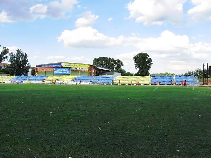 Stadionul 1 Mai Landmark, Slobozia24 km W
Sources & licences
Data last updated: