- Population
- 3,583
- 3.6K
- Elevation
- 534 m
- above sea level
- Local time
- UTC+01:00
- Europe/Bratislava · UTC+01:00
- Airports
- TAT Poprad-Tatry Airport38 km
- KSC Košice International Airport50 km
About Nálepkovo
Nálepkovo is a village. Location: Gelnica District, Košice Region. Population: 3,583. Elevation: 534 m.
Nálepkovo, formerly Vondrišel (German: Wagendrüssel, Hungarian: Merény) is a village and municipality in the Gelnica District in the Košice Region of eastern Slovakia. Total municipality population was in 2011 3,039 inhabitants. Previously, the village was named Vondrišel, but in 1948 after the German population was expelled it was renamed Nálepkovo, after the anti-fascist Slovak captain Ján Nálepka.
Source: Wikipedia · CC BY-SA 4.0
Population of Nálepkovo over time
| 2017 | 3,411 | |
|---|---|---|
| 2021 | 3,630 | |
| 2024 | 3,861 | |
| 2025 | 3,937 |
Censuses and official estimates; source: Wikidata.
Climate of Nálepkovo
Best months for sightseeingBest months for sightseeing: June–August.
This month · November
A cold month
Day 5° · Night -1° · Rain 45 mm
- Hottest month
- July (day 23°)
- Coldest month
- January (night -7°)
- Wettest month
- June (101 mm)
- Driest month
- February (28 mm)
Bars: average monthly low and high temperature. Below: precipitation. Monthly averages for 1970–2000 at about 18 km resolution, adjusted for elevation. Highlighted months are mild and relatively dry. Source: WorldClim 2.1 (CC BY 4.0).
Show values as a table
| Month | Jan | Feb | Mar | Apr | May | Jun | Jul | Aug | Sep | Oct | Nov | Dec |
|---|---|---|---|---|---|---|---|---|---|---|---|---|
| Average high (°C) | 0° | 2° | 7° | 12° | 18° | 21° | 23° | 22° | 18° | 13° | 5° | 1° |
| Average low (°C) | -7° | -6° | -2° | 2° | 7° | 10° | 11° | 11° | 7° | 3° | -1° | -5° |
| Precipitation (mm) | 36 | 28 | 32 | 53 | 81 | 101 | 88 | 76 | 56 | 45 | 45 | 37 |
How to get to Nálepkovo
The nearest airport is Poprad-Tatry Airport (TAT), 38 km to the northwest as the crow flies. The nearest large city is Košice, 49 km to the east.
Airports
- Poprad-Tatry Airport (TAT) Poprad 38 kmnorthwest
- Košice International Airport (KSC) Košice 50 kmsoutheast
- Sliač Airport (SLD) Sliač 112 kmwest
Nearby large cities
- Košice Population: 225K 49 kmeast
- Miskolc Population: 154.5K 83 kmsouth
- Nyíregyháza Population: 117.7K 128 kmsoutheast
- Debrecen Population: 202.4K 164 kmsoutheast
- Satu Mare Population: 112.5K 203 kmsoutheast
Straight-line distances; road distances are longer. Airport data: OurAirports.
Day trips from Nálepkovo
Within 100 km: 22 historic and cultural sites, 225 natural sites, 16 lakes, rivers and coasts.
0–25 km5 places
- Spišská Kapitula Attraction 20 kmNE
- Spiš Castle Historic site 21 kmNE
- Slovenský Raj Mountain 20 kmNW
- Slovenské Rudohorie Mountain 23 kmSW
25–60 km50 places
- Skalnaté pleso Lake 48 kmNW
- Popradské Pleso Lake 53 kmNW
- Ostrá Mountain 57 kmNW
- Vysoká Mountain 53 kmNW
60–100 km208 places
- Beskids Mountain 69 kmNW
- Poľana Mountain 87 kmW
- Čertovica Mountain 66 kmW
- Bystrá Mountain 69 kmNW
Straight-line distances.
Nearby attractions & nature
Everything nearby-
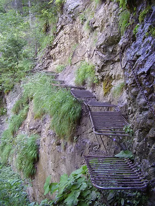 Prielom Hornádu Natural site, Czechia16 km NW
-
Spiš Castle Historic site, Okres Spišská Nová Ves21 km NE
-
Spišská Kapitula Attraction, Levoča District20 km NE
-
Slovenský Raj Mountain, Košice Region20 km NW
-
Slovenské Rudohorie Mountain, Košice Region23 km SW
Sources & licences
Data last updated: · 2 independent sources