Malá Franková
Located in Kežmarok District, Prešov Region Coordinates: 49°18′50″ N 20°18′10″ E
- Population
- 194
- 194
- Elevation
- 759 m
- above sea level
- Local time
- UTC+01:00
- Europe/Bratislava · UTC+01:00
- Airports
- TAT Poprad-Tatry Airport27 km
- KRK Kraków John Paul II International Airport93 km
About Malá Franková
Malá Franková is a village. Location: Kežmarok District, Prešov Region. Population: 194. Elevation: 759 m.
Malá Franková (Hungarian: Kisfrankvágása, German: Kleinfrankenau, Rusyn: Мала Франкова) is a village and municipality in the Kežmarok District of the Prešov Region of north Slovakia. It is traditionally inhabited by Gorals, as one of their westernmost settlements (along with Veľká Franková and Osturňa).
Source: Wikipedia · CC BY-SA 4.0
Population of Malá Franková over time
| 2017 | 190 | |
|---|---|---|
| 2021 | 185 | |
| 2024 | 194 | |
| 2025 | 193 |
Censuses and official estimates; source: Wikidata.
Climate of Malá Franková
Best months for sightseeingBest months for sightseeing: June–August.
This month · November
A cold month
Day 5° · Night -1° · Rain 72 mm
- Hottest month
- August (day 20°)
- Coldest month
- January (night -6°)
- Wettest month
- June (161 mm)
- Driest month
- February (51 mm)
Bars: average monthly low and high temperature. Below: precipitation. Monthly averages for 1970–2000 at about 18 km resolution, adjusted for elevation. Highlighted months are mild and relatively dry. Source: WorldClim 2.1 (CC BY 4.0).
Show values as a table
| Month | Jan | Feb | Mar | Apr | May | Jun | Jul | Aug | Sep | Oct | Nov | Dec |
|---|---|---|---|---|---|---|---|---|---|---|---|---|
| Average high (°C) | 1° | 2° | 5° | 10° | 16° | 19° | 20° | 20° | 16° | 12° | 5° | 2° |
| Average low (°C) | -6° | -6° | -3° | 1° | 6° | 9° | 10° | 10° | 7° | 3° | -1° | -5° |
| Precipitation (mm) | 57 | 51 | 59 | 88 | 122 | 161 | 159 | 134 | 101 | 75 | 72 | 65 |
How to get to Malá Franková
The nearest airport is Poprad-Tatry Airport (TAT), 27 km to the south as the crow flies. For international flights: Kraków John Paul II International Airport (KRK) (93 km). The nearest large city is Košice, 97 km to the southeast.
Airports
- Poprad-Tatry Airport (TAT) Poprad 27 kmsouth
- Kraków John Paul II International Airport (KRK) Balice 93 kmnorthwest
- Košice International Airport (KSC) Košice 100 kmsoutheast
Nearby large cities
- Košice Population: 225K 97 kmsoutheast
- Miskolc Population: 154.5K 139 kmsouth
- Nyíregyháza Population: 117.7K 184 kmsoutheast
- Debrecen Population: 202.4K 221 kmsoutheast
- Satu Mare Population: 112.5K 253 kmsoutheast
Straight-line distances; road distances are longer. Airport data: OurAirports.
Day trips from Malá Franková
Within 100 km: 36 historic and cultural sites, 321 natural sites, 11 lakes, rivers and coasts.
0–25 km69 places
- Skalnaté pleso Lake 15 kmS
- Popradské Pleso Lake 24 kmSW
- Vysoká Mountain 22 kmSW
- Slavkovský štít Mountain 19 kmSW
25–60 km146 places
- Ostrá Mountain 26 kmSW
- Branisko Mountain 52 kmSE
- Bystrá Mountain 36 kmSW
- Baníkov Mountain 45 kmW
60–100 km153 places
- Veľký Kriváň Mountain 94 kmW
- Rakytov Mountain 91 kmSW
- Poľana Mountain 96 kmSW
- Chleb Mountain 92 kmW
Straight-line distances.
Nearby attractions & nature
Everything nearby-
Belianske Tatry Mountain, Prešov Region9.7 km SW
-
Lomnický štít Mountain, Poprad District15 km SW
-
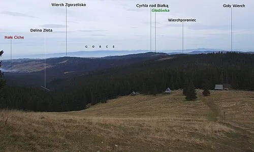 Goły Wierch - 1202 m npm Tatry Mountain, Gmina Bukowina Tatrzańska16 km W
-
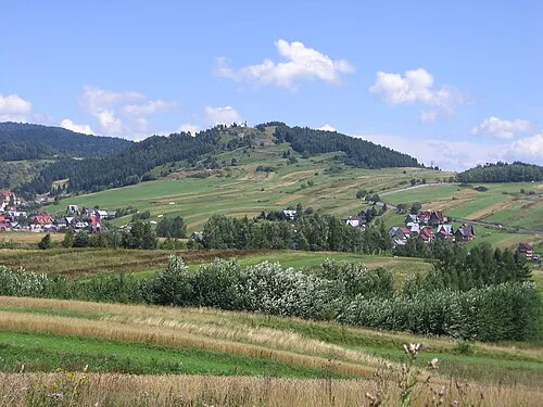 Zar Mountain, Gmina Czorsztyn16 km N
-
 Rysy Mountain, Gmina Bukowina Tatrzańska22 km SW
-
Červený Kláštor Attraction, Kežmarok District13 km NE
Sources & licences
Data last updated: · 2 independent sources